She created Wander In Arizona to share first-hand information about traveling to the many fantastic cities, trails, national parks, monuments and more as she continues to explore.
- From San Francisco to Phoenix: A Haunted Road Trip - October 17, 2024
- 25 BEST ARIZONA WINTER HIKES FOR ADVENTURE - October 10, 2024
- EPIC ARIZONA BUCKET LIST – 50 THINGS TO DO - July 18, 2024
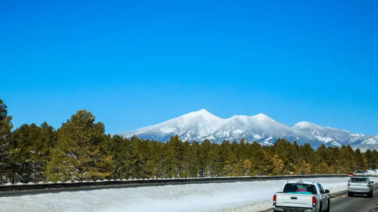
Looking for the guide to the best Arizona winter hikes? You are in the right place. While winter in most places means spending days on couches wrapped in blankets or huddled in front of crackling fireplaces, the story is different in Arizona.
Plus, who says winter is for staying indoors? In Arizona, winter means perfect hiking weather—no snow boots or parkas are required as winter brings mild, balmy days to the desert and even AZ snow experiences.
Sure, there are cool skiing resorts, sledding and plenty of places to enjoy Arizona Christmas lights, but winter hiking in Arizona is special.
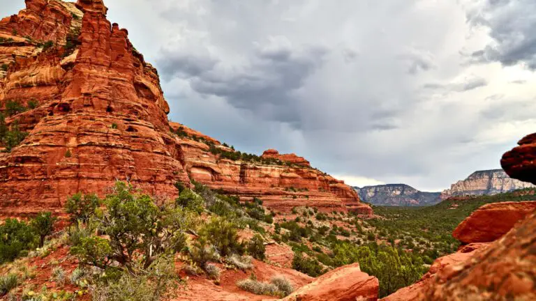
On your Arizona winter hikes, you will enjoy diverse landscapes, ranging from desert to alpine to urban to remote and everything in between.
While the rest of the country is bundled up like penguins, you’re out here lacing up your hiking boots, basking in the warm desert sun, and soaking in some of the most breathtaking trails the Southwest offers.
So grab your sunscreen (yes, in December), and let’s dive into Arizona’s winter hikes that will make you the envy of your frostbitten friends.
THINGS TO KNOW FOR PLANNING ARIZONA WINTER HIKES
Arizona in the winter is surprisingly an expensive time to visit, which most people often overlook, especially southern Arizona, which is the most expensive and crowded.
The hotels and rental cars are usually booked, with their rates at their peak, especially on holiday weekends, so it’s best to plan your trip well ahead for holiday deals.
Arizona in the winter can be dry, with single-digit temperatures, and if you are here for the first time, it is best to keep moisturiser, lip balm and sunscreen, too.
Although most National Parks, National Monuments, State Parks, and reserve areas are open to hiking and camping, some routes or sections can get closed. So do a specific check before planning any of these Arizona winter hikes.
Also, many need prior permits/reservations, so check online before you plan your Arizona winter trip.
Road closures and blockages are expected in Arizona in the winter, and sometimes, unfortunately, you may have to spend overnight in your vehicle too, if unexpected snow storms occur. So carry spare blankets and layers to stay comfortable.
In the winter, you will likely need several layers of clothing throughout the day, so be sure to pack some moisture-wicking fabrics for outdoor activities as well as a good hat or two and lots of sunscreen.
The weather will get freezing at night in Northern and Southern Arizona, although some places in the south can even be sunny during the day.
So carry hiking gear, sturdy walking shoes, sufficient layers, and only camp if you are used to very cold temperatures and have prior camping experience.
THE BEST ARIZONA WINTER HIKES
Here are some popular winter hiking destinations in Arizona:
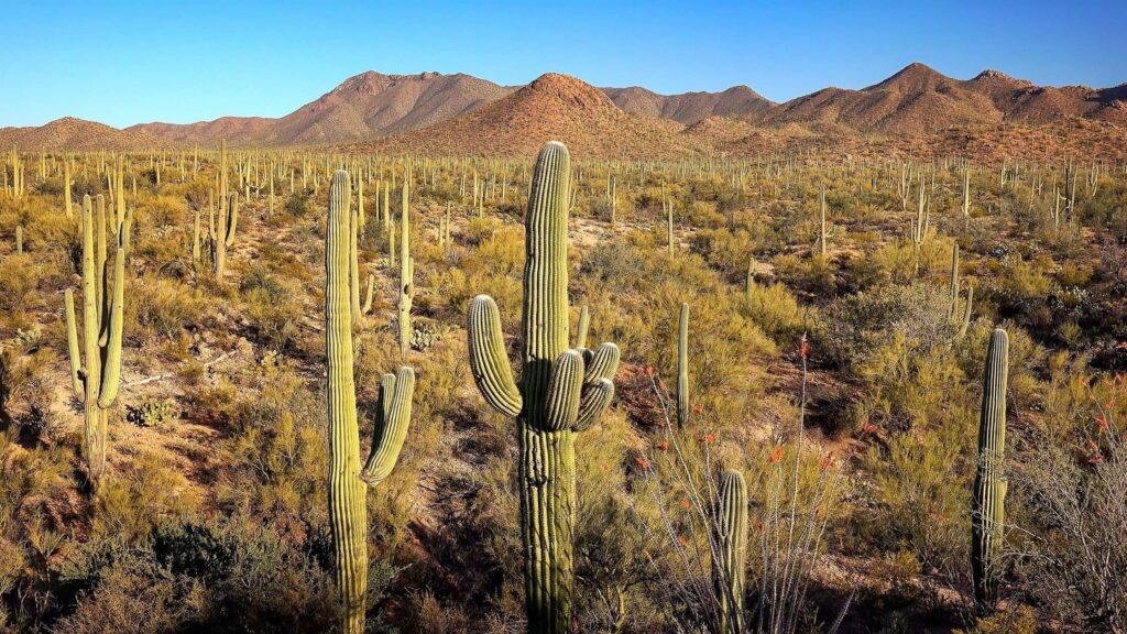
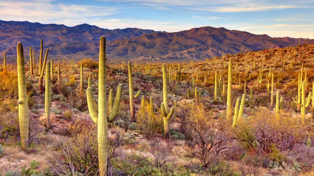
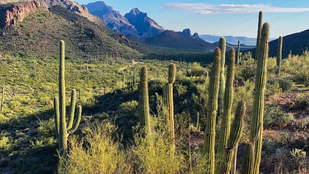
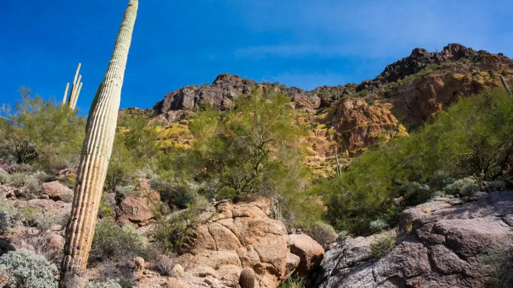
SAGUARO NATIONAL PARK
Under 2 hours drive from Phoenix, Saguaro National Park is one of the best places for Arizona winter hikes.
Saguaro National Park, surrounding the western and eastern edges of Tucson, Arizona’s second-largest city, is the ideal place for a winter hike in Arizona the rare desert snow.
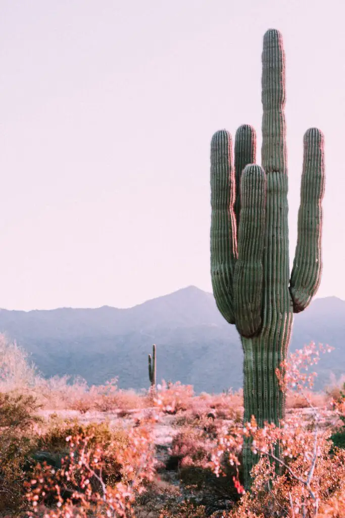
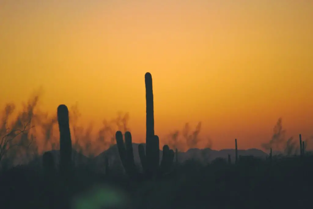
Saguaro National Park is home to vast forests of saguaro cacti, including America’s tallest and most iconic cactus species.
The majestic saguaro recognized worldwide as a symbol of the desert and an iconic image of the American Southwest, only appears naturally in the Sonoran Desert—which stretches across the southwestern United States on either side of Tucson.
The park, spanning a massive 143 square miles, is divided into two sections.
One is on either side of Tucson, named the Rincon Mountain District east of Tucson and the Tucson Mountain Unit west of Tucson, covering over 54000 acres.
The Rincon Mountain District, on the east side, is more remote and includes a large mountainous region with summits over 8,000 feet.
Rincon Mountain also features the park’s famous Cactus Forest Loop drive and offers stunning sunset and sunrise views.
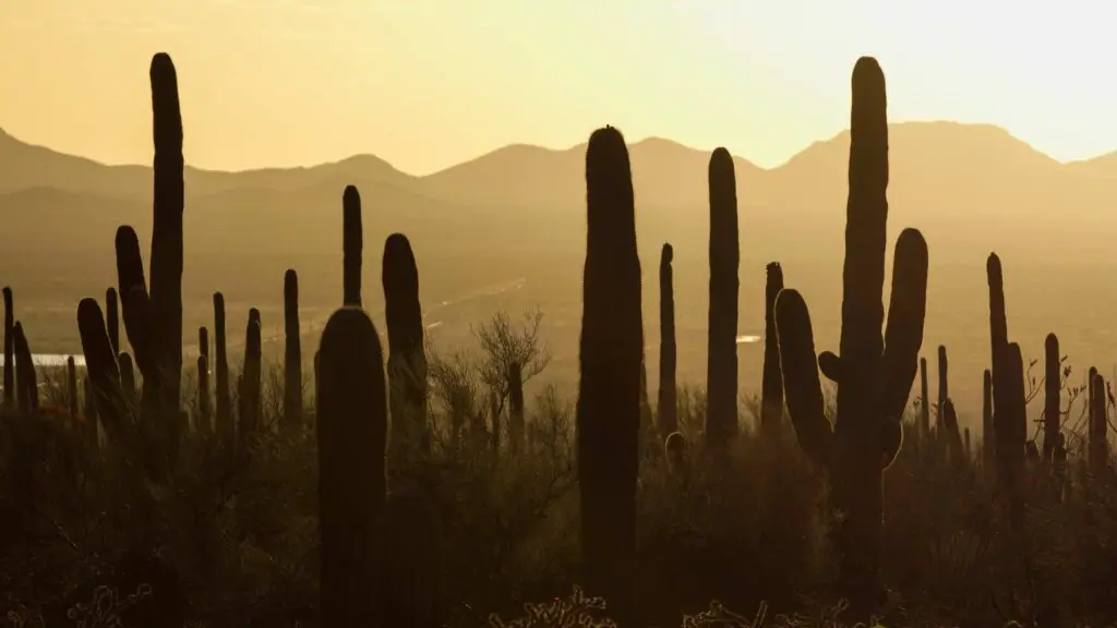
WHY WINTER IS THE BEST TIME TO BE HERE
It is not often that you see giant green cacti sprinkled with snow on the ground with ocotillo, cholla, and prickly pear cacti blanketed in white.
Plan a trip to this beautiful national park in January for the best outdoor explorations, where you will encounter massive saguaros towering up to 50 feet high and many older than a hundred years.
POPULAR WINTER HIKING TRAILS IN THE PARK
There are many trails in the park of different difficulty levels for hiking and biking, which will take you across its dazzling and dramatic landscapes.
Many short hiking trails are ideal for beginners to explore the national park, including the unpaved Bajada Loop Drive driveway.
Also known as the Valley View Overlook Trail, it is one of the most accessible winter hikes in Arizona and offers beautiful views of Saguaro Cacti.
At just 0.8 miles round trip, this is an easy walk, making it a fantastic winter hike with kids.
One of my favourites for admiring those majestic Cacti is the Cactus Forest Trail.
Tanque Verde Ridge Trail is the best to experience the unique desert landscape.
Hugh Norris Trail, located on the western side of the park, is another popular trail if you are looking for a moderately challenging climb.
This 5-mile one-way trail leads to the highest point in the Tucson Mountains. All the sweat is worth it as you are greeted with sweeping views at the top of Wasson Peak, which rises to nearly 4,700 feet.
The national park is home to roadrunners, coyotes, Gila monsters, and many types of snakes, which you should watch out for while hiking.
HOW TO REACH?
Saguaro National Park is less than half an hour from Tucson International Airport.
PETRIFIED FOREST NATIONAL PARK
If you are a nature lover or an outdoor enthusiast, I highly recommend adding this stunning forest to your itinerary of Arizona in the winter.
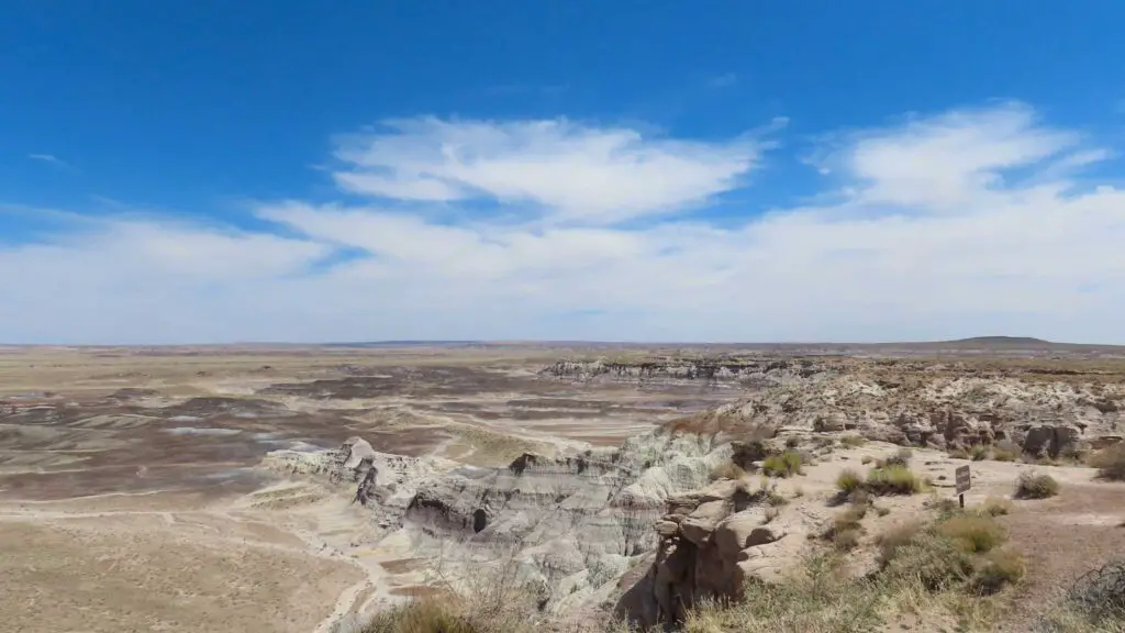
Located less than 4 hours northeast of Phoenix in eastern Arizona, near the New Mexico border, this is one of America’s most underrated national parks.
This beautiful national park has been protected since 1906 and is heaven for exploring one of the most ancient landscapes in the world.
Petrified Forest National Park is known for its fossils and is a paradise for paleontologists, historians and archaeologists, for it is home to vast acres of landscapes encompassing 225-million-years-old fossilized trees from the Late Triassic period, which was the dawn of the dinosaurs.
These ancient tree trunks are spectacular and have survived thanks to the minerals they absorbed after submerging in a riverbed nearly 200 million years ago.
RECOMMENDED FOR YOU – 10 BEST SPOTS FOR WATCHING EPIC SUNRISE IN SEDONA
These wooden logs have transformed into solid, sparkling quartz, including citrine, amethyst, and jasper.
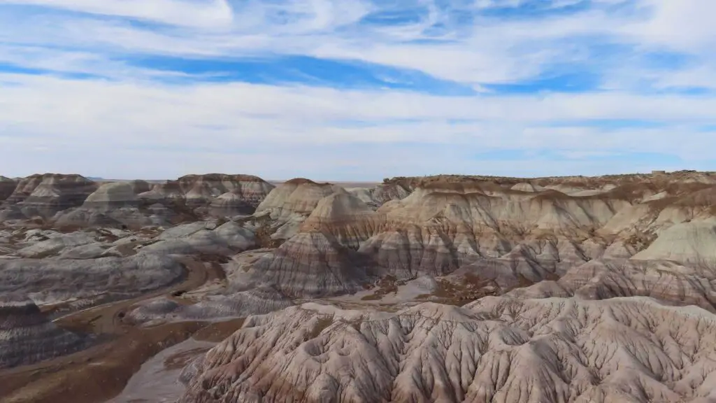
This mineral-tinted landscape basks in colours in the sunlight, offering fantastic panoramic views.
WHY WINTER IS THE BEST TIME?
Winter is a fantastic time to visit Petrified National Forest as the crowd is small and the weather is perfect to hike
However, despite the few visitors, this trail is popular, and you can expect crowds, especially if you are planning to visit on a weekend or a busy holiday.
It is best to head early on these days to have the trail all to yourself.
BEST HIKING TRAILS
You can hike on the lands where dinosaurs roamed and stand where ancient forests fell.
Check out the Crystal Forest and Long Logs Trails if you love hiking trails.
Jasper Forest Trail is another among the popular longer hiking trails known for its gorgeous views.
The Blue Mesa Trail is one of the best hikes in Petrified Forest National Park.
The 0.9-mile loop easy trail starts at the Blue Mesa Trailhead in the southern section of the park.
ORGAN PIPE CACTUS NATIONAL MONUMENT
If you have been to Saguaro National, one of the top national parks in Arizona, you will be surprised to see how similar it looks to the Organ Pipe Cactus National Monument.
Organ Pipe Cactus National Monument is one of the top Arizona National Monuments located in the extreme southern part of the state, sharing a border with the Mexican state of Sonora.
Organ Pipe Cactus is known for its magnificent Organ Pipe cacti, native to Mexico, covering over 516 square miles of untouched wilderness, with other dominant cacti being Saguaro.
It is the only place in the US where the senita and organ pipe cacti grow wild. Organ Pipe Cactus are fascinating plants and can live over 150 years old.
They produce their first flower when they are 35 years old. These fascinating and giant cacti bloom only at night in May and June and become bright red fruits in July.
It is also classified as a UNESCO biosphere reserve, home to unique desert wildlife and a popular bird-watching spot.
The monument encompasses diverse landscapes, from arid plain lands to surprisingly high mountains, with Mount Ajo topping out at 4,800 high.
Despite its rich and abundant terrain, it is one of the underrated national monuments in Arizona, receiving fewer tourists.
BEST HIKING TRAILS
This varied landscape makes for excellent hiking opportunities, where you can also explore the remains of abandoned mines and their ancient cultures.
One of the best trails is the Bull Pasture hike, a three-mile round trip covering a part of Mount Ajo, offering spectacular bird views.
Victoria Mine Trail is one of the popular hikes that you should try.
This 2.2-mile trail, starting from the south side of the monument’s campground, offers exquisite panoramas encompassing the varied landscapes dotted with many types of cacti leading to the remains of the Victoria Mine.
ARIZONA WINTER HIKES IN NATIONAL MONUMENTS
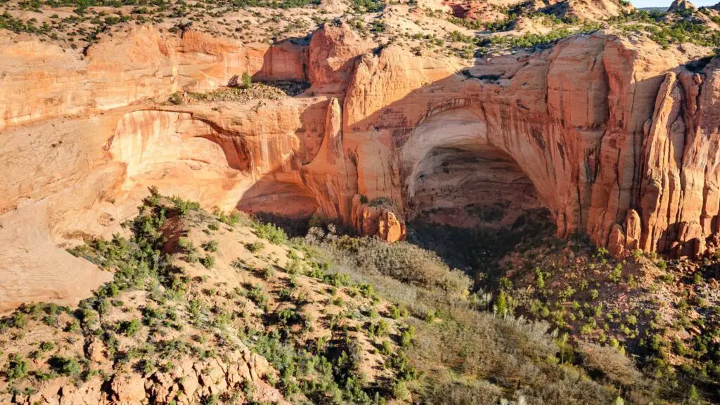
NAVAJO NATIONAL MONUMENT
Not to be confused with the iconic Monument Valley, Navajo National Monument is one of the best Arizona National Monuments for offbeat outdoor travel in the state.
The monument was established to preserve three well-preserved cliff dwellings dating to the early 14th century of the Ancestral Puebloan people: Keet Seel, Betatakin, and Inscription House, the inhabitants of the Navajo Nation region, also known by other names.
You need to book your spot for the tour in advance.
BEST HIKING TRAILs
The best hiking trail among these is the Betatakin Cliff Dwelling, visible from the Betatakin Overlook.
You can reach here following the easy Sandal Trail, which is the only way to see the cliff dwelling without a guided tour,
The 1.3-mile loop trail starts from behind the Visitor Center and is doable by most people.
If you prefer something more challenging, check the trail to remotely located Keet Seel, 17-miles long round trip.
Note that this trail is moderately strenuous and even challenging, apart from being longer.
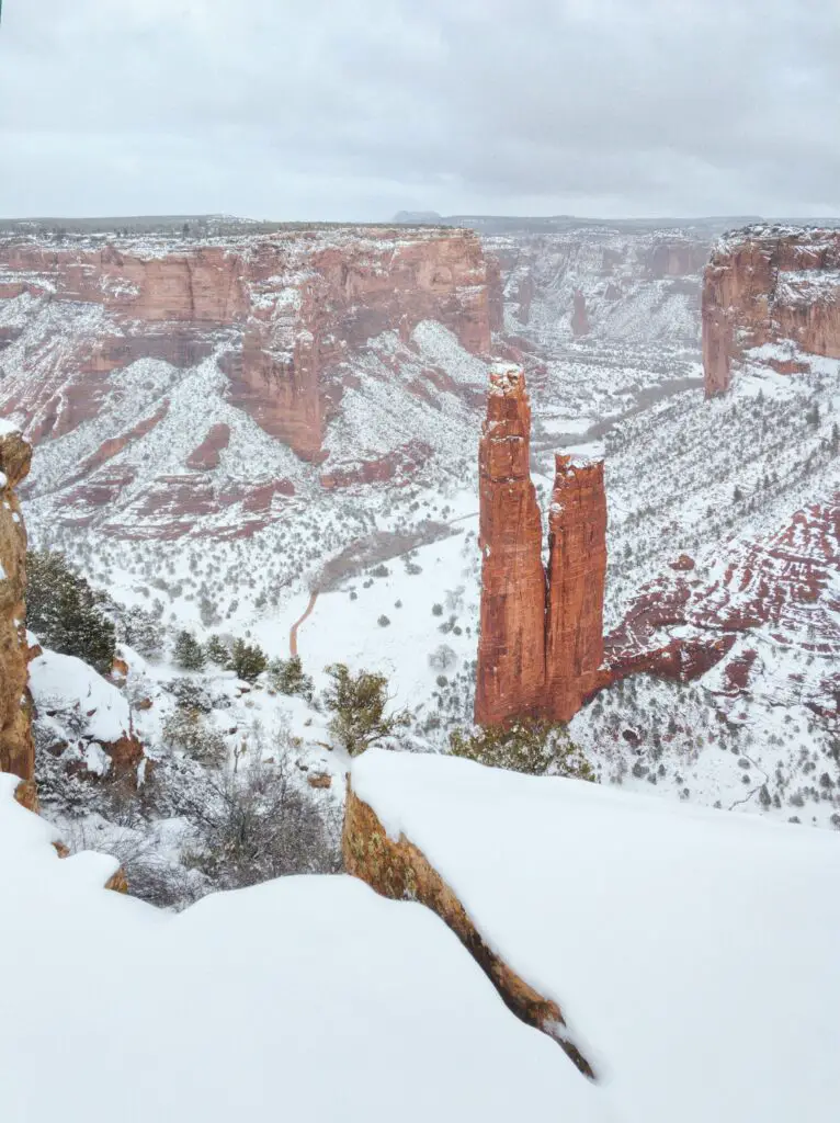
CANYON DE CHELLY NATIONAL MONUMENT
Located in northeast Arizona and part of the Navajo Nation, Canyon de Chelly National Monument encompasses magnificent red sandstone canyons created by Chinle Creek and its tributaries and ancient cliff dwellings high up in the walls along the ledges of the cliffs.
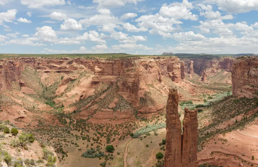
Carved into the sandstone bedrock of north-eastern Arizona, near Chinle, the three spectacular canyons, De Chelly, Del Muerto, and Monument, lie at the centre of the Navajo Nation and the heart of many native legends.
There are over 800 ancient archaeological sites between Monument Canyon, Canyon de Chelly, and Canyon del Muerto.
These canyons have been occupied by Indigenous peoples for 5,000 years uninterrupted, more continuously than anywhere in North America.
Forty families still live within the park’s boundaries even today.
Since the Navajo still call Canyon De Chelly their home and a sacred site, you can only explore the monument on a guided Navajo tour with a native or National Park Service rangers.
Two panoramic drives run along the north and south rims of the canyon and have many overlooks.
You can opt for self-guided driving tours and stop at lookouts to cover many of the site’s attractions, including Mummy Cave, carved into the sheer cliff, and Antelope House, standing at the base of the canyon walls.
To see more, you’ll need to hire a native guide to escort you on either foot, 4×4 or horseback.
Half-day tours traverse the rough river bottom and are best to experience ancient ruins, caves, and petroglyphs up close.
HIKING TRAIL
If you don’t have time for a tour and are up for a relatively challenging hike, do the only self-guided walk, the 3-mile White House Trail, going 600 feet down into the canyon to arrive at the spectacular White House ruins.
The trail begins six miles east of the visitor centre along the South Rim drive.
Winter is the best time to hike the White House ruins, as the entire landscape is beautiful when covered in snow.
The White House ruin trail can be slippery when icy, so wear crampons.
Head to the Cottonwood campsite for tent and RV camping.
MONUMENT VALLEY NAVAJO TRIBAL PARK
Located within the Navajo Nation Reservation, straddling the Arizona-Utah state borders, its dramatic desert landscapes are instantly recognisable.
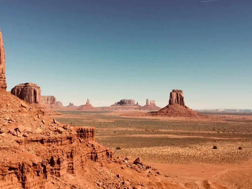
Although its cinematic fame may be why it is so popular, it is one of the least visited Arizona national monuments.
This fantastic landscape, known for dozens of spectacular free-standing sandstone buttes and monoliths towering above the sweeping sagebrush panoramas, is also home to ancient cliff dwellings.
Known to the Navajo as the ‘Valley Between the Rocks,’ it is one of the best places in Arizona for watching stunning sunsets and spectacular sunrises, and no wonder it draws thousands of photographers.
You’ll need to hire a jeep or high-clearance four-wheel-drive vehicle and pay an access fee to drive through the tribal park on a 17-mile dirt loop to experience everything in the park.
You can take guided tours with a Navajo or Hopi person to Mystery Valley and Hunts Mesa, which can be booked at the visitor centre, to learn about the Puebloan history and culture.
For hikers, the 3.2-mile Wildcat trail around the West Mitten butte is one of the best to explore without a guide.
The Wildcat Trail is one of the best Arizona winter hikes offering you splendid views of the valley including West Mitten and Merrick Butte.
UPPER AND LOWER ANTELOPE CANYON
By far the most famous of all the slot canyons in Arizona, and one of the iconic landmarks in the world is Antelope Canyon, located in the Navajo Nation east of Page.
It is so large that it is split into two distinct canyons: Upper Antelope and Lower Antelope.
Upper Antelope is the most famous and visited, while Lower Antelope is slightly more challenging to see and receives fewer tourists.
It is best to buy your tickets online in advance even if you do not want to join any tours.
The best way to secure your spot is to buy online tickets at least some months in advance, guaranteeing your trip and avoiding hassles.
While both canyons are relatively short in length and offer a slightly different experience, both are incredible slot canyons comprising unique and impressive formations on the tall Navajo sandstone walls.
Recommended –5 Best Sedona Breweries You Should Visit To Unwind After Hiking
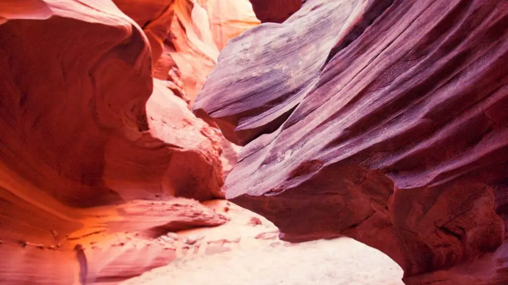
These striking wonders are millions of years old, formed due to the consistent work of flash floods, carving their famous rugged edges, creating deep and narrow winding fissures through the soft, red sandstone rock.
You can only access Antelope Canyons on a guided tour, which remains full throughout the year, thanks to its immense popularity.
It is best to book the tours in months if you want to explore during peak seasons.
Upper Antelope Canyon, also known as the place where water runs through rocks, is the most crowded of the slot canyons near Page.
Upper Antelope Canyon, spanning 200 meters long, has the largest caverns, with the entire canyon at ground level and no climbing, giving it easy access and attracting millions of visitors each year.
It is narrow and has more twists and turns than Lower Antelope Canyon.
Upper Antelope Canyons is also easily accessible from Horseshoe Bend and the Glen Canyon Dam.
LOWER ANTELOPE
If you only have time to visit one of Page’s famous slot canyons, it should be Lower Antelope Canyon.
Lower Antelope Canyon is known for its spectacular spiral rock arches amidst narrow passages and shallow water on the ground.
Since the lower canyon is v-shaped, the light shines from above onto the canyon floor instead of through specific openings like the a-shaped upper canyon bringing more light into the canyon and offering splendid photo-capturing options.

Although it is only a quarter-mile long and twice as long as the Upper Antelope, it is home to some of the most iconic undulating formations in the rock walls, along with fantastic lighting and colouring, making it one of the top landmarks in Arizona and a bucket list destination for hikers, outdoor lovers and photographers.
On your guided tour, you will pass through a series of fantastic passageways where you can see the floors and the walls illuminated by sunlight pouring in, creating beautiful views.
If you only wish to visit Lower Antelope Canyon, check this 1 to 2 hours Lower Antelope Canyon Admission Ticket.
You’ll have to scale some ladders to access Lower Canyon, but it is worth the extra effort.
As this is one of the most popular canyons, tours for Lower Antelope Canyon can fill up fast, and booking your trip in advance is best.
If you are willing to visit both Upper and Lower Canyon tours and want to go for the best Antelope Canyon Tour, this tour is your best pick.
Check this guide to know about the best Antelope Canyon Tours.
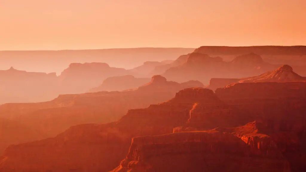
BRIGHT ANGEL TRAIL
The Bright Angel Trail offers one of the best views of the Grand Canyon and is one of the best Arizona winter hikes.
If you want to get on one of the trails in the Grand Canyon, I highly recommend this one.
Although this is a moderate to strenuous trail and only recommended for seasoned hikers, you will be rewarded with the best Grand Canyon views on this 12 miles round trip hike.
If you have more than two days in the Grand Canyon, one of the recommended things to do in the Grand Canyon in winter is go on a day hike along Bright Angel Trail.
Spring is the next best time to do the Bright Angel hike.
Avoid this trail in the summer as the weather gets scorching and there is no shade.
It is a strenuous hike only recommended if you are a seasoned hiker that begins just near the Grand Canyon Village and descends over 4300 feet to the base of the Colorado River.
It is a well-maintained trail that will reward you with splendid views of the Canyon, but an additional challenge when doing it in winter is that the initial part of the trail is steep and slippery as it is layered with ice.
It is best to carry hiking poles and traction devices.
You can only hike until Plateau Point for completing in a day, which is about 12 miles and Plateau Point is not reached by car. Although it may feel like a short distance, the elevation will take longer.
Other notable stops before arriving at Plateau Point are Mile-and-a-half Rest house at around 1.6 miles, Three-mile Rest house at around 3.1 miles, Indian Garden at 4.9 miles, and River Rest house at around 8 miles.
You can turn back after reaching other points if you want shorter versions of this hike.
Despite its length and difficulty, the trail attracts large crowds that love the outdoors.
It is best to begin your hike early as it takes around 8 to 10 hours depending on your pace, and the stops you make along the way.
If you want to spend overnight camping after your hike, head further for almost 2 miles to reach the Bright Angel Campground and Phantom Ranch.
HIKE THIS VORTEX
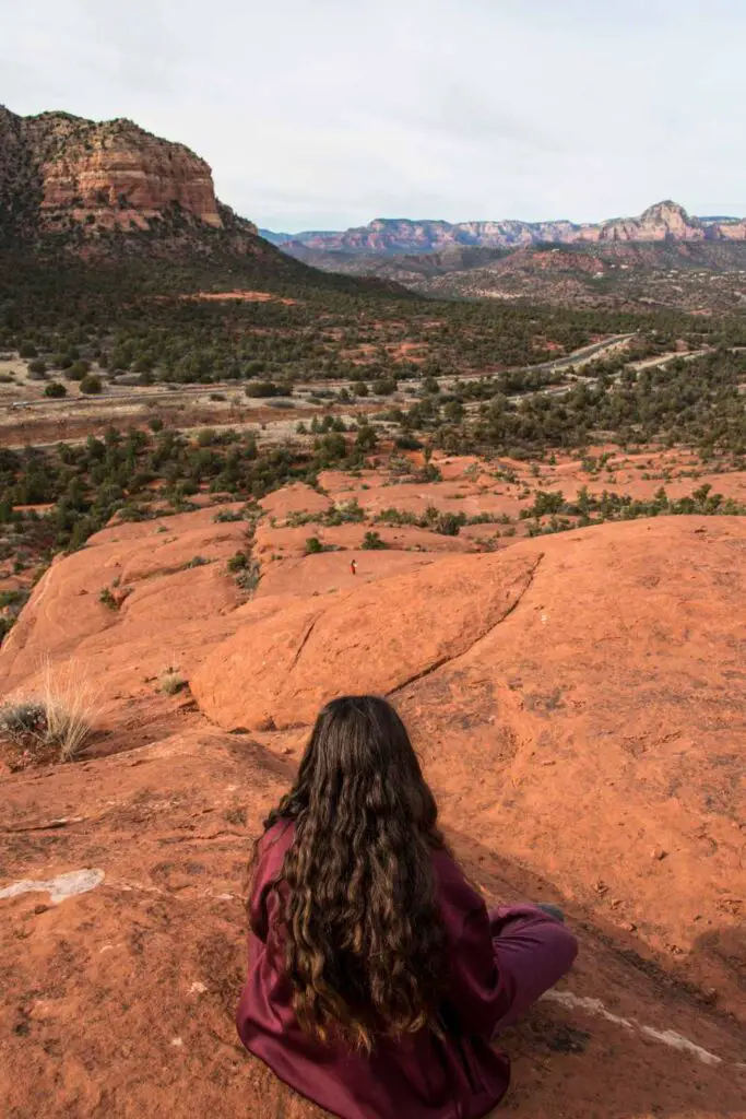
As I mentioned earlier, Sedona has long been regarded as a place both sacred and powerful, and people come from around the world to meditate and experience the mysterious cosmic forces within the area.
These vortexes, or powerful energy fields, are used for healing, meditation, accessing psychic abilities, and spiritual and self-exploration. If you are into this mystical forces, you’ll love adding this experience to your Arizona Bucket List.
One of the famous vortexes in Sedona is Bell Rock, one of the first red rock formations that you will notice in the city.
Due to its more accessible trail and gorgeous formations, the Bell Rock Loop Trail is a popular spot among locals and visitors.
Although it is a short trail, the uphill climbing will make it a 30-minute journey to get to the base section of Bell Rock from the parking area.
A vast viewing platform offers splendid views of the sunrise in Sedona.
For more adventure, you can climb further to reach the upper portions of the rock.
Also, check out Courthouse Butte in the early morning sunlight.
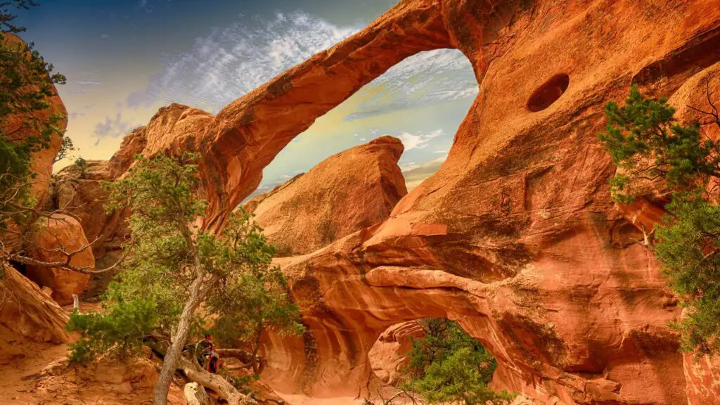
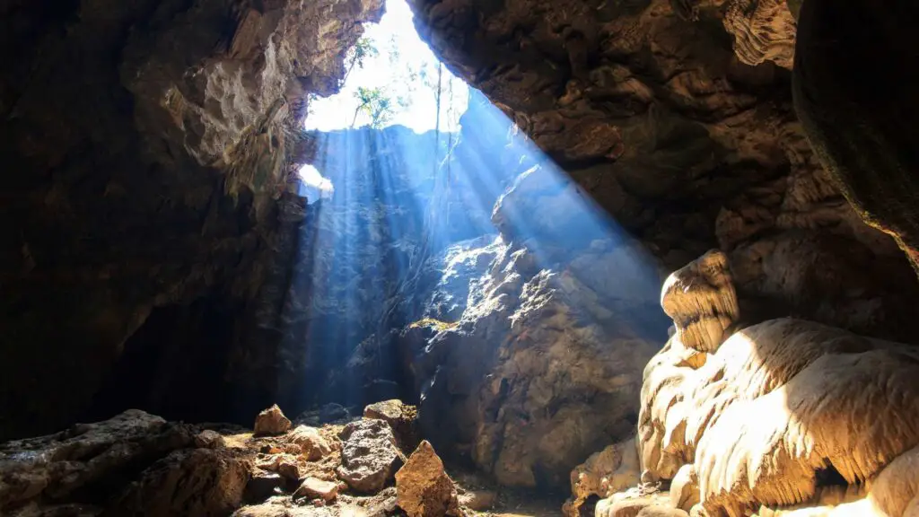
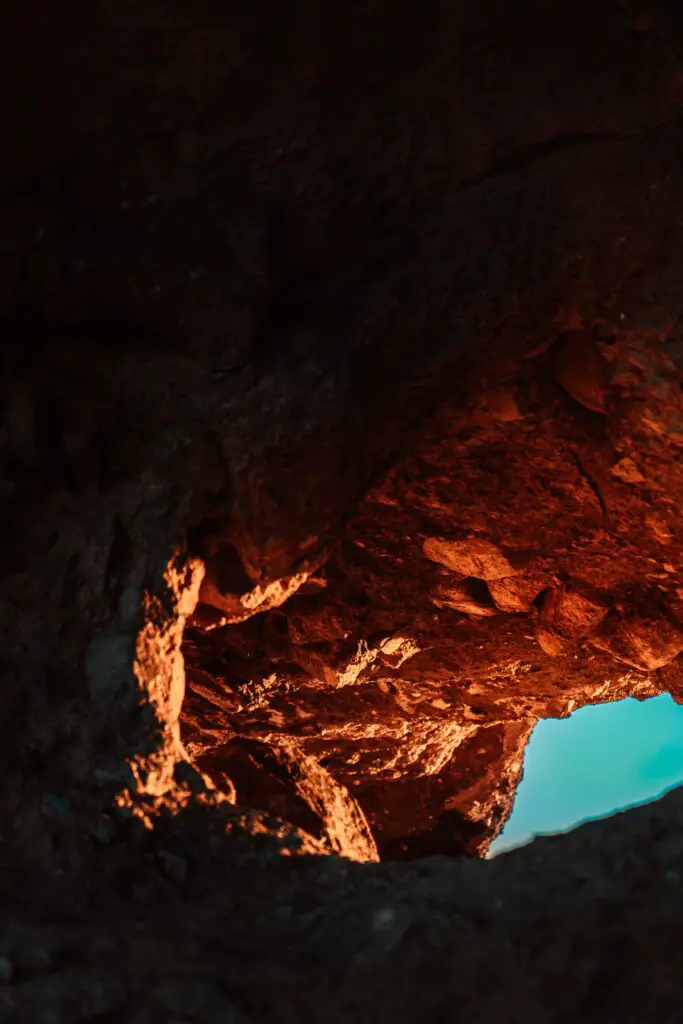
BOYNTON CANYON(SUBWAY CAVE)
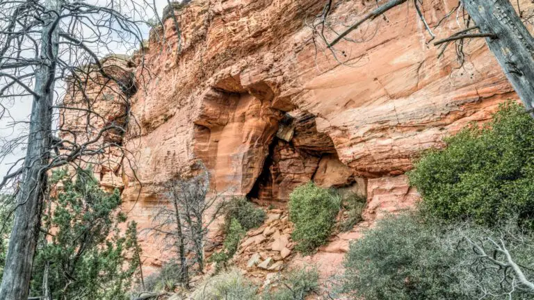
One of the caves in Sedona that has recently become popular is Boynton Canyon Cave, also known as the Subway Cave, thanks to Instagram.
Subway Cave is a distinct tunnel-shaped sandstone formation accessed via a spur trail in Boynton Canyon.
Its unique shape running vertically with a wide split, its gorgeous settings amidst the arid landscapes forming an excellent location and the lighting conditions make it one of the most visually stunning photogenic caves in the Sedona area.
You can combine the hike on Boynton Canyon Trail with the walk to the Kachina tree above as it is nearby, although a bit more complicated.
WHAT IS THE BEST TIME TO VISIT SUBWAY CAVE?
Since Subway Cave faces east, early morning around or after sunrise is the best time to visit Subway Cave.
Avoid going there afternoon as the cave gets darker, making the place unsuitable for great photos.
Due to its increased popularity, no matter when you visit, Subway Cave is almost always crowded.
Recommended – A Total Guide To Hiking The Subway Cave(Boynton Cave)
HOW TO REACH THE SUBWAY CAVE?
The hike is initially flat and easy, leading you to an unmarked trail that involves a climb, which will take you to Subway Cave.
Park at Boynton Canyon Trailhead, and after hiking for about 2 miles on the main Boynton Canyon trail, you will come across a large Juniper tree dividing the course.
Take right slightly ahead of this tree to head to Boynton Canyon cave. Pass through a wash to continue to arrive at another wash, at which point you should take right again.
The last portion of the hike here involves a slight climb up the hill that will lead you to the base of the Boynton Canyon Subway Cave.
You can get into the cave between the split or walk on the ridge and the cliff dwellings.
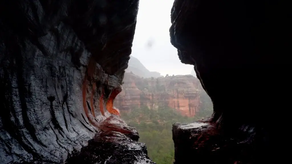
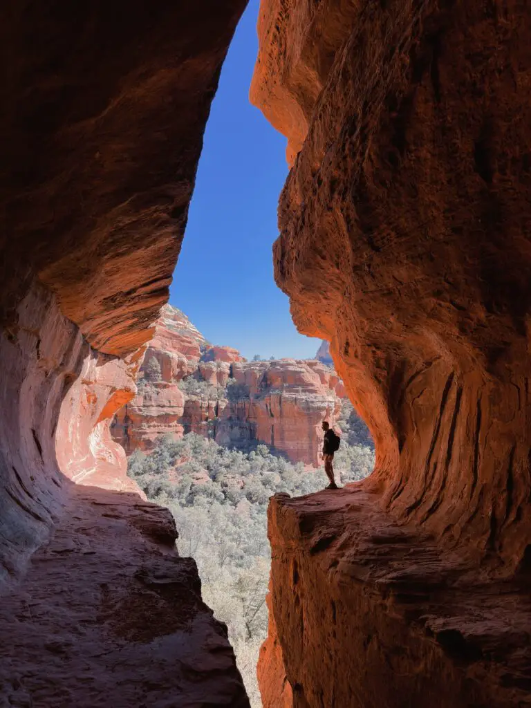
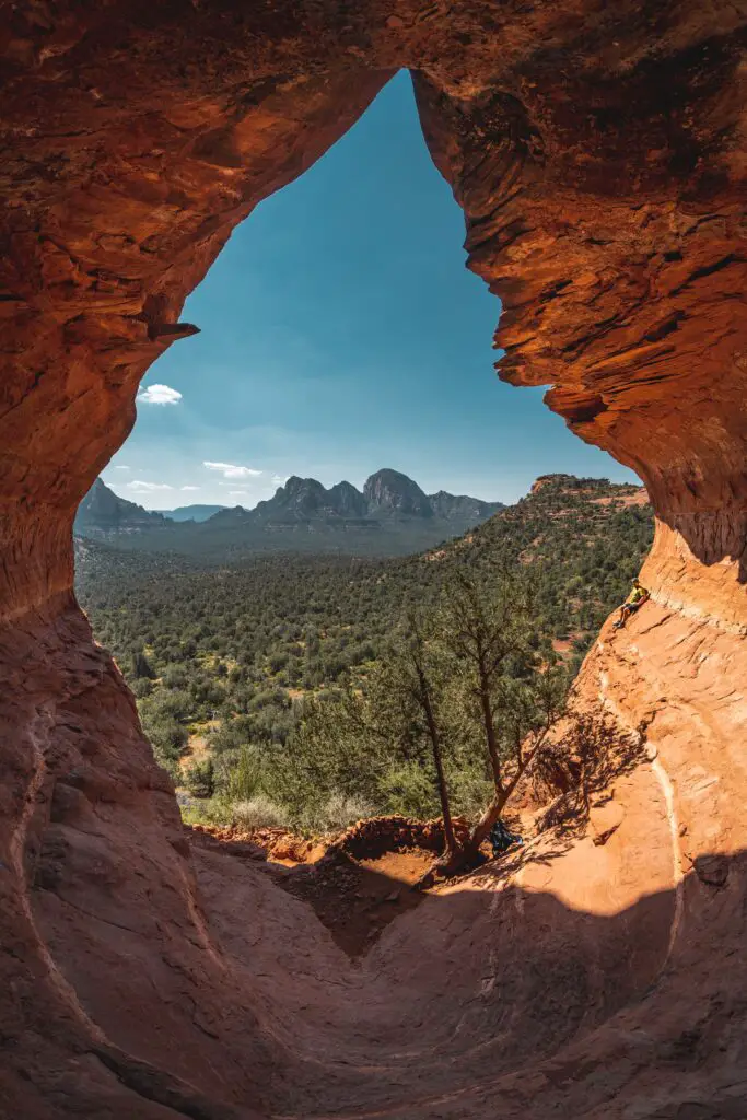
BIRTHING CAVE TRAIL
Considered one of the unique caves in Sedona, the Birthing Cave is ideal if you want to go off the beaten path.
Since Birthing Cave and Boynton Canyon Subway Cave are located nearby, it is easy to hike both in one day.
Located on the Long Canyon Trail, it is not a traditional cave but more of a rock face, sphere-shaped at the centre with a depression that you can see after passing through the flame-shaped cave entrance.
The hike to Birthing Cave is a relatively easy one, with only a short but steep climb, in the end, leading to the cave.
Unlike Sedona’s other hikes and caves, this is much quieter and less visited, although you can easily access Birthing Cave.
If you plan a trip to Birthing Cave for photography, getting a wide lens to get the entire window in a frame is best.
Also, the best shots are at the centre, crowded during peak times.
WHAT IS THE BEST TIME TO VISIT BIRTHING CAVE?
Since Birthing Cave is east-facing, the best time to visit is between and late afternoon, ideally between noon to 3 pm, during which the cave is filled with light.
The views of the horizon encompassing unique desert vegetation are surreal to watch.
HOW TO REACH THE BIRTHING CAVE?
You’ll begin your hike at Long Canyon Trailhead.
If you hike for 0.6 miles on Long Canyon, passing through logs and rocks, you will find a fork where you need to turn left at this point and keep hiking along Long Canyon Trail for 0.3 miles leading to Birthing Cave.
There is another fork in the trail, where you’ll keep left again, leading you up to the cave.
From the base of the cave, you need to climb a bit of elevation to get in the cave.
Recommended – A Complete Guide to Hiking the Birthing Cave Sedona
You can also stop at the Boynton Canyon vortex site, one of the four main Sedona vortex sites, at the end of your hike.
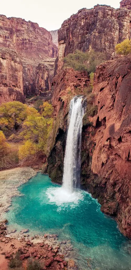
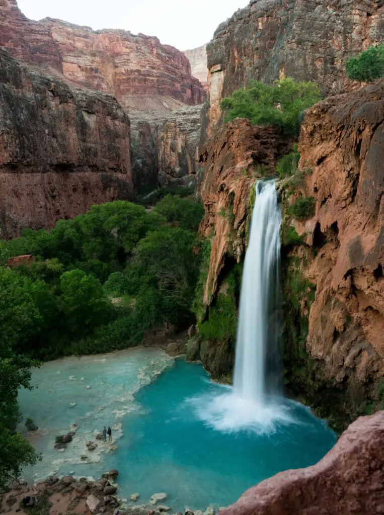
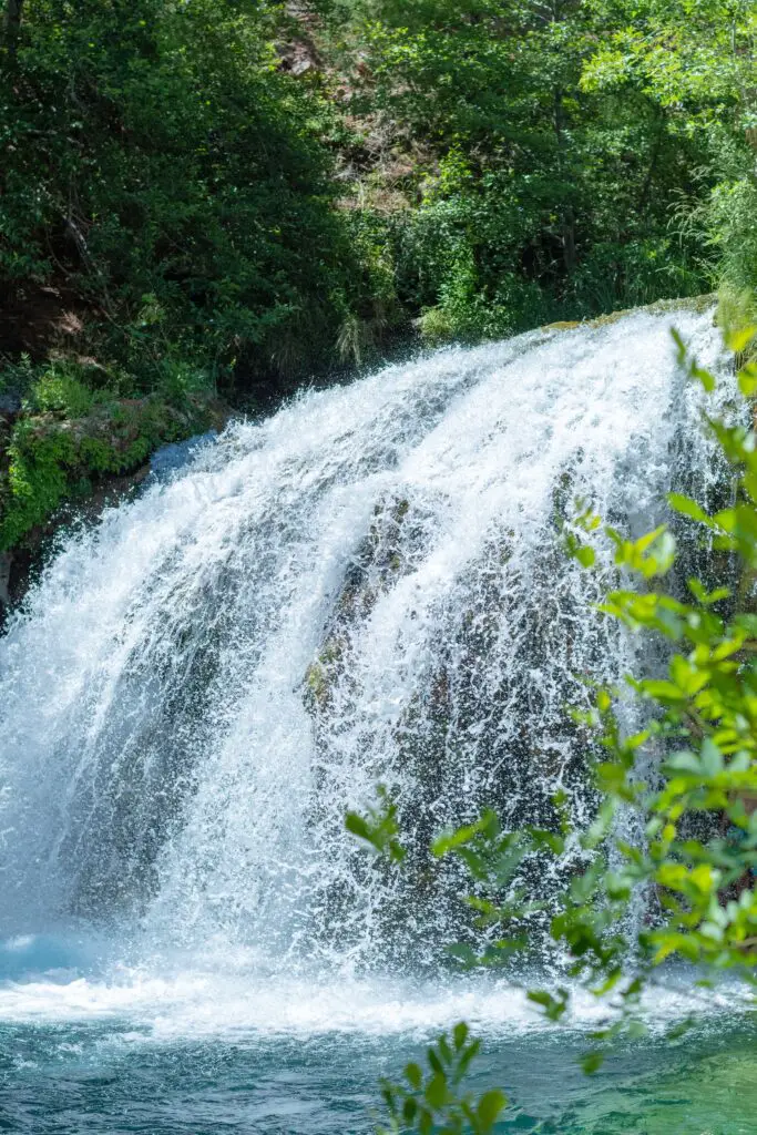
HAVASU FALLS
Among the top waterfall hikes in Arizona is Havasu Falls, the iconic landmark and the most popular Arizona Waterfall. Havasu Falls is located in Havasupai Reservation, a remote area of the Grand Canyon National Park in Arizona.
It is known for its spectacular thunder and roar as it plunges amidst rocky canyons forming splendid blue-green pools below.
It is no wonder that Havasu Falls is one of the top destinations on the Arizona Bucket List for millions of people worldwide.
The challenge in getting here and the fantastic beauty of the falls make this a once-in-a-lifetime hike.
The magnificent colours of the falls are due to the dissolved calcium carbonate and magnesium, resulting in stunning turquoise blue water at Havasu Falls.
Due to its immense popularity, getting a permit to do this hike is more challenging than the trail itself, so you need to plan for this epic waterfall hike in Arizona.
Although Havasu Falls is the main highlight for those that hike into Havasu Canyon, the whole Canyon is full of waterfalls that you will encounter along the way, including the nearby 200-foot Mooney Falls, the cascading pools of Beaver Falls, Navajo Falls, and many other waterfalls waiting to be explored.
The Havasupai Trailhead is in the Hualapai Hilltop parking area.
Although it is just a short walk of over a mile from the Havasu Campgrounds, you have to hike a total of 11+ miles just to get to the campgrounds, and reservations require a minimum of 3 nights’ stay.
The trail starts at Hualapai Hilltop, at an elevation of about 5200 feet.
The trail drops 2,000 feet from here as you make your way through switchbacks down to the canyon floor, passing through narrow slot canyons, boulder crossings and hopping the rocks before reaching the village of Supai.
From the campground, complete the last mile to check this off your bucket list and be truly rewarded by the glowing oasis in the desert.
Havasu Falls plunges from hundred feet canyons towering over the landscapes with a thunderous noise as it bounces off the tall red rock cliff faces. It is a sight to behold.
The water is cold throughout the year. You can swim, relax and enjoy picnics after the challenging hike.
BEST TIME TO VISIT
Early Spring or late Fall seasons, between March to May and September to November, are the best months to explore Havasu Falls.
SEVEN FALLS
- Location – Sabino Canyon
- Distance – 8.3 miles from visitor’s centre or 4.3 miles via shuttle
- Difficulty – Easy to Moderate
- Duration – 5 to 6 hours
- Elevation – 900 ft
- Type – Out-and-back
- Dog-Friendly – Yes
- Kid-Friendly – Yes
- Parking – $5
Seven Falls, located in Sabino Canyon, in the Catalina Foothills, close to Tucson is one of the relatively more accessible and most popular waterfall hikes in Arizona in the middle of the desert.
As the name suggests, you will be treated to not one but a series of seven beautiful cascading waterfalls surrounded by stunning desert landscapes.
The trail leading to the falls is usually crowded as it is one of the most famous falls and attractions for people exploring Tucson.
The hike is 2.5 miles one-way if you use the Bear Canyon Tram. And if you do not use this shuttle, it will be 4.5 miles one way.
The best part is that you can access this all year round, but like other Arizona waterfalls hikes, know that the water levels are seasonal.
So if you want a fully-flowing fall, it is best to hike in the right season.
The hike goes through the Catalina Foothills amidst lush landscapes, where you will pass through forests encompassing many cacti, saguaros, sycamore, and cottonwood trees.
You will cross a river at several points during this hike, which is a great relief, especially while hiking through the arid landscapes of the Sonoran Desert in the heat.
The trail begins in a small parking lot marked Bear Canyon Trail. Although it is a little longer hike at 8.2 miles, it is primarily flat.
Throughout the trail, you can find pockets of swimming holes on your way up to the Seven Falls.
The first 3 miles involve many creek crossings and are generally flat.
The last part of the hike leading to the Seven Falls involves a moderately challenging climb.
You will be rewarded with stunning views of the Seven Waterfalls right after this climb, with each fall forming a vast pool. Scramble to the top levels to reach the best swimming holes.
Sunbathe, enjoy picnics, cliff-jump, swim, scramble, and slide until your heart’s content before making your way back on the same trail that you used.
GOOD TO KNOW
Arrive at the trailhead early, as the parking lot fills up quickly.
Also, starting the hike around sunrise means avoiding the sweltering Arizona desert heat.
Bring plenty of water and snacks to keep you hydrated, as the weather can wear you down more.
If you want to cut down your hiking distance and time, take the shuttle, which costs about $6 per person and the parking fees.
You can buy the ticket to the shuttle at the visitor centre using cash or credit cards. These shuttles run from 9 AM to 4 PM, with one every half hour.
BEST TIME TO VISIT
Fall and Spring are the best times to visit the Seven Falls, as the temperature is manageable during these months.
VERMILION CLIFFS NATIONAL MONUMENT
- Famous for – Stunning rock formations
- Best time to visit – Fall
- Facilities – None. Carry water and food
- Managed by – The Bureau of Land Management
- Entry – $10 per person
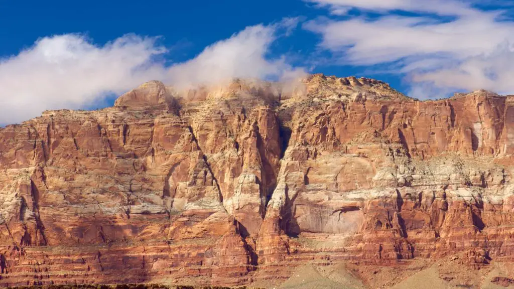
If you’re visiting the North Rim of the Grand Canyon, stop at this beautiful national monument near Page to admire the spectacular cliffs plunging from the Paria plateau on the Utah border.
Vermillion Cliffs National Monument is a massive 280,000-acre park in northern Arizona and one of the most remote and rugged possible to explore only on a high-clearance four-wheel as there are no paved roads.
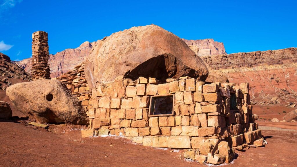
One of the latest additions to the list of Arizona National Monuments, Vermilion Cliffs, established in 2000, is known for its enormous, distinct and colourful sandstone rock formations, beautiful buttes and stunning slot canyons at the edge of remote, sandy plateau and cliffs rising from 3100 to 7100ft.
The area across Marble Canyon also has a rich history. It has been inhabited for more than 12,000 years, as suggested by the remains of some ancient Native American pueblos and fascinating prehistoric petroglyphs found throughout the plateau.
It is one of the most photographed destinations in the US, and if you seek solitude amidst a vast expanse of primarily unexplored wilderness, a visit to Vermilion Cliffs will take off-the-beaten travel to a new level.
RECOMMENDED – TOP 10 SPOTS TO WATCH A STUNNING SUNRISE IN SEDONA
The gorgeous cliffs with stunning stripes of white and orange and peaks offer some splendid views during sunset and sunrise.
There are three main attractions to explore in Vermilion – the Buckskin Gulch slot canyon, the rock formations of Coyote Buttes, including the Wave, and Lees Ferry, a small settlement along the Colorado River-Paria River confluence.
Coyote Buttes North, home of the Wave, is a must-stop, loved by photographers and nature lovers.
The Wave is a fascinating swirled sandstone formation that you can access via a 6-mile round-trip hike.
Unlike other Arizona national monuments that can be explored spontaneously, you’ll need to plan to visit Vermilion, as many areas require permits for camping and hiking.
Note that only 20 permits a day are given to visit The Wave.
Half are available through an online lottery, and you can obtain the other half from the visitor centre at Grand Staircase-Escalante national monument in Kanab, Utah.
Also, check out the Vermilion Cliffs Condor Release Viewing Site to watch endangered California condors cruising overhead or on the cliffside.
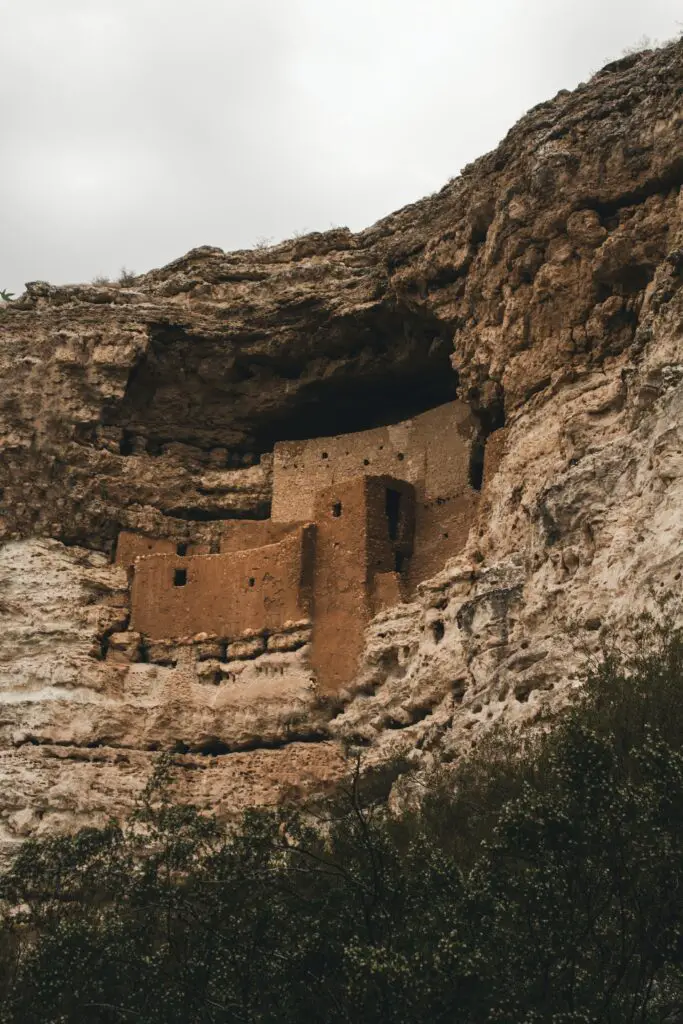
MONTEZUMA CASTLE NATIONAL MONUMENT
One of the popular day trips from Sedona Montezuma Castle National Monument is among the most beautiful cliff dwellings in Arizona, located on the Colorado Plateau.
It is one of the best Arizona National Monuments if you are on a quest to explore the state’s best cliff dwellings or want to know the rich and ancient history of the Native Americans inhabiting the vast expanse of landscapes in the Grand Canyon state.
Castle National Monument is home to one of the most impressive and important archaeological sites in the States.
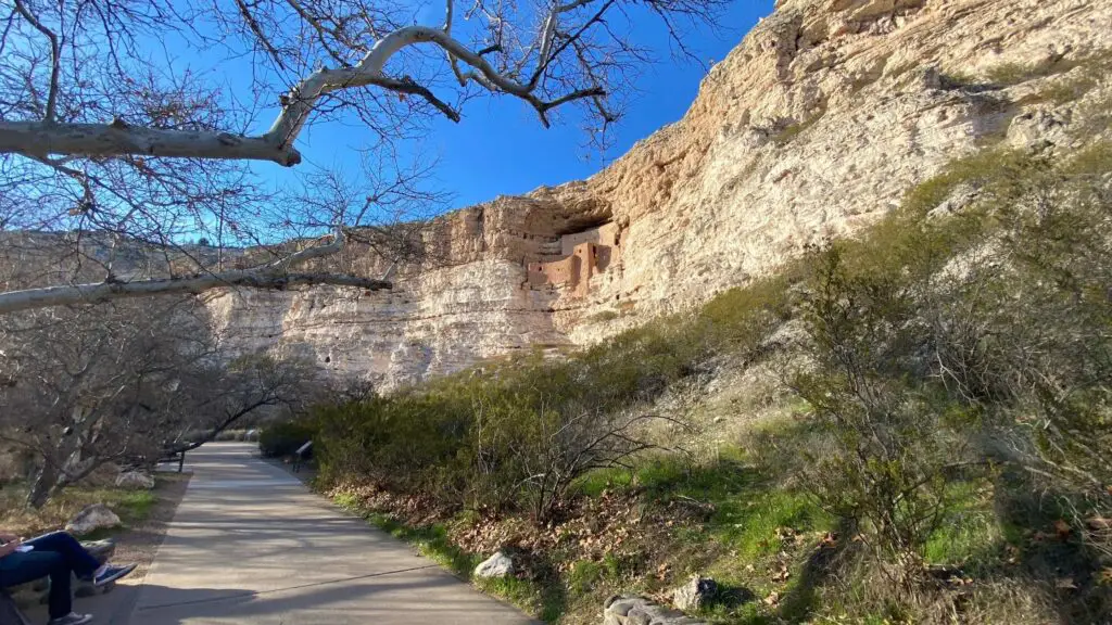
It is considered one of the largest and the best-preserved cliff dwellings in North America, the remains of an ancient settlement over 900 years old.
Located in Camp Verde town in the Verde Valley 25 miles south of Sedona, it was established in 1906 to preserve Indigenous American culture.
Although not related to the famous Aztec emperor, this compact structure is the most spectacular among all the national monuments in Arizona.
It comprises a 5-floor structure carved into a cliff 1,500 feet high above the ground in an alcove in the limestone cliffs bordering Beaver Creek, a tributary of the Verde River.
The inhabitants were the Sinagua people that existed here between 650 and 1425AD.
This cliffside complex was built around AD700 by the Sinagua people and abandoned in 1485 after a long drought.
A short pathway lined with sycamores and catclaw mimosa trees leads to the limestone cliff, which is a stunning and sophisticated example of Sinaguan architecture comprising 20 rooms in multiple stories reached by ladders, and also includes Montezuma Well, a flooded limestone sinkhole a few miles east.
RECOMMENDED – TOP 10 STUNNING CAVES IN SEDONA FOR OUTDOOR LOVERS
Made out of stone-and-mortar masonry, it is an example of exquisite engineering skills and ingenuity, whether it is the placement of rooms to take shelter from the scorching sun or its elevated location that provided protection from Beaver Creek’s annual flooding and to keep an eye on approaching visitors.
While you can’t enter the building during a visit to protect its delicate features, today, you can access Montezuma Castle by a paved third-of-a-mile trail leading to a viewing point below the ruins.
The route has shade, thanks to large trees and passes beneath the cliff dwellings and then loops back to the visitor centre.
You can learn about the pre-Columbian site at its museum to imagine life in this unforgiving desert landscape.
Along the way to the viewing point, there are informative exhibits about the region and its inhabitants.
After touring this stunning castle, drive 11 miles north to see the Montezuma Well, also part of the national monument.
An unusual spring-fed travertine pool in the middle of the arid desert, it is a unique geological feature that once provided water for Sinaguan communities.
After arriving at the trailhead, take the short hike to the lookout to see down into the deep waters below.
The water in the well today, which is about 400 feet deep, has high levels of arsenic and other chemicals.
Continuing along the trail will lead to an ancient but still functioning canal system, along with a large shaded area. Here, you can see smaller dwellings and the remains of an irrigation system.
LOST DUTCHMAN STATE PARK
Among the top and easy-to-access places to watch the sunrise in Scottsdale is Lost Dutchman State Park, at the base of the beautiful Superstition Mountains near Apache Junction and Gold Canyon.
It is one of my favourite spots that I always stop by, if I am driving from Scottsdale to Tombstone, and a must item on Arizona Bucket List.
About 40 minutes drive from Scottsdale will take you to Lost Dutchman State Park in the Sonoran Desert, which got its name after the fabled lost gold mine.
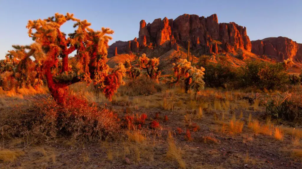
Whether the tales of the treasure are true or not, the real gem at Lost Dutchman Park is the magnificent sunrises over the Superstition Mountain ranges.
The state park offers spectacular views of morning light, bringing a glow of yellow, blue and red to the surrounding desert landscapes.
An icon of the East Valley in the Phoenix Area, it is a paradise for outdoor lovers. It is one of the top spots for Arizona winter hikes with your kids.
You can choose from the many trails that lead from the park into the Superstition Mountain Wilderness and surrounding Tonto National Forest.
Some popular routes include:
- Flatiron via Siphon Draw(6.5 miles round trip/Moderate/Difficult)
- Massacre Falls Trail(5.5 miles out and back, which leads to Massacre Falls, one of the top waterfall hikes in Arizona)
- Prospector’s View Trail(3.5 miles round trip).
- Jacob’s Crosscut Trail(11.5 miles out and back trail) will take you through diverse vegetation and gorgeous views of 4 Peaks Wilderness, Camelback Mountain and other landmarks.
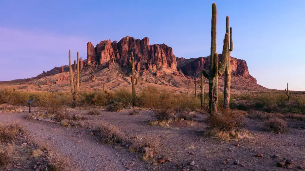
Stop along the trails to admire the saguaros, desert wildflowers and any local wildlife.
You can enjoy the vibrant spectacles of sunrise on one of these many hiking trails scattered across the park or from the comfort of your campsite or cabin.
Hues of pink, yellow, blue and red cast a beautiful glow over the mountain range adorning the Sonoran Desert with magical touches of the dawn.
Start your hike early enough to capture the gorgeous views painted across the sky at sunrise in Scottsdale and Phoenix.
The parking lot is located at the entrance of Lost Dutchman State Park.
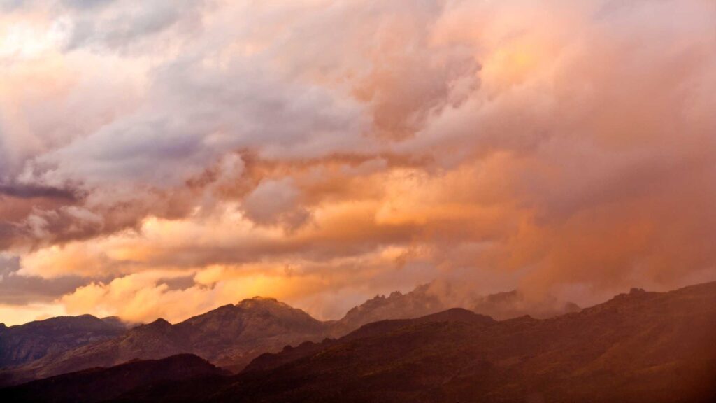
MOUNT LEMMON
Located about 4 hours away(150 miles), one of the beautiful weekend trips from Phoenix is Mount Lemmon.
Mount Lemmon is the Santa Catalina Mountains’ tallest peak at 9,157 feet, and the winding drive up from Tucson is one of the most scenic drives in Arizona.
Located in the hills just outside Tucson, the drive-up is one of the top reasons you should add Mount Lemmon on a weekend getaway from Phoenix.
On this 27-mile-long stretch, the Sky Island Scenic Byway climbs more than 6,000 feet from desert to forest.
You will climb up steadily as you can through the constant twists and turns and witness spectacular panoramic views throughout your journey.
If you prefer hiking exclusively, check out Marshall Gulch Trail and Meadow Trail. Both offer fantastic views and pass through pine forests.
While daytime temperatures in the summer maybe 100 degrees Fahrenheit at the foot of the hills around Tucson, they can fall below 70 degrees in Summerhaven at the top of Mount Lemmon.
So be prepared for the sudden weather changes, carry layers, and stop along the way to check out attractions.
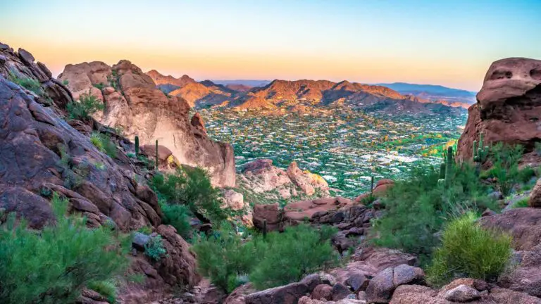
CAMELBACK MOUNTAIN(ECHO CANYON RECREATION AREA)
If you are looking for one of the quick Arizona winter hikes, head to Echo Canyon Recreation Area, located only a 15-minute drive away from Phoenix.
One of the trails leads you to the top of Camelback Mountain, one of the best spots to view sunrise in Phoenix and spectacular 360-degree views of the valley and surrounding mountains.
This mountain gets its name from its two rock formations resembling the head and back of a kneeling camel.
Considered one of the best sunrise hikes in Phoenix, the 1.2-mile Echo Canyon Trail to Camelback Mountain offers magnificent sunrise views apart from featuring many landmarks and iconic attractions near the city, including Praying Monk, Superstition Mountain ranges, CamelBack, Piestewa Peak and others.
The hike begins on the Echo Canyon trail, with the trailhead located close to the parking lot. There is an easy incline at the start, which will offer amazing views.
A few more climbs can be managed well with the help of well-placed handrails.
Pause to take in the pictures of the surrounding attractions on the horizon, including the views of Piestewa Peak behind.
The last mile gets steeper with more steps and boulder hopping between the wash on a marked trail.
Since there is little light, it is best to scramble rather than hop if you are not very confident.
Around the bend at the top, you are rewarded with splendid panoramic views.
Enjoy the sunrise in Phoenix from the summit cast in the backdrop of the skyline of Phoenix, South Mountain Park and Preserve, the Superstitions Mountains and Four Peaks off in the distance.
Start the hike early. Carry a jacket as the temperatures are cooler, a headlamp, water and snacks.
SOUTH MOUNTAIN PARK(DOBBINS LOOKOUT)
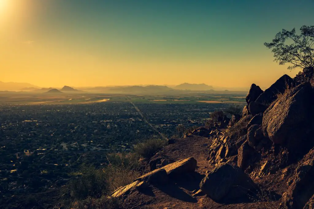
Among the top attractions of Phoenix, South Mountain Park is also one of the best places to watch an epic sunrise in Phoenix, and also, you can enjoy one of your amazing Arizona winter hikes.
South Mountain Park is the largest municipal park in the United States and one of the largest urban parks in North America.
You can spend a few hours or many days in this massive 16000 acres plus park offering tons of activities, from over 60 miles of hiking and biking trails to camping, rock climbing and much more.
The best part is it is only about 20 minutes south of downtown Phoenix, and hence the best spot to start your day is by going on one of the many sunrise hikes in Phoenix to enjoy magical colours, a perfect way to begin your day.
The trek to Dobbins Lookout is the most famous sunrise trail within South Mountain Park and Preserve.
At over 2300 feet, Dobbins Lookout is the highest accessible point within South Mountain Park and Preserve, the perfect spot for watching the skies painted with yellow, red, blue, and orange as the sun rises against the downtown skyline, the Greater Phoenix area, surrounded by majestic mountains in the valley.
There are two ways to reach Dobbins Lookout.

You can hike the 4.6-mile round trip out and down Holbert Trail or take the easy route by car if you are not in the mood for a morning hike.
The views on the trail are far more rewarding, though, so it is the better choice if you are willing to sweat it a bit.
The trail has only short stretches of incline at the start and the end, but almost flats out in the middle.
Throughout the trail, you will be treated to rustic wilderness of the Sonoran Desert landscapes dotted with beautiful wildflowers if you are here in spring.
MORE ARIZONA WINTER HIKES
USERY MOUNTAIN REGIONAL PARK
- Driving duration – 30 minutes
- Average Hiking Distance – 2 to 4 miles one way(depending on the trail)
- Hiking duration – 3 to 4 hours
- Difficulty level – Easy
- Parking – Available
Scottsdale is one of the amazing destinations for Arizona winter hikes. And one of the best experiences in the city is watching a beautiful sunrise.
One of the top Arizona winter hikes for an epic sunrise in Scottsdale is Usery Mountain Regional Park, located about 25 minutes from downtown.
Home to over 30 trails of varying lengths and difficulties to explore, Usery Mountain Regional Park has many routes that you can explore.
Some of the popular trails for sunrise hikes at Usery Mountain Regional Park include Merkle Trail (Easy) and Wind Cave Trail (Medium).
DEVIL’S BRIDGE
- Difficulty – Moderate
- Distance – 6 miles round trip (out and back)
- Duration – About an hour
- Parking – Limited parking available from Monday to Wednesday
One of the year-round popular trails in Sedona is Devil’s Bridge, and if you are in Sedona in winter, I highly recommend adding this to your itinerary as it is one of the best Arizona winter hikes.
One of the popular spots for watching a calming sunrise in Sedona is Devil’s Bridge, which can be accessed via the Chuck Wagon trail.
It is a 2-mile trail one way that is primarily flat and takes about an hour. But wear proper hiking shoes as the path has many rocks.
You have the parking at the Chuck Wagon Trailhead lot off Boynton Pass Road.
If you want a shorter trail, you can drive a 4×4 vehicle directly to Devil’s Bridge Trail.
You will arrive at the Devil’s Bridge Trail junction that opens to stunning panoramas of the bridge gleaming with different shades of colours, making it a fantastic Sedona sunrise hiking trail.
SOLDIER PASS TRAIL
- Difficulty – Easy to Moderate
- Distance – 2.6 miles out and back
- Duration – 30 minutes
- Parking – Available at Jordan Road parking lot
Sedona’s most accessible trail for witnessing a sunrise is the Soldier Pass trail, which passes through different caves, pools, and even sinkholes.
Recommended – A Complete Guide To Hiking The Soldier’s Pass Trail, Sedona
You can access the Soldier Pass trail via Cibola Pass Trail, with a mile total hike length.
For parking, you can use the Jordan Road parking lot.
This is a popular trail as it covers two famous landmarks in Sedona, the famous Devil’s Kitchen Sinkhole and the Seven Sacred Pools, before arriving at the Soldier Pass Cave.
This trail, open throughout the year, is very popular for mountain biking, running, and trekking.
The best time to do this hike is after rainy months as the pools will be full, making it one of the popular Arizona winter hikes.
Recommended – 25 Beautiful Beaches in Arizona For Your Family Weekend Getaway
East Wetlands
The Yuma East Wetlands, part of the Yuma Crossing National Heritage Area, is one of the top things to do in Yuma AZ, for nature lovers.
For those looking for a serene trail, East Wetlands offers a few of the best Arizona winter hikes, simpler and easy for all.
Once a dump site, the 1,400 acres is now a protected wetland area that features wildlife habitats along the banks of the Colorado River and a popular hangout spot among locals and tourists thanks to the many activities to enjoy amidst peaceful, lush landscapes.
You can enjoy biking, exploring hiking trails, horseback riding alongside the Colorado River, admiring the beautiful views, birdwatch, walking your dog, or having a relaxing picnic.
The most popular way to explore the East Wetlands is the easy, 2.6-miles heritage trail.
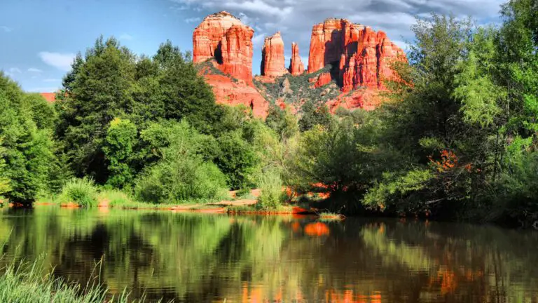
CATHEDRAL ROCK TRAIL
- Difficulty – Moderate to Difficult
- Distance – 1.4 miles out and back(3+ miles including the spire)
- Duration – About an hour
- Parking – Limited parking available Monday through Wednesday
Cathedral Rock is one of the best winter hikes in Arizona, and it is no surprise, given the gorgeous views you will encounter.
One of the best things about choosing this spot for watching a sunrise in Sedona from this place is that you will witness beautiful panoramas throughout your hike, not just at the Cathedral Rock itself.
Although it is a challenging hike, you will pass through many beautiful points where you can rest and enjoy the views.
You will arrive at the base of the rock in about some time, opening to stunning views.
You can continue climbing further after you have admired the views here.
To the left of the viewpoint, there is another smaller trail leading upwards to the Cathedral spire, which feels slightly more challenging than the journey so far, but soon you will notice that it’s only the rocks.
Recommended – A Complete Guide To Hiking The Cathedral Rock, Sedona
On your way down, be cautious and take care of your steps as they can get slippery.
If you do both the hikes, it may take about 2 hours and a little more time if you include the time to watch the sunrise and photograph the same.
PAPAGO PARK(HOLE-IN-THE-ROCK)
- Driving duration – 10 minutes
- Average Hiking Distance –0.3 miles one way
- Hiking duration – 1 to 2 hours
- Difficulty level – Easy
- Parking – Available
One of the popular spots for watching a beautiful sunset in Scottsdale is Hole in the Rock, a natural geological formation in Papago Park, a municipal state park of Phoenix and Tempe.
If you are looking for an easy hike, one of the best Arizona winter hikes in Scottsdale, Papago Park should be your first pick.
Hole-in-the-Rock is a series of holes carved out by millions of years of erosion by the wind into the sandstone hills.
Due to its location, this 1,500-acre park, also only 15 minutes east of downtown Phoenix, is also one of the best Phoenix sunrise spots as well.
So you can watch either or both. Before heading for the hike, you can visit Phoenix Zoo nearby.
Plenty of trails are categorized into the West Side Trails and the East Side Trails.
RECOMMENDED – 10 Best Places To Watch An Epic Sunset In Sedona
The trail, about 0.3 miles one way, is easy, and you can enjoy a quick hike with your family and friends to admire the gorgeous views during the golden hour.
From the parking lot, you will pass a series of unique red sandstone rocks to get to the viewpoint accessed via stone steps rising 200 feet high.
You can climb inside the formations and watch one of the best sunsets in Scottsdale, casting brilliant hues over downtown and the desert oasis beyond.
HIKE THE RAILROAD TUNNEL TRAIL
If you love hiking, add the hike along the Railroad Tunnel Trail to your list of things to do in Payson Az that will take you through the wilderness secluded from any signs of civilization.
Also, as the name suggests, you will stumble upon many rail lines on this trail, including a railroad track that connected Las Vegas, Boulder City, and Hoover Dam bordering Nevada.
This trail was formed in the 1880s when a tunnel was excavated by the Arizona Mineral Belt Railroad through the Mogollon Rim to allow ore transport, but it had to be stopped.
This abandoned tunnel in the 19th century turned into a secluded spot for hikers as it offers fantastic views of the Mogollon Rim along the way.
Also, the Historic Railroad Trail offers splendid views of both Hoover Dam and Lake Mead, Arizona’s largest artificial reservoir.
Recommended – 15 Stunning Hikes Around Payson For Beautiful Views and Picnic Spots
One of the best ways to access the Railroad Tunnel Trail is via the Colonel Devin Trail, which is about a mile long, but steeper and packed with loose rocks and gravel.
Hence it is recommended to wear hiking shoes with great grip and comfortable clothes on this Payson hike.
So this is the guide to your best Arizona winter hikes.
TIPS FOR ARIZONA WINTER HIKES
Here are some more tips to keep in mind for your Arizona winter hikes.
START THE HIKE EARLY
As mentioned earlier, no matter which of Arizona winter hikes you choose, starting the hike early in the morning is best, ideally around or right after sunrise despite some of the trails being non-crowded.
It may not be feasible to wake up early in the cold days everywhere, but I still suggest you start early to make up the most on your Arizona winter hikes.
Apart from securing parking spaces, you can hike without crowds and enjoy photographing and peacefully exploring the trail and cave.
KEEP TRACK OF YOUR PATH WHILE HIKING
Keep looking at the GPS and track your trail once you begin your hike to know your route and to ensure that you can periodically check in and see you’re on the right path.
RESPECT THE LAND
Most of these Arizona winter hikes are located on sacred sites to many communities, and also fragile landscapes and encompassing protected areas.
Do not remove anything from the area, make rock piles, or move the rocks or graffiti rocks.
LEAVE NO TRACE
Please practice the seven principles of Leave No Trace when hiking:
- Packing out what you bring to the hiking trail.
- Being considerate of other hikers.
- Staying on the course.
- Minimising campfire impacts.
- Not approaching or feeding wildlife.
TAKING PHOTOS
If you are specifically planning to do photography, it is best to go in the morning or afternoon when there is sufficient light, especially in trails that involves dwellings, slot canyons or caves.
If you are doing hikes around sunrise or sunset, check out the time required and the sun timings as the days are relatively shorter and it is not recommended to hike in the dark.
FOLLOW THE TRAIL
It is best to stick to the trail to avoid being lost although it is possible to reach the pools following the side paths.