She created Wander In Arizona to share first-hand information about traveling to the many fantastic cities, trails, national parks, monuments and more as she continues to explore.
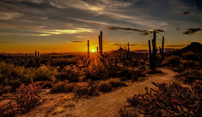
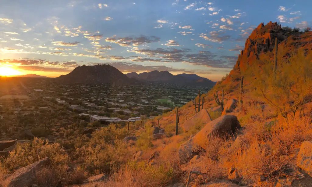
It is no secret that sunrise in Scottsdale is spectacular, and the city boasts fantastic sunsets as well.
Thanks to its stunning location surrounded by some magnificent mountain peaks in the rugged Sonoran desert wilderness and wonderful geological formations, you have plenty of spots to go on sunrise hikes in Scottsdale, a perfect way to begin your day as the panoramas come alive in that golden morning light.
Whether you want to go on a morning hike to watch Scottsdale’s sunrise spectacle or prefer an easy-to-access drive-through spot, below is the list of the best sunrise spots in Scottsdale that should be on your itinerary.
If you are looking for stunning Scottsdale sunset spots, check this guide here.
WHERE TO WATCH SUNRISE IN SCOTTSDALE
MCDOWELL SONORAN PRESERVE
- Distance from Scottsdale – 16 miles
- Driving duration – 21 minutes
- Average Hiking Distance – 3 to 8 miles one way(depending on the trail)
- Hiking duration – 3 to 6 hours
- Difficulty level – Easy to Moderate
- Parking – Available
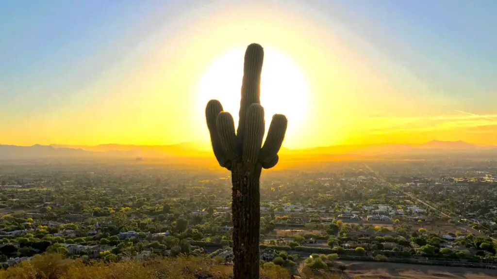
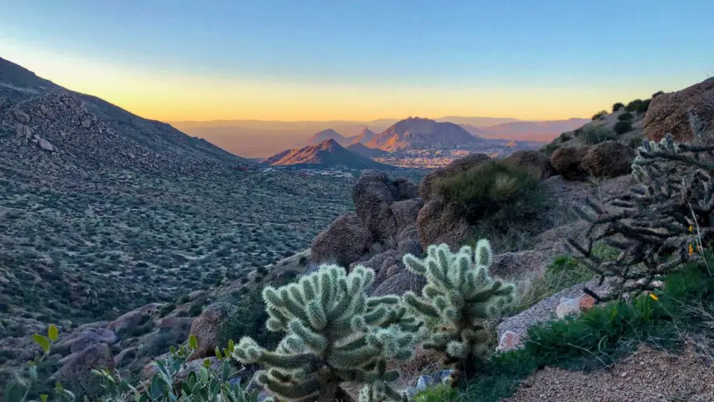
One of the top spots to watch epic sunrise in Scottsdale is the massive McDowell Sonoran Preserve, spanning across 30,580 acres of Sonoran Desert, featuring over 225 miles of trails to explore, loved by outdoor lovers, hiking enthusiasts and mountain bikers.
Open every day from sunrise to sunset, and you will be treated to gorgeous landscapes of the true Sonoran Desert wilderness packed with deep canyons, high mountain peaks, hundreds of varieties of cacti, and rich wildlife along its many trails.
If you are here during spring, the most popular season, you will also come across the magical, vibrant wildflowers standing out distinctly in the arid landscapes.
There are many trails to choose from, depending on your preference.
To make it easy, pick a route or viewpoint that faces east for one of the best sunrise hikes in the McDowell Sonoran Reserve.
Here are our top picks for where to watch the sunrise in McDowell Sonoran Preserve when in Scottsdale.
Gateway Loop Trail
One of the most popular trails in the McDowell Sonoran Preserve is the Gateway Loop Trail, a beautiful 4.4 miles loop hike ideal for watching a stunning sunrise in Scottsdale and an epic Scottsdale sunset.
This is a relatively more leisurely hike where you can take your dogs on a leash well.
You’ll find plenty of giant saguaro cacti everywhere and vibrant desert wildflowers in spring, glowing as the rising sun touch the wilderness.
Sunrise Peak via Sunrise Trail
Although a challenging trail, one of the best sunrise hikes in Scottsdale in the McDowell Sonoran Reserve if you are up for a moderate challenge is the summiting the Sunrise Peak via sunrise trail.
Although not a very strenuous hike, due to the elevation gain involved, it may be slightly challenging for some.
On this 4.4 miles out-and-back trail, you will be treated to stunning sunrise views over the Scottsdale skyline from 1500 feet above, offering beautiful panoramas of the morning skies against the backdrops of the Sierra Estrella range to the west and the high peaks of the Mazatzal Wilderness to the north.

Winter and early spring are the best times to watch stunning sunrise in Scottsdale from this peak.
You may even see the snow-sprinkled peaks during winter.
Carry a jacket, a headlamp, sufficient water, snacks, a hat and sunscreen which you will be needing on your way back. Watch out for snakes and lizards. You can bring dogs on a leash.
Tom’s Thumb Trail
One of the popular hikes to watch the sunrise in Scottsdale and over Phoenix is Tom’s Thumb, a very challenging trail, harder than Pinnacle Peak, offering spectacular views of the Phoenix valley
You will pass through many switchbacks on a steep hike, and best tackled with hiking poles as it can get slippery navigating loose gravel. It is best to wear good hiking shoes with grip.
On the way, you have plenty of opportunities to stop, relax and take photos.
The landscapes look more surreal as you climb up on this well-maintained route.
The trail climbs at a low steady grade to the ridgeline along a smooth gravel trail.
After two miles on this marked trail, you will reach the signed junction for the East End Trail and the base of Tom’s Thumb. Here make a right and head towards the summit.
You will require a bit of scrambling during the last stretch, but the trail is easy to follow.
Once at the top, you are greeted by the giant granite tower that is Tom’s Thumb at 1000-foot high surrounded by alcoves to explore..
Restrooms are available, but there is no drinking water.
Carry sufficient water, snacks, a jacket, a hat, and sunglasses. Watch out for rattlesnakes and scorpions. Bring a headlamp.
Ringtail Trail
Although it is one of the popular sunset trails, one of the top spots for watching an epic sunrise in Scottsdale in the Sonoran Reserve is Ringtail Trail, a 2.4-mile loop which offers spectacular 360-degree views of the rugged Sonoran Desert.
PAPAGO PARK(HOLE-IN-THE-ROCK)
- Distance from Scottsdale – 3 miles
- Driving duration – 10 minutes
- Average Hiking Distance –0.3 miles one way
- Hiking duration – 1 to 2 hours
- Difficulty level – Easy
- Parking – Available
One of the popular spots for watching a beautiful sunrise in Scottsdale is Hole in the Rock, a natural geological formation in Papago Park, a municipal state park of Phoenix and Tempe.
If you are looking for a quick getaway for an early morning sunrise hike in Scottsdale, Papago Park should be your first pick.
Hole-in-the-Rock is a series of holes carved out by millions of years of erosion by the wind into the sandstone hills.
Due to its location, this 1,500-acre park, also only 15 minutes east of downtown Phoenix, is also one of the best Phoenix sunrise spots as well.
So you can watch either or both. Before heading for the hike, you can visit Phoenix Zoo nearby.
Plenty of trails are categorized into the West Side Trails and the East Side Trails.
One of the most popular routes for enjoying a quiet Phoenix sunrise is the trail to Hole-in-the-Rock.
RECOMMENDED – 10 Best Places To Watch An Epic Sunset In Sedona
The trail, about 0.3 miles one way, is easy, and you can enjoy a quick hike with your family and friends to admire the gorgeous views during the golden hour.
From the parking lot, you will pass a series of unique red sandstone rocks to get to the viewpoint accessed via stone steps rising 200 feet high.
You can climb inside the formations and watch one of the best sunsets in Scottsdale, casting brilliant hues over downtown and the desert oasis below. Since the park gates close at 7 PM, plan your hike accordingly.
PIESTEWA PEAK
- Distance from Scottsdale – 9.5 miles
- Driving duration – 20 minutes
- Average Hiking Distance – 2.2 miles one way
- Hiking duration – 3 to 4 hours
- Difficulty level – Easy to Moderate
- Parking – Available
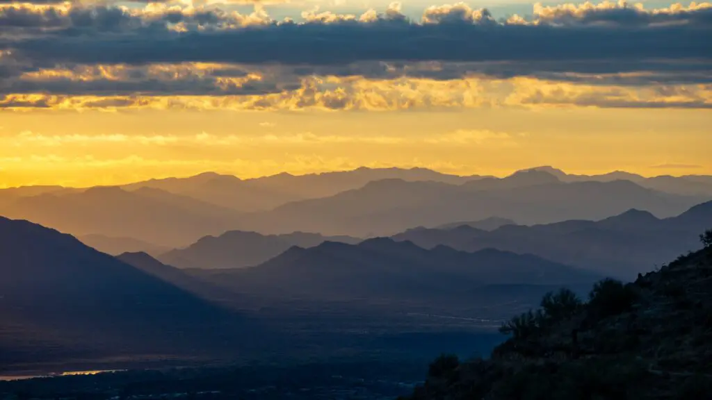
One of the popular spots to watch both a sunset and sunrise in Scottsdale is Piestewa Peak, one of the most prominent mountains in the Phoenix Valley located in the Phoenix Mountains Preserve.
Named in honour of Lori Ann Piestewa, the first Native American woman in the U.S. military to lose her life in combat, Piestewa Peak, close to Camelback, is one of the few places to watch Scottsdale sunrise where you can admire the magnificent 360-degree views.

You can access the peak on the Summit Trail, a 2.1-mile one-way path, which involves a few switchbacks and a steady incline that can be managed due to the sizeable well-placed step sections.
At the top, you will be treated to sweeping views of the valley.
Look for the Superstitions Mountains, White Tanks, the McDowells and South Mountain to the south.
Start the hike early for the best sunset views. Carry a jacket and a headlamp. Note that pets aren’t allowed on this trail.
LOOKOUT MOUNTAIN
- Distance from Scottsdale – 17 miles
- Driving duration – 25 minutes
- Average Hiking Distance – 0.85 miles one way
- Hiking duration – 1 to 2 hours
- Difficulty level – Easy
- Parking – Available
One of the short and steep sunrise hikes in Scottsdale suitable for beginners and intermediate-level hikers is the Lookout Mountain trail in the Lookout Mountain Preserve, a municipal park in the northern part of Phoenix, Arizona.
Although it is under a mile out-and-back trail, it is generally considered a moderately challenging route as it involves climbing over scattered loose rocks patches.

Take it slow, carry a headlamp, and wear good hiking shoes. You can even bring your dogs on a leash.
At the end of the climb, you will be rewarded with glorious views of the setting sun against the desert vegetation carpeted mountains, the skyline of Scottsdale and Phoenix valley.
PINNACLE PEAK PARK
- Distance from Scottsdale – 21 miles
- Driving duration – 30 minutes
- Average Hiking Distance – 2 miles one way
- Hiking duration – 3 to 4 hours
- Difficulty level – Easy
- Parking – Available
One of the most popular places to watch the sunrise in Scottsdale is Pinnacle Peak Park, which attracts thousands of visitors for the sunrise hike thanks to the truly spectacular panoramas overlooking the city and the valley beyond, surrounded by rocky desert mountains.
The 2 miles out and back trail is well-maintained, and since it is relatively easy, the hike is popular and you can expect a lot of crowds on the weekends and holidays during peak season.
The hike to the top has an elevation gain of 1,300 feet two miles, which is gradual.
During the last stretch, you will descend a lot of stairs, which you have to climb back up, which can feel a bit difficult due to the elevation and the stairs up.
From the summit, you will be rewarded with a gorgeous sunrise over the unique granite formations of Pinnacle Peak in north Scottsdale alongside the towering saguaros, abundant wildlife, and spectacular views of Scottsdale and Phoenix.
There are plenty of places where you can stop by, relax and capture the stunning views.
Unlike the many trails for watching Scottsdale sunrise, Pinnacle Peak Park has better amenities, including a welcome booth where you can collect the maps, a sitting area(shaded), restrooms, a large parking area and a small shopping centre nearby selling snacks.
SOUTH MOUNTAIN PARK(DOBBINS LOOKOUT)
- Distance from Scottsdale – 19 miles
- Driving duration – 32 minutes
- Average Hiking Distance – 2.3 miles one way
- Hiking duration – 3 to 4 hours
- Difficulty level – Moderate
- Parking – Available
Among the top attractions of Scottsdale, South Mountain Park is also one of the best places to watch an epic sunrise in Scottsdale.
South Mountain Park is the largest municipal park in the United States and one of the largest urban parks in North America.
You can spend a few hours or many days in this massive 16000 acres plus park offering tons of activities, from over 60 miles of hiking and biking trails to camping, rock climbing and much more.
The best part is it is only about 30 minutes from downtown Scottsdale, and hence the best spot to start your day is by going on one of the many sunrise hikes in Scottsdale to enjoy magical colours, a perfect way to begin your day.
The trek to Dobbins Lookout is the most famous sunrise trail within South Mountain Park and Preserve. At over 2300 feet, Dobbins Lookout is the highest accessible point within South Mountain Park and Preserve, the perfect spot for watching the skies painted with yellow, red, blue, and orange as the sun rises against the downtown skyline of Scottsdale, the Greater Phoenix area, surrounded by majestic mountains in the valley.
There are two ways to reach Dobbins Lookout.
You can hike the 4.6-mile round trip out and down Holbert Trail or take the easy route by car if you are not in the mood for a morning hike.

The views on the trail are far more rewarding, though, so it is the better choice if you are willing to sweat it a bit.
The trail has only short stretches of incline at the start and the end, but almost flats out in the middle.
Throughout the trail, you will be treated to the rustic wilderness of the
Sonoran Desert landscapes are dotted with beautiful wildflowers if you are here in spring.
USERY MOUNTAIN REGIONAL PARK
- Distance from Scottsdale – 21 miles
- Driving duration – 30 minutes
- Average Hiking Distance – 2 to 4 miles one way(depending on the trail)
- Hiking duration – 3 to 4 hours
- Difficulty level – Easy
- Parking – Available
One of the underrated places to watch a beautiful sunrise in Scottsdale is Usery Mountain Regional Park, located about 25 minutes from downtown.
Home to over 30 trails of varying lengths and difficulties to explore, Usery Mountain Regional Park has many routes that you can explore.
Some of the popular trails for sunrise hikes at Usery Mountain Regional Park include Merkle Trail (Easy) and Wind Cave Trail (Medium).
CAVE CREEK(BLACK MOUNTAIN SUMMIT TRAIL)
- Distance from Scottsdale – 21 miles
- Driving duration – 30 minutes
- Average Hiking Distance – 1 mile one way
- Hiking duration – 2 to 3 hours
- Difficulty level – Easy
- Parking – Available
One of the offbeat sunrise hikes in Scottsdale is the Black Mountain Summit trail near Cave Creek, a 2.2-mile hike with 1,100 ft in elevation gain offering stunning views of Scottsdale, North Phoenix and Cave Creek.
It is one of the few hikes in Scottsdale where you will be rewarded with 360-degree views of the Sonoran Desert landscapes behind the city’s skyline.
Although the trail is short, it can be moderately difficult due to the incline and the climb. It is best to wear good hiking shoes and carry water and snacks.
At the summit, there’s an American flag. You can also bring your dogs on a leash.
LOST DOG WASH TRAILHEAD
- Distance from Scottsdale – 14 miles
- Driving duration – 25 minutes
- Average Hiking Distance – 2 miles one way
- Hiking duration – 3 to 4 hours
- Difficulty level – Easy
- Parking – Available
One of the easy hikes to watch the sunrise in Scottsdale is near Fountain Hills, also close to Phoenix.
Lost Dog Wash trail is a 3.5 miles loop trail and is a favourite among locals, bikers and families looking for a quick getaway for enjoying stunning sunset and sunrise views.

On this easy trail with only subtle inclines, you will be surrounded by beautiful views throughout, especially the vibrant desert wildflowers if you are here in spring.
LOST DUTCHMAN STATE PARK(DOBBINS LOOKOUT)
- Distance from Scottsdale – 35 miles
- Driving duration – 45 minutes
- Average Hiking Distance – 1.5 miles to 6 miles(depending on the trails)
- Difficulty level – Easy to Moderate
- Hiking Duration – 2 to 5 hours
- Parking – Available
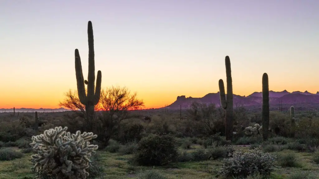
Among the top and easy-to-access places to watch the sunrise in Scottsdale is Lost Dutchman State Park, at the base of the beautiful Superstition Mountains near Apache Junction and Gold Canyon.
About 40 minutes drive from Scottsdale will take you to Lost Dutchman State Park in the Sonoran Desert, which got its name after the fabled lost gold mine.

Whether the tales of the treasure are true or not, the real gem at Lost Dutchman Park is the magnificent sunrises over the Superstition Mountain ranges.
The state park offers spectacular views of morning light, bringing a glow of yellow, blue and red to the surrounding desert landscapes.
An icon of the East Valley in the Phoenix Area, it is a paradise for outdoor lovers.
You can choose from the many trails that lead from the park into the Superstition Mountain Wilderness and surrounding Tonto National Forest.
Some popular routes include:
- Flatiron via Siphon Draw(6.5 miles round trip/Moderate/Difficult)
- Massacre Falls Trail(5.5 miles out and back, which leads to Massacre Falls, one of the top waterfall hikes in Arizona)
- Prospector’s View Trail(3.5 miles round trip).
- Jacob’s Crosscut Trail(11.5 miles out and back trail) will take you through diverse vegetation and gorgeous views of 4 Peaks Wilderness, Camelback Mountain and other landmarks.
Stop along the trails to admire the saguaros, desert wildflowers and any local wildlife.
You can enjoy the vibrant spectacles of sunrise on one of these many hiking trails scattered across the park or from the comfort of your campsite or cabin.
Hues of pink, yellow, blue and red cast a beautiful glow over the mountain range adorning the Sonoran Desert with magical touches of the dawn.
Start your hike early enough to capture the gorgeous views painted across the sky at sunrise in Scottsdale and Phoenix. The parking lot is located at the entrance of Lost Dutchman State Park.
MAP OF THE BEST SCOTTSDALE SUNRISE SPOTS
USEFUL TIPS TO WATCH SUNRISE IN SCOTTSDALE
- Check the timings – Look for Scottsdale sunrise time before you plan your sunrise hike, as the time slightly varies depending on the season you are visiting Scottsdale.
- Calculate time for hiking – Depending on your fitness levels and your speed, you may take more time than the average estimates provided. It is best to have an idea of how long you may need which allows you to time your sunrise hike in Scottsdale correctly.
- Carry essentials – Great hiking shoes with a good grip, headlamps, jackets, water, and snacks are a must, irrespective of the hike.

- Watch out for snakes and lizards – Although the Rattlesnake season runs from May through October, you may run into snakes at any time of year.
- Gila Monster Lizards and scorpions can also be seen, but if you stick to the trails and never put your feet where you can’t see them, you should be okay. If you do come across one, move very slowly backwards and alert the staff.
- Stay hydrated – Although temperatures can be low if you’re heading out before sunrise, once the sun is up, it quickly gets hot no matter which time of the year. Drink sufficient water to stay hydrated.
- Protecting from the sun – Going back, you will be exposed to the heat likely, as most of the trails have minimal or no shaded areas. Carry sunscreen, a hat and sunglasses.
OTHER RECOMMENDED POSTS FOR YOU
- 10 SPOTS TO WATCH EPIC SUNRISE IN SEDONA
- 10 TOP PLACES TO WATCH THE STUNNING SEDONA SUNSET
- 15 BEST PLACES TO WATCH PHOENIX SUNSETS
- 10 TOP PHOENIX SUNRISE HIKES YOU SHOULD CHECK OUT
WHERE TO STAY IN SCOTTSDALE?
APARTMENTS AND LUXURY HOTELS
✅ Hilton North Scottsdale At Cavasson 🤩 Rating: 9.4/10 Wonderful (200+ reviews) – Rooms feature air-conditioning, balconies, tea and coffee makers, hairdryers, work desks, complimentary toiletries, and TVs.
Scottsdale Airport is 1.9 mi away, with attractions like Tpc Scottsdale 1.4 mi and WestWorld of Scottsdale 3 mi nearby Hilton North Scottsdale.
Couples in particular like the location. Check more here.
✅ Omni Scottsdale Resort & Spa at Montelucia 🤩 Rating: 9.2/10 Wonderful (200+ reviews) – Set within 12 km of OdySea Aquarium, Omni Scottsdale Resort & Spa at Montelucia in Scottsdale features several amenities, including a bar.
Couples in particular like Omni Scottsdale Resort – they rated it 9.7 for a two-person trip.
Check here to know more this excellent resort perfect for a holiday!
✅ Boulders Resort & Spa Scottsdale, Curio Collection by Hilton 🤩 Rating: 8.5/10 Very Good (200+ reviews)
The Boulders Resort & Spa, Curio Collection by Hilton features 4 swimming pools and a state-of-the-art fitness centre with whirlpool tubs and saunas.
After a game of golf or tennis, guests can relax with a massage at Spa at the Boulders. Yoga and pilates classes are also offered.
Guests at The Boulders Resort & Spa, Curio Collection by Hilton, will enjoy a variety of dining options, from casual to gourmet. Check out more here.
POPULAR MID-BUDGET HOTELS
✅ Canopy By Hilton Scottsdale Old Town 🤩 Rating: 8.9/10 Excellent (380+ reviews)
Located in Scottsdale, Canopy By Hilton Scottsdale Old Town is 6.8 miles from Phoenix Sky Harbor International Airport.
Guests enjoy a rooftop swimming pool, fitness center, terrace, restaurant, bar, and free bicycles.
Couples in particular like the location – they rated it 9.6 for a two-person trip.
Check more details to book your stay here.
✅ Hyatt House Scottsdale Old Town 🤩 Rating: 8.6/10 Very Good (450+ reviews)
Featuring an outdoor swimming pool and a hot tub, this hotel is 20 minutes’ drive from Phoenix Sky Harbour International Airport.
All rooms include free Wi-Fi. A hot breakfast buffet is served daily.
The Hyatt House hotel is located in the centre of Old Town Scottsdale.
Continental Golf Course is 5 minutes’ drive from Hyatt House Scottsdale Old Town. Check more details here!
✅ Sentral Old Town🤩 Rating: 8.6/10 Very Good (450+ reviews)
Sentral Old Town in Scottsdale offers 4-star comfort with air-conditioning, private bathrooms, and modern amenities.
Sentral Old Town is an excellent apartment hotel with a sun terrace near the Desert Botanical Gardens.
Read more here to also find holiday deals for the best prices.