She created Wander In Arizona to share first-hand information about traveling to the many fantastic cities, trails, national parks, monuments and more as she continues to explore.
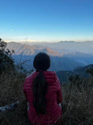
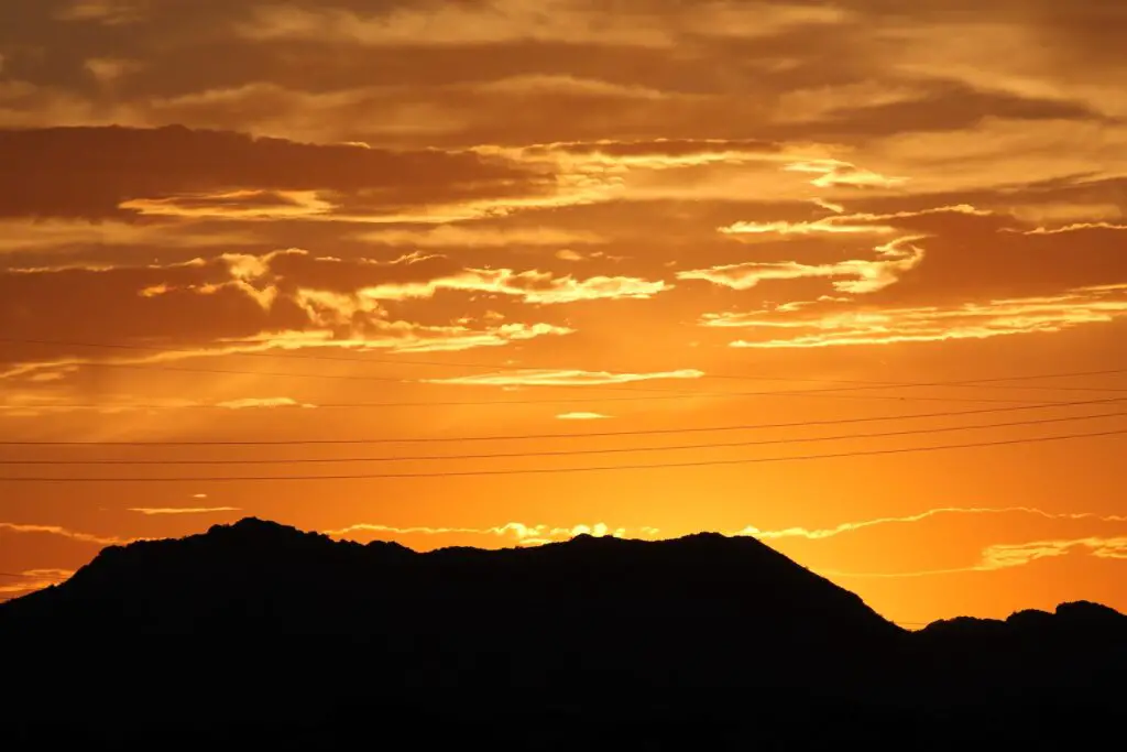
If you are wondering where to watch a Sunrise in Phoenix, look no further.
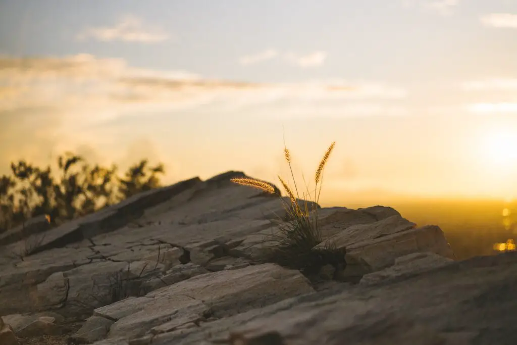
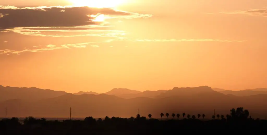
There’s no better way to start your trips than by watching the sunrise, creating a beautiful canvas of colours against the rocky mountains, sandstones, and cacti-packed rugged desert landscapes surrounding the beautiful Phoenix valley.
Whether you want to go on a morning hike to watch Phoenix sunrise spectacle or prefer an easy-to-access drive-through spot, below is the list of the best sunrise spots in Phoenix that should be on your itinerary.
WHERE TO WATCH A SUNRISE IN PHOENIX – TOP PLACES
WATCH THE SUNRISE FROM A HOT AIR BALLOON
One of my favourite bucket list experiences in Arizona so far was watching a splendid sunrise, feeling like a bird as I soared up in the sky in a hot air balloon ride.
If you are wondering where to watch a stunning Phoenix sunrise, join a guided hot-air balloon tour, which will take you on a magical journey in the dawn.

Depending on how long you want to be up and what else you need to enjoy, you can choose tours ranging between 30 minutes to 4 hours.
Here are three of my best recommendations you should check out to have a blast!
✅ Phoenix Hot Air Balloon Ride at Sunrise(4.9/5 500+ reviews🤩) – This is the perfect value-for-money tour and lasts 4 hours. Experience stunning 360-degree views of the mammoth Sonoran Desert in North Phoenix on this sunrise flight, floating effortlessly across the sky at dawn.
Then, celebrate with a traditional champagne toast and breakfast after the flight. Read more here.
✅ Sunrise Hot Air Balloon Ride in Phoenix with Breakfast (5/5 300+ reviews🤩)- This 4-hour tour includes breakfast.
Take this small group tour to float over the Sonoran Desert in a hot air balloon!
Depart before daybreak to get incredible views of the desert sun as it rises. Check out more details here.
✅ Sunrise Sonoran Desert Hot Air Balloon Ride from Phoenix (5/5 150+ reviews🤩) – Wake up early to experience a Sonoran Desert sunrise and transform it into a story by seeing it from a birds-eye view.
This hot air balloon ride from Phoenix takes you into the air with a professional guide who will narrate your trip. Find more details here.
PAPAGO PARK(HOLE-IN-THE-ROCK)
- Distance from Phoenix – 8.5 miles
- Driving duration – 15 minutes
- Average Hiking Distance –0.3 miles one way
- Hiking duration – 1 to 2 hours
- Difficulty level – Easy
- Parking – Available
If you’re looking to add a quick hike to the itinerary for your day in the city, which also offers one of the fantastic spots for watching a splendid sunrise in Phoenix, Papago Park is the place to go.
This 1,500-acre park, only 15 minutes east of downtown Phoenix, is one of the best places for a beautiful sunrise hike in Phoenix.
Plenty of trails are categorized into the West Side Trails and the East Side Trails.
One of the most popular routes for enjoying a quiet Phoenix sunrise is the trail to Hole-in-the-Rock.
As the name suggests, Hole-in-the-Rock is a series of holes carved out by millions of years of erosion by the wind into the sandstone hills.
On a short hike of about only 0.3 miles one way, you can reach the Hole-in-the-Rock formations to find the best spots to watch the perfect sunrise over Phoenix, offering dramatic views of the desert oasis below.
From the parking lot, you will go past a series of unique red sandstone rocks to get to the viewpoint accessed via stone steps rising 200 feet high.

Please bring a blanket or your early breakfast, as there are lots of flat and smooth spaces and wait for sunrise to cast its magic.
Remember to carry your camera to capture stunning shots of panoramas in the magical dawn hours.
Note that the parking lot may not be open if you come before sunrise, and the roads remain closed as well. So plan your drive accordingly.
PIESTEWA PEAK
- Distance from Phoenix – 14 miles
- Driving duration – 15 minutes
- Average Hiking Distance – 2.2 miles one way
- Hiking duration – 3 to 4 hours
- Difficulty level – Easy to Moderate
- Parking – Available
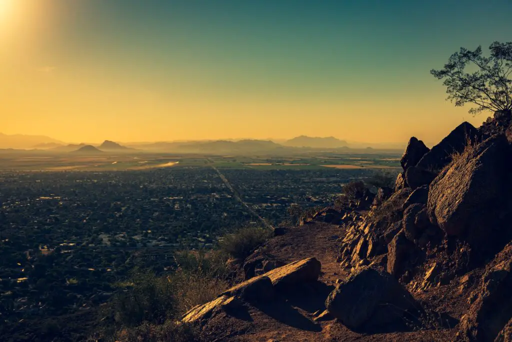
One of the popular spots to watch both a sunset and sunrise in Phoenix is Piestewa Peak, one of the most prominent mountains in the Phoenix Valley located in the Phoenix Mountains Preserve.

Named in honour of Lori Ann Piestewa, the first Native American woman in the U.S. military to lose her life in combat, Piestewa Peak, close to Camelback, is one of the few places to watch Phoenix’s sunrise and sunsets where you can admire the magnificent 360-degree views.
You can access the peak on the Summit Trail, a 2.1-miles one-way path, which involves a few switchbacks and a steady incline that can be managed due to the sizeable well-placed step sections.
At the top, you will be treated to sweeping views of the valley.
Look for the Superstitions Mountains, White Tanks, the McDowells and South Mountain to the south.
Start the hike early for the best sunrise views.
Carry a jacket and a headlamp. Note that pets aren’t allowed on this trail.
If you want a comfortable trip with a local expert, check this fantastic tour(5/5 reviews🤩), you can also opt for the guided night tour to watch the sunset if you are a night owl!
CAMELBACK MOUNTAIN(ECHO CANYON RECREATION AREA)
- Distance from Phoenix – 13.3 miles
- Driving duration – 15 minutes
- Average Hiking Distance – 1.2 miles one way
- Difficulty level – Easy to Moderate
- Hiking duration – 1 to 2 hours
- Parking – Available
If you are looking for one of the quick-to-reach spots to watch a beautiful sunrise in Phoenix, head to Echo Canyon Recreation Area, located only a 15-minute drive away from Phoenix.
One of the trails leads you to the top of Camelback Mountain, one of the best spots to view sunrise in Phoenix and spectacular 360-degree views of the valley and surrounding mountains.
This mountain gets its name from its two rock formations resembling the head and back of a kneeling camel.
Considered one of the best sunrise hikes in Phoenix, the 1.2-mile Echo Canyon Trail to Camelback Mountain offers magnificent sunrise views apart from featuring many landmarks and iconic attractions near the city, including Praying Monk, Superstition Mountain ranges, CamelBack, Piestewa Peak and others.
The hike begins on the Echo Canyon trail, with the trailhead located close to the parking lot. There is an easy incline at the start, which will offer amazing views.
A few more climbs can be managed well with the help of well-placed handrails.
Pause to take in the pictures of the surrounding attractions on the horizon, including the views of Piestewa Peak behind.
The last mile gets steeper with more steps and boulder hopping between the wash on a marked trail.
Since there is little light, it is best to scramble rather than hop if you are not very confident.
Around the bend at the top, you are rewarded with splendid panoramic views.
Enjoy the sunrise in Phoenix from the summit cast in the backdrop of the skyline of Phoenix, South Mountain Park and Preserve, the Superstitions Mountains and Four Peaks off in the distance.
Start the hike early. Carry a jacket as the temperatures are cooler, a headlamp, water and snacks.
LOOKOUT MOUNTAIN PRESERVE
- Distance from Phoenix – 18 miles
- Driving duration – 25 minutes
- Average Hiking Distance –0.85 miles one way
- Hiking duration – 1 to 2 hours
- Difficulty level – Easy
- Parking – Available
One of the short and steep sunrise hikes in Phoenix suitable for beginners and intermediate-level hikers is the Lookout Mountain trail in the Lookout Mountain Preserve, a municipal park in the northern part of Phoenix, Arizona.
Although it is under a mile out-and-back trail, the trail is generally considered a moderately challenging route as it involves climbing over scattered loose rocks patches.
Take it slow, carry a headlamp, and wear good hiking shoes. You can even bring your dogs on a leash.
At the end of the climb, you will be rewarded with glorious views of the rising sun against the desert vegetation carpeted mountains, the city’s skyline and Phoenix valley.
SOUTH MOUNTAIN PARK(DOBBINS LOOKOUT)
- Distance from Phoenix – 32 miles
- Driving duration – 30 minutes
- Average Hiking Distance – 2.3 miles one way
- Hiking duration – 3 to 4 hours
- Difficulty level – Moderate
- Parking – Available
Among the top attractions of Phoenix, South Mountain Park is also one of the best places to watch an epic sunrise in Phoenix.
South Mountain Park is the largest municipal park in the United States and one of the largest urban parks in North America.
You can spend a few hours or many days in this massive 16000 acres plus park offering tons of activities, from over 60 miles of hiking and biking trails to camping, rock climbing and much more.
The best part is it is only about 20 minutes south of downtown Phoenix, and hence the best spot to start your day is by going on one of the many sunrise hikes in Phoenix to enjoy magical colours, a perfect way to begin your day.
The trek to Dobbins Lookout is the most famous sunrise trail within South Mountain Park and Preserve.
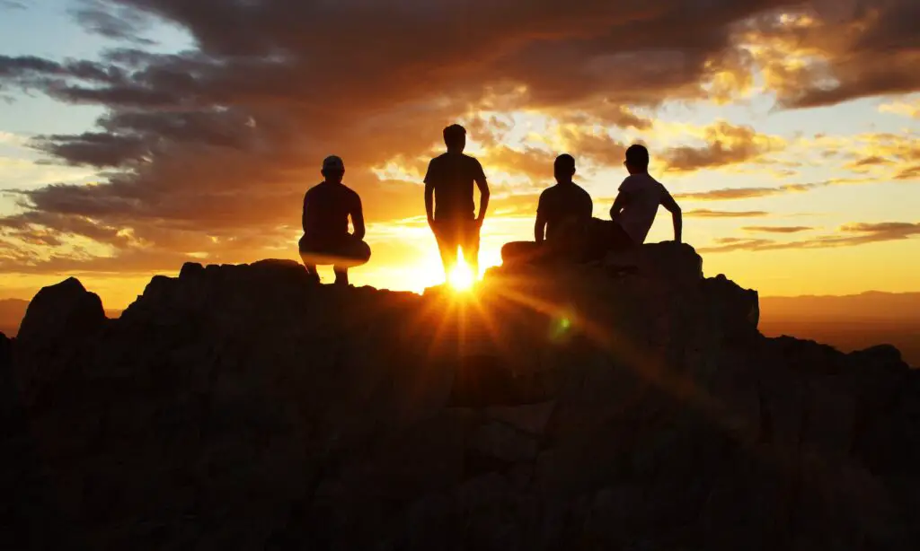
At over 2300 feet, Dobbins Lookout is the highest accessible point within South Mountain Park and Preserve, the perfect spot for watching the skies painted with yellow, red, blue, and orange as the sun rises against the downtown skyline, the Greater Phoenix area, surrounded by majestic mountains in the valley.
There are two ways to reach Dobbins Lookout.
You can hike the 4.6-mile round trip out and down Holbert Trail or take the easy route by car if you are not in the mood for a morning hike.
The views on the trail are far more rewarding, though, so it is the better choice if you are willing to sweat it a bit.
The trail has only short stretches of incline at the start and the end, but almost flats out in the middle.
Throughout the trail, you will be treated to rustic wilderness of the Sonoran Desert landscapes dotted with beautiful wildflowers if you are here in spring.
THUNDERBIRD MOUNTAIN PARK(CHOLLA LOOP)
- Distance from Phoenix – 24 miles
- Driving duration – 30 minutes
- Average Hiking Distance – 4 to 6 miles one-way average
- Difficulty level – Easy to Moderate
- Hiking duration – 3 to 4 hours
- Parking – Available
One of the best sunset spots in Phoenix that has become popular is Thunder Mountain Conservation Park, located about 30 minutes from Phoenix.
There are over 15 trails for hiking in this conservation area, which attracts many families and outdoor lovers.
Among the best trails for sunset are Cholla Loop, a 4-mile out-and-back trail leading to a summit offering stunning vistas of the cacti-packed landscapes.
It also offers some fantastic sunrise views, so if you want to hike in Phoenix, check out the sunrise summit trail in Thunder Mountain Park.
Bring plenty of water and a hat, as there is zero shade. Watch out for tiny cacti along the edge of the trails, especially with pets and kids.
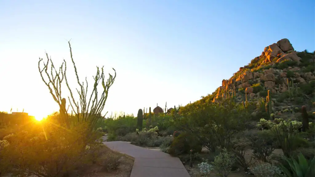
DESERT BOTANICAL GARDEN
- Distance from Phoenix – 9 miles
- Driving duration – 15 minutes
- Average Hiking Distance – 0.3 miles one way
- Difficulty level – Easy
- Parking – Available
One of the most accessible locations to enjoy the sunrise in Phoenix is the Desert Botanical Garden, located 15 minutes from downtown Phoenix.
Home to thousands of varieties of desert plants native to the American Southwest, it is also one of the top Phoenix sunrise spots to enjoy stunning views of colourful skies against the garden’s saguaros, chollas, and cacti. It is one of the best places to watch a sunset in Phoenix.
There are five trails based on different themes that will offer glimpses of the people of the Sonoran Desert along with introducing you to a plethora of beautiful desert wildflowers.
Although the park may not be open for accessing the trails until 8 AM, you can watch the sunrise around the park and capture pictures before heading inside.
SONORAN DESERT PRESERVE(APACHE WASH TRAIL)
- Distance from Phoenix – 29 miles
- Driving duration – 30 minutes
- Average Hiking Distance – 2 miles one way
- Hiking duration – 3 to 4 hours
- Difficulty level – Easy to Moderate
- Parking – Available
If you are looking for offbeat sunrise hikes in Phoenix, one of the best-secluded places to watch a sunrise in Phoenix is near the Sonoran Desert Preserve on the Apache Wash trail hike.
Unlike the other trails for watching Phoenix sunrises, the Apache Wash trail is a wide sidewalk and thus more accessible, meandering through the stunning preserve.
You will cross bridges across the washes and pass through beautiful desert scapes before arriving at the vantage points to enjoy the sunrise spectacle.
Although you may not be experiencing the heights of tall mountains like Piestewa or Camelback, the wide-open vistas of Apache Wash are unique to watching one of the best sunrises in Phoenix on a short and more straightforward hike, ideal for beginners and families.

There is a large parking lot near the trailhead. On your sunrise hike near Phoenix, you will find runners and hikers(mostly locals).
Two out-and-back options are available: a shorter, roughly 2-mile loop with moderate elevation change and a longer 5-mile loop with more significant elevation.
If you want to do the shorter one, head right from the trailhead, where you pass to a minor hill along the bend. If you are up for an early-morning challenge, head to the left.
Both will pass through the wash before opening up to many viewpoints. Both trails offer splendid sunrise views.
You can enjoy birdwatching and have an early picnic after sunrise before making your way back down.
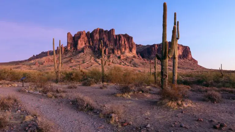
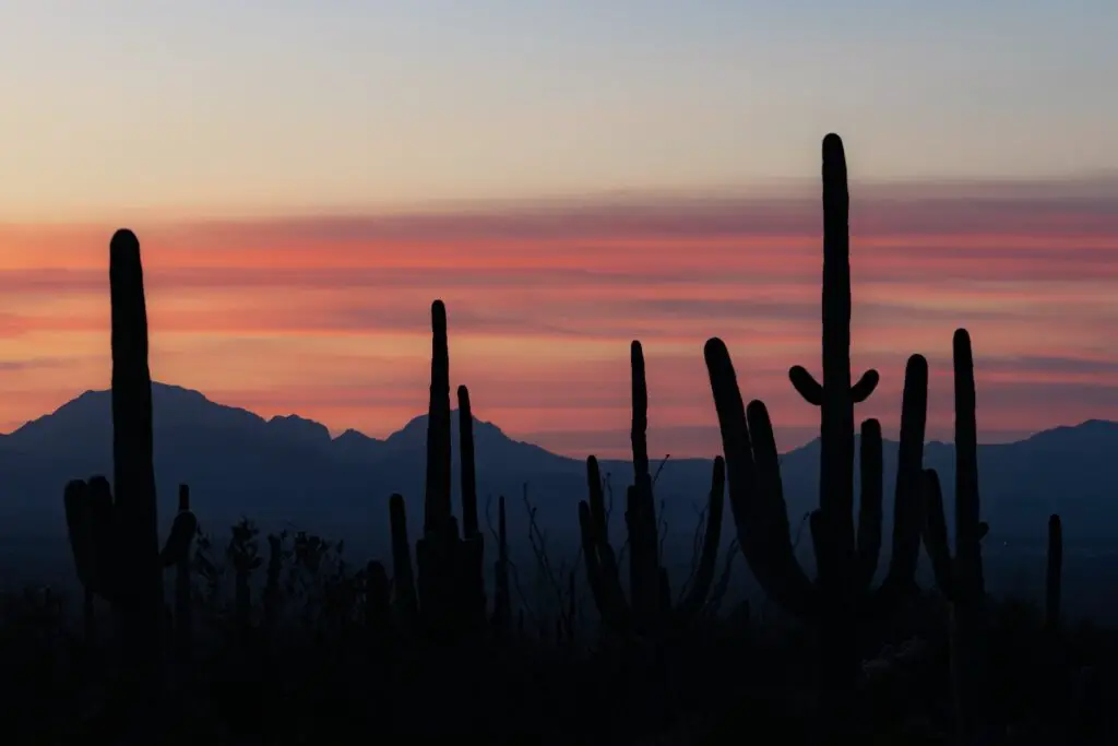
LOST DUTCHMAN STATE PARK(SUPERSTITION MOUNTAINS)
- Distance from Phoenix – 41 miles
- Driving duration – 45 minutes
- Average Hiking Distance – 1.5 miles to 6 miles(depending on the trails)
- Difficulty level – Easy to Moderate
- Parking – Available
Among the top places to watch the sunrise in Phoenix is Lost Dutchman State Park, at the base of the beautiful Superstition Mountains near Apache Junction and Gold Canyon.
An hour’s drive from Phoenix will take you to Lost Dutchman State Park in the Sonoran Desert, which got its name after the fabled lost gold mine.
Whether the tales of the treasure are true or not, the real gem at Lost Dutchman Park is the magnificent sunrises over the Superstition Mountain ranges.

An icon of the East Valley in the Phoenix Area, it is a paradise for outdoor lovers.
You can choose from the many trails that lead from the park into the Superstition Mountain Wilderness and surrounding Tonto National Forest.
Some popular routes include Flatiron via Siphon Draw(6.5 miles round trip), Massacre Falls Trail(5.5 miles out and back, which leads to Massacre Falls, one of the top waterfall hikes in Arizona) and Prospector’s View Trail(3.5 miles round trip).
Jacob’s Crosscut Trail is 11.5 miles out and back trail that will take you through diverse vegetation and gorgeous views of 4 Peaks Wilderness, Camelback Mountain and other landmarks.
Stop along the trails to admire the saguaros, desert wildflowers and any local wildlife.

You can enjoy the vibrant spectacles of sunrise on one of these many hiking trails scattered across the park or from the comfort of your campsite or cabin.
Hues of pink, yellow, blue and red cast a beautiful glow over the mountain range adorning the Sonoran Desert with magical touches of the dawn.
If you are keen on a hassle-free experience, I highly recommend this Sunrise Sonoran Desert Hot Air Balloon Ride from Phoenix, one of the most popular tours and for a reason.
Start your hike early enough to capture the gorgeous views painted across the sky at sunrise in Phoenix.
The parking lot is located at the entrance of Lost Dutchman State Park.
MAP OF PLACES FOR SUNRISE IN PHOENIX
USEFUL TIPS TO WATCH SUNRISE IN PHOENIX
- Check the timings – Look for Phoenix sunrise time before you plan your sunrise hike as the time slightly varies depending on the season you are visiting Phoenix.
- Calculate time for hiking – Depending on your fitness levels and your speed, you may take more time than the average estimates provided. It is best to have an idea of how long you may need which allows you to time your sunrise hike in Phoenix correctly.
- Carry essentials – Great hiking shoes with a good grip, headlamps, jackets, water and snacks are a must irrespective of the hike.
- Stay hydrated – Although temperatures can be low if you’re heading out before sunrise, once the sun is up, it quickly gets hot no matter which time of the year. Drink sufficient water to stay hydrated.
- Protecting from the sun – Going back, you will be exposed to the heat likely as most of the trails have minimal or no shaded areas. Carry sunscreen, a hat and sunglasses.
WHERE TO STAY IN PHOENIX?
POPULAR HOTELS AND APARTMENTS
Hyatt Place Phoenix/Downtown – Hyatt Place Phoenix/Downtown features accommodation with a fitness centre, private parking, a shared lounge and a restaurant.
It is one of the most popular hotels in Phoenix and given its location and excellent amenities, it is no surprise! Check out their rooms and the latest prices here.
Holiday Inn Express & Suites – Phoenix – Airport North, an IHG Hotel – Holiday Inn Express & Suites – Phoenix – Airport North, an IHG Hotel is another popular hotel loved by families and couples.
It provides accommodation with an outdoor swimming pool, free private parking, a fitness centre and a shared lounge. Check prices and more here.
Hampton Inn & Suites Phoenix Downtown – Hampton Inn & Suites Phoenix Downtown is a 3-star hotel with room service, a 24-hour front desk and free WiFi. Check prices here.
Fairfield Inn & Suites by Marriott Phoenix West/Tolleson – Fairfield Inn & Suites by Marriott Phoenix West/Tolleson is a gorgeous 3-star hotel that features accommodation with free bikes, free private parking, a fitness centre and a shared lounge. Check the prices here.
Drury Inn & Suites Phoenix Happy Valley – Drury Inn & Suites Phoenix Happy Valley, near the international airport, is one of the most popular hotels loved by families and couples for its location and excellent amenities. They also offer deals regularly. Check prices and room details here.
Home2 Suites By Hilton Phoenix Airport North, AZ, provides accommodation with an outdoor swimming pool, free private parking, a fitness centre and a shared lounge. Check more details here.
LUXURY HOTELS AND APARTMENTS
Royal Palms Resort and Spa, part of Hyatt – Experience world-class service at Royal Palms Resort and Spa, part of Hyatt, between the prestigious area of Biltmore and Scottsdale city centre; the Royal Palms Resort & Spa, part of Hyatt is a beautiful hideaway resort. Check prices and deals here.
AC Hotel Phoenix Biltmore – AC Hotel Phoenix Biltmore offers excellent accommodation with an outdoor swimming pool, free private parking, a fitness centre and a shared lounge. Check prices and deals here.
Arizona Biltmore A Waldorf Astoria Resort – Situated on 39 acres of lush gardens, Arizona Biltmore A Waldorf Astoria Resort resort and spa offers a peaceful oasis, complete with exceptional on-site facilities, including 8 pools, along with first-class accommodations and amenities.
Each room offers a flat-screen cable TV and a private bathroom. Select rooms have a patio or balcony or a full kitchen. Check prices here.
Embassy Suites by Hilton Phoenix Downtown North – Featuring an atrium, an indoor pool and a restaurant, Embassy Suites by Hilton Phoenix Downtown North offers accommodation in the city centre of Phoenix. Check reviews, prices and best deals here.
JW Marriott Phoenix Desert Ridge Resort & Spa – Located in the centre of the Sonoran Desert, JW Marriott Phoenix Desert Ridge Resort & Spa boasts 2 golf courses, spacious seating areas, multiple swimming pools and waterslides.
The Desert Ridge Resort also boasts a spa with a lap pool and a fitness centre. Check this guide here.
The Westin Phoenix Downtown – Located at Arizona State University’s downtown campus, this eco-friendly hotel is a 10-minute walk to the US Airways Center. It features on-site dining, an outdoor pool and a gym. Check the prices here