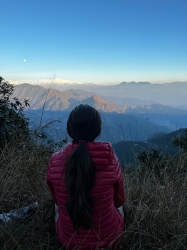
She created Wander In Arizona to share first-hand information about traveling to the many fantastic cities, trails, national parks, monuments and more as she continues to explore.
Payson hiking trails offer the best chance to experience outdoors with your kids and pets as there are plenty of hiking trails in Payson Az suitable for all age levels.
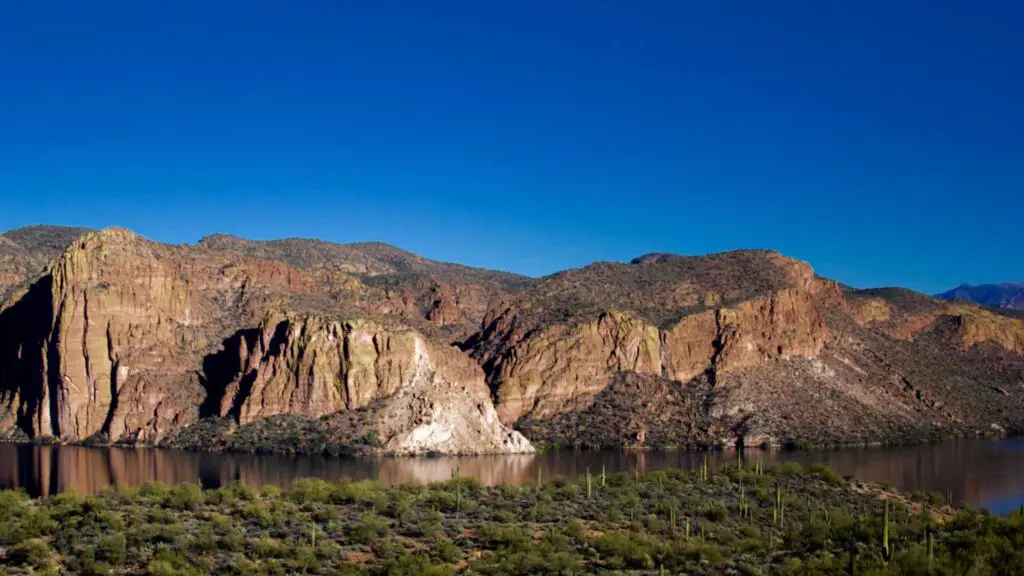
Hiking in Payson means you will be rewarded with gorgeous views of the canyons, swim in the beautiful creeks, witness the thunderous waterfalls, dive into crystal-clear turquoise-coloured pools, and have a fantastic time outdoors escaping the heat.
Being surrounded by the National Forest of Tonto means you can plan these hikes spontaneously at any time of the year whenever you feel like taking in the fresh breeze or want to cool off in the creeks.
This list of the best hikes in Payson Az has something for everyone, and some of these also are ideal for mountain biking.
Whether you’re getting ready to hike, bike, trail run, or simply have an incredible time with your family, this guide will help you choose from the best hiking trails in Payson, including Payson hiking trails with water, and the best hikes near Payson.
Planning a trip to Payson? check this complete guide to the list of Payson things to do on a weekend getaway.
Check out our post on the Best Cabin Rentals in Payson for fantastic and romantic cabin stays while exploring the town.
BEST PAYSON HIKING TRAILS
HORTON CREEK
- Location – Payson
- Distance – 4.3 miles one way
- Difficulty – Difficult
- Duration – 5 to 6 hours
- Elevation – 750 ft
- Type – Out-and-back
- Dog-Friendly – Yes
- Kid-Friendly – No
- Parking – Tonto Creek campground
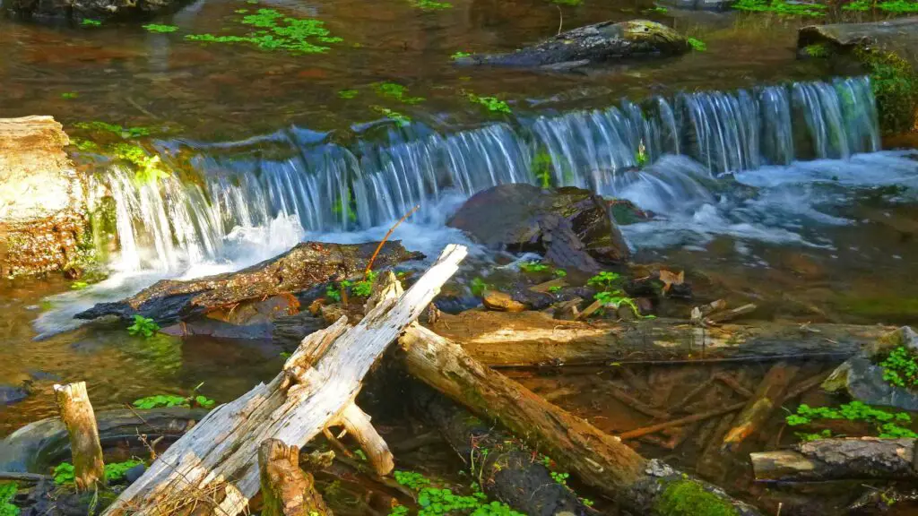
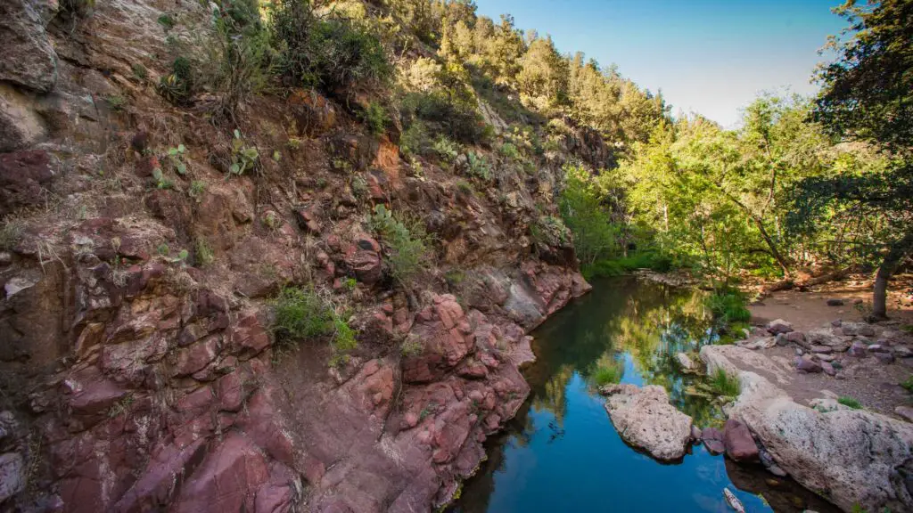
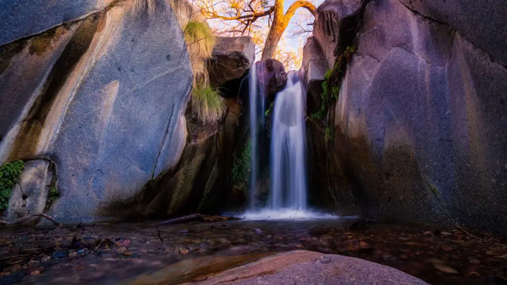
If you are traveling to Payson or looking for day trips from Flagstaff or Phoenix involving waterfalls, one of the best waterfall hikes in Arizona recommended for you is Horton Creek.
Located in the Mogollon Rim area, about 20 miles away from the town, it is one of the most popular Payson hiking trails.
Also, this is a very popular area for backpacking, camping, and on this trail, you will be rewarded with pretty Horton Springs and a few mini waterfalls.
It is one of the best picnic spots ideal for swimming thanks to its close location to the springs and the many smaller pools.
This waterfall hike starts from parking at Upper Tonto Creek, home to a campground with a trailhead on the left.
Once you begin the hike from the parking lot, the trail heads gradually up along Horton Creek, with many waterfalls, surrounded by magnificent pine stands.
You have many spots to jump into the pools or sunbathe and picnic on the trail.
Once you are at the trail’s end, you will reach the views of the stunning crystal-clear waters of Horton Springs, perfect for swimming to escape from the Arizona heat.
The last mile of the stretch involves a slight climb past Horton Springs into rim country
BEST TIME TO VISIT
The best times to visit Horton Creek trail are May through October when the water levels in the creek and springs rise after rains.
BARNHARDT TRAIL
- Location – Payson
- Distance – 6 miles one way
- Difficulty – Moderate/Difficult
- Duration – 5 to 6 hours
- Elevation – 300 ft
- Type – Out-and-back
- Dog-Friendly – No
- Parking – Yes
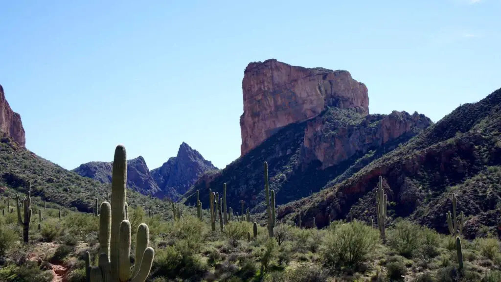
Considered the most challenging among Payson hiking trails, the Barnhardt trail is one of the adventurous hikes that will reward you with some of the fascinating panoramas in Gila Country.
This trail, considered an expressway since it connects with many other trails, starts in the Barnhardt Canyon along a creek.
Depending on the season you hike, you will pass through gorgeous waterfalls and cascades. It involves crossing boulders, wading through creeks, and climbing up steep hills, all of which make the trail challenging.
Although it is suitable for pets, I would not recommend it as it is strenuous given all the varying landscapes and the challenges with them.
The first three miles offer the best views and are mostly shaded, while the last part of the trail gets challenging not only because of the unpaved rough path but also because it is completely exposed with no shade.
Wear good hiking shoes, sunscreen, hat, and carry lots of water as it gets hot and causes dehydration easily.
BOULDERS LOOP TRAIL
- Location – Payson
- Distance – 1.4 miles one way
- Difficulty – Moderate/Difficult
- Duration – 2 to 4 hours
- Type – Out-and-back
- Dog-Friendly – Yes
- Kid-Friendly – Yes
- Parking – Yes
If you want to up the difficulty level of your trek, Boulders Loop Trail is one of the best Payson hiking trails.
It is considered one of the most beautiful trails in Arizona and is known for magnificent views of gigantic boulders, washes, hilly rocks and landscapes varying at every other turn.
No wonder it is one of the hotspots among outdoor enthusiasts, including mountain bikers and rock climbers thanks to its difficult hills, washes, and canyons.
You can either do a part of the trail, about 1.5 miles one way approximately or do the entire 5-mile loop trail if you are game for an adventurous hike in Payson.
There are two ways to access this trail, one-off Phoenix Street, or the more popular route via the Cypress trail
If you start from the Cypress trailhead, it is much easier as the path is more or less flat. About 2 miles into the trail, you will reach after passing through a series of canyons, fantastic views of the Boulders and washes.
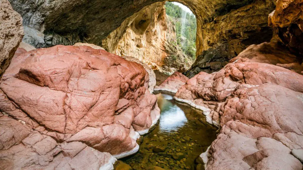
TONTO NATURAL BRIDGE STATE PARK
- Location – Payson
- Distance – 0.4 miles one way
- Difficulty – Easy
- Duration – 1 to 2 hours
- Type – Out-and-back
- Dog-Friendly – Yes
- Kid-Friendly – Yes
One of the top attractions in Payson among outdoor lovers, Tonto Natural Bridge State Park is home to a few stunning swimming holes in Arizona.
Tonto Natural Bridge is the largest natural travertine bridge in the world at 183 feet high over a 400-foot long tunnel that measures 150 feet at its widest point.
Located right off the highway, Tonto Natural Bridge is a fantastic stop for a quick hike leading you to a cave, a pretty waterfall and a swimming pool, ideal for a picnic day.
There are viewing platforms, picnic tables and a few shaded spots to enjoy a day trip.
Gowan Trail, a 0.4-mile heavily trafficked out-and-back trail, is the most popular trail in Tonto Natural Bridge State Park.
This route starts with a short out-and-back on the waterfall trail, taking you to a waterfall along Pine Creek offering spectacular views of the Tonto National Bridge, the cave, and the waters on the way that you can view from the observation deck.
After taking in the fantastic views, return up the Gowan Trail to get to the parking lot. This is the easiest and the direct trail to the bridge, and hence gets crowded during peak seasons. The trail is accessible year-round and is one of the photo spots near Payson.
DOLL BABY TRAIL(SPANISH RUINS)
- Location – Payson
- Distance – 1.4 miles one way
- Difficulty – Easy
- Duration – 2 to 3 hours
- Elevation – 150 ft
- Type – Out-and-back
- Dog-Friendly – Yes
- Kid-Friendly – Yes
One of the unique Payson hiking trails is Doll Baby Ranch trail leading to Spanish Ruins, a large ancient Native American village ruin site that includes many rooms and extensive walls.
It offers stunning views of Snowy mountains, vibrant wildlfowers, and creeks after spring, the best time to do this hike after snow melt.
It is one of the underrated hiking trails in Payson with fewer crowds, and if you want to go off the beaten path, this easy to moderate trail is the perfect choice.
The rocky terrain that can get slippery and going up the cliffs in certain sections make this trail slightly challenging to some, but most people can easily do this as the path is well-defined and easy to follow through a rugged forest service road up to the cliffs.
Continuing on this trail, you will pass through boulders reaching the top of the mesa. Stop here and take in the spectacular mountain views before following the signs leading to Spanish ruins and a cave.
As mentioned, note that some sections can be slippery, especially right after snow or rain, so wear good hiking shoes with proper grip.
MILITARY SINKHOLE TRAIL
- Location – Payson
- Distance – 5 miles round trip
- Difficulty – Difficult
- Duration – 5 to 7 hours
- Elevation – 900 ft
- Type – Out-and-back
- Dog-Friendly – No
- Kid-Friendly – No
Although it is marked as an easy-to-moderate hike in Alltrails, Military Sinkhole Trail is one of the most difficult Payson hiking trails.
It can feel challenging despite being fit and moderately experienced, and partly this is due to the steep trail.
But it is probably one of the best trails for enjoying the most beautiful views of the Payson near Forest Lakes, and you will be treated to spectacular views of the wildflowers, wildlife, and wilderness along the Mogollon Rim.
If you are a seasoned hiker or someone looking for an adventure, Military Sinkhole Trail is your best choice. Despite the climb, it is worth doing as the trail is very well-maintained and marked throughout.
Also, you will be in shaded areas for the most part treated to stunning wildflowers, which is a respite.
SEE CANYON TRAIL
- Location – Payson
- Distance – 7.5 miles one way
- Difficulty – Easy
- Duration – 2 to 3 hours
- Elevation – 1500 ft
- Type – Out-and-back
- Dog-Friendly – Yes
- Kid-Friendly – Yes
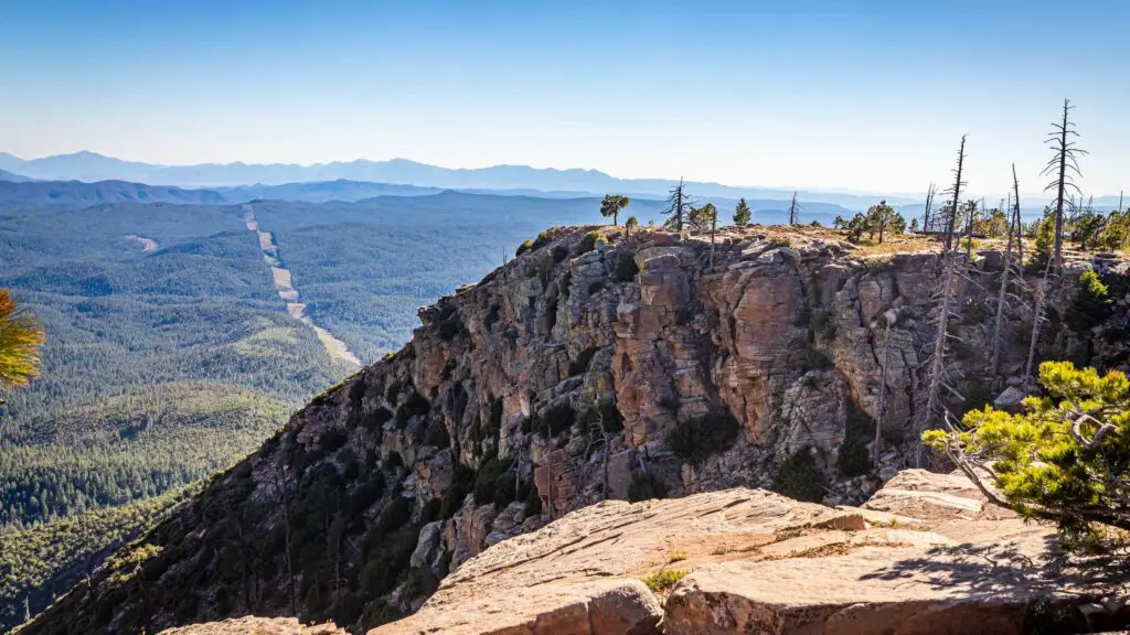
One of the most popular Payson hiking trails for spectacular views of fall foliage along the Mogollon Rim,
See Canyon Trail is an 8-mile moderately trafficked out-and-back trail.
The trail is relatively easy and offers stunning views of the lush Ponderosa Pine forest filled with ferns all along. Only the last section of the trail involves a steep climb, gaining an elevation of over 1000 feet, which some may find slightly challenging.
You can also take the fork leading to the pretty See Springs on the way, especially if you are here after the snow melts in spring when you can also witness colourful wildflowers.
You will also cross many creeks during spring and for the most part, you will follow along a clear mountain stream of Christopher Creek.
After passing through this beautiful trail that is sometimes rocky, you will reach the top of the Mogollon Rim. through the lush green forest to the top of the Mogollon Rim.
MORE BEAUTIFUL PAYSON HIKING TRAILS
WATER WHEELS FALLS
- Location – Payson
- Distance – 1.8 miles one way
- Difficulty – Easy
- Duration – 3 to 4 hours
- Elevation – 150 ft
- Type – Out-and-back
- Dog-Friendly – Yes
- Kid-Friendly – Yes
- Permit – $6 per person
- Parking – Yes
One of the most popular Payson hiking trails with kids and pets is Water Wheel falls located near Payson, tucked between Payson, Arizona and the base of the Mogollon Rim.
It is one of the best options for beginner hikers as well, thanks to the short distance and easily accessible trail.
You can enjoy a nice swim at the waterfalls and the swimming holes on this hike or picnic with your kids, soaking in the fantastic views around you as crystal-clear mountain water pours from the East Verde River, creating deep gorges and dramatic waterfalls.

Since the entire trail runs the length of the river, you have the options to sunbathe, picnic, swim and relax at many places before making it to the waterfalls.
The waterfall hike starts from the Houston Mesa Road parking lot. In a short while, you will pass through the East Verde River on your right, amidst boulders.
About 0.25 miles into the trail, you’ll get your first chance to dip into the chilly water of Ellison Creek.
You can stop by and picnic or continue your hike to encounter huge granite boulders, soon after which the small creek turns into a beautiful turquoise river.
You only have to go on this trail for about half a mile past these boulders to arrive at the roaring waters of Water Wheel Falls.
If you are looking for a longer walk, continue on the trail to the Bridal Veil Falls, another among the list of the best waterfalls in Arizona.
If you want to avoid crowds, weekdays are the best days to enjoy picnics here.
BEST TIME TO VISIT
Spring, summer and Falls are the best months to visit Water Wheel Falls, but it is best to avoid monsoons since the area is frequently prone to flash floods.
Ensure to check the forecast before heading out on the trail to avoid dangerous conditions.
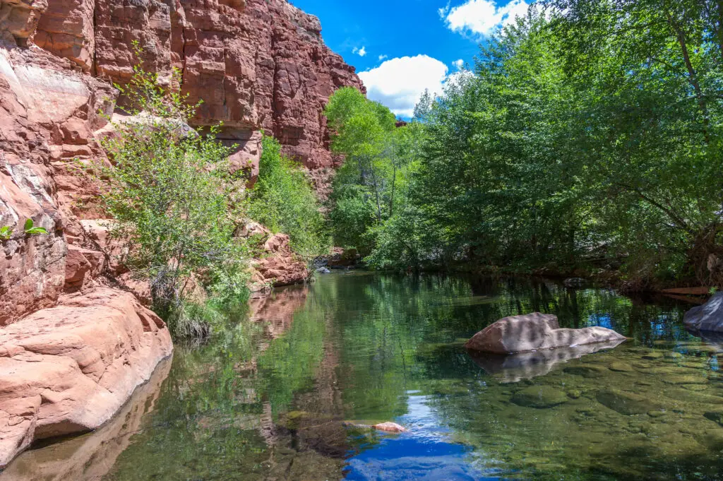
ELLISON CREEK
- Location – Payson
- Distance – 1.4 miles one way
- Difficulty – Easy
- Duration – 2 to 3 hours
- Elevation – 150 ft
- Type – Out-and-back
- Dog-Friendly – Yes
- Kid-Friendly – Yes
- Permit – $6 per person
- Parking – Yes
If you are visiting Water Wheel Falls, add another easy trail to Ellison Creek Cascades, one of the comfortable Payson hiking trails to visit with kids nestling between the Mogollon Rim and the town.
This short and easy hike is suitable for all ages and levels and is a fun trail leading to beautiful waterfalls views.
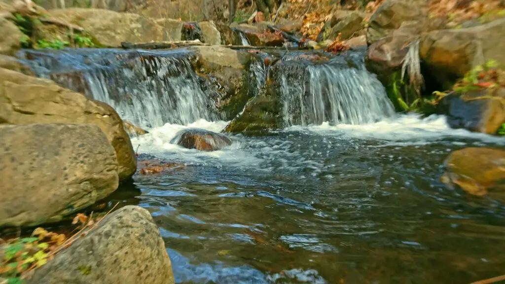
The trailhead lies at a parking lot on Houston Mesa Road, with restrooms available. In a short while, you will pass through the East Verde River on your right amidst boulders.
This out-and-back hike leading to Ellison Creek Waterfall is over two miles and moderately complex due to some wash crossings, loose rocks and slippery sections, best tackled with good hiking shoes and water shoes.
About 0.25 miles into the trail, you’ll get your first chance to dip into the chilly water of Ellison Creek.
Take care while stepping on rocks that can be slippery, and check the water levels that vary according to the seasons.
You will be rewarded with the sights of a stunning waterfall plunging from 3650 feet to form a pretty pool amidst the rocks.
Some points offer perfect spots for diving into the waters. Lounge, sunbathe, relax, and enjoy a picnic lunch with your family, admiring the views of the pool and the waterfalls.
You can bring your pets on a leash on this trail and fish for trout.
Due to its popularity, expect crowds if you go during the summer months, especially during the weekends and crowds.
Continue your hike to encounter huge granite boulders, soon after which the small creek turns into a beautiful turquoise river.
RAILROAD TUNNEL TRAIL
If you love hiking, add the hike along the Railroad Tunnel Trail to your hikes in Payson Az that will take you through the wilderness secluded from any signs of civilization.
Also, as the name suggests, you will stumble upon many rail lines on this trail, including a railroad track that connected Las Vegas, Boulder City, and Hoover Dam bordering Nevada.
This trail was formed in the 1880s when a tunnel was excavated by the Arizona Mineral Belt Railroad through the Mogollon Rim to allow ore transport, but it had to be stopped.
This abandoned tunnel in the 19th century turned into a secluded spot for hikers as it offers fantastic views of the Mogollon Rim along the way.
Also, the Historic Railroad Trail offers splendid views of both Hoover Dam and Lake Mead, Arizona’s largest artificial reservoir.
One of the best ways to access the Railroad Tunnel Trail is via the Colonel Devin Trail, which is about a mile long, but steeper and packed with loose rocks and gravel.
Hence it is recommended to wear hiking shoes with great grip and comfortable clothes on this Payson hike.
WOODS CANYON LAKE TRAIL
- Location – Payson
- Distance – 2.5 miles one way
- Difficulty – Easy
- Duration – 2 to 3 hours
- Type – Out-and-back
- Dog-Friendly – Yes
- Kid-Friendly – Yes
- Parking – Yes
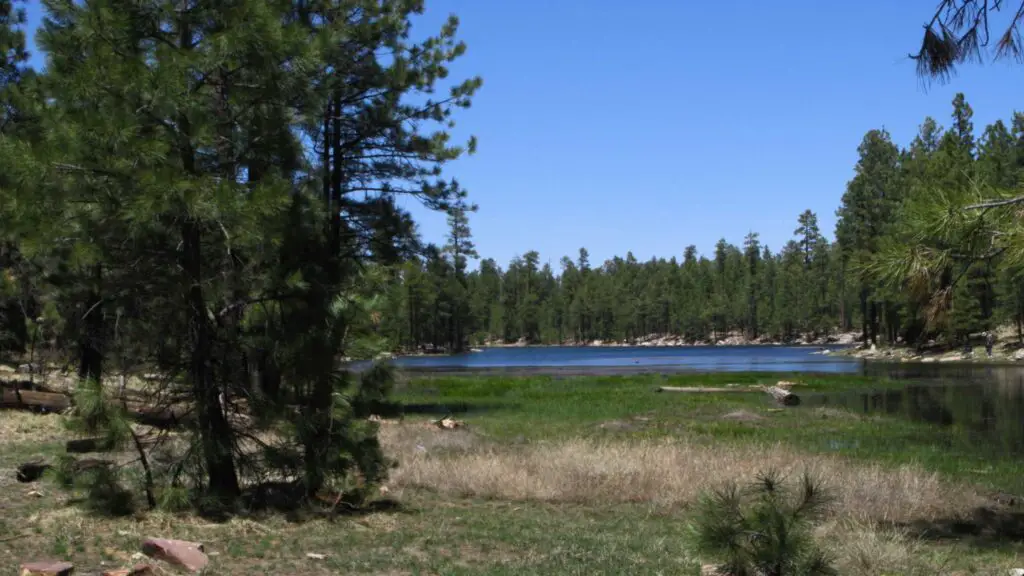
Woods Canyon Lake is one of the most popular recreation areas in Arizona.
One of the best lakes in Payson, Woods Canyon Lake is one of the Rim Lakes on the Mogollon Rim, easily accessible within an hour from the town.
Woods Canyon Lake is very popular among families visiting in large numbers during summer thanks to the fun activities you can enjoy, from kayaking to boating and everything in between.
Woods Canyon Lake is seasonal and only open to visitors between April and October, with the winter months freezing the waters.
There are options for launching ramps, boat rentals, five campgrounds, and plenty of short and long trails near the lake.
The lake is stocked with rainbow, brown, Skamania, and tiger trout from April through September.
Enjoy boating, rent kayaks, SUP, or canoes, or simply swim in the waters to cool off.
Since it gets very crowded during peak months, it is best to arrive early for better access.
HOW TO REACH?
Woods Canyon Lake Trail is a 2.8-mile easy hike trail popular for bird watching as you will see eagles, osprey, and herons, and stunning views of the Rim before arriving at the lake.
This trail is the only way to access the lake if you are visiting in winter between November and March as the road is closed in the coldest winter months.
WILLOW SPRINGS LAKE TRAIL
- Location – Payson
- Distance – 2.7 miles one way
- Difficulty – Easy
- Duration – 3 to 4 hours
- Type – Out-and-back
- Dog-Friendly – Yes
- Kid-Friendly – Yes
- Parking – Yes
Willow Springs Lake, located near Woods Canyon Lake, is the closest lake to the town and one of the most popular lakes in Payson among locals and tourists alike.
Located on the Mogollon Rim and a part of the Rim Lakes, about a mile from the town, Willow Springs is a famous lake for fishing in summer when it gets crowded, and it is larger, making it a better habitat for rainbow and tiger trout.
Apart from these, Willow Springs Lake is also famous for largemouth bass, green sunfish, and smallmouth bass, and unlike the Woods Canyon, you can also access Willow Springs during winter months to enjoy ice fishing.
You can rent a boat, kayak or canoe in the many nearby shops, although there is a limit to boating as only small engines and electric ones are permitted.
HOW TO REACH?
Willow Springs Lake Trail is an easy 5.7-mile loop trail following the lake’s perimeter, taking you through stunning forests of Ponderosa pines overlooking beautiful views of the lake.
FOSSIL SPRINGS TRAIL
- Location – Payson/Camp Verde
- Distance – 1 mile one way
- Difficulty – Difficult
- Duration – 2 to 3 hours
- Elevation – 250 ft
- Type – Out-and-back
- Dog-Friendly – Yes
- Kid-Friendly – Yes
- Permit – Yes, $10 per person
- Parking – Available at the trailhead
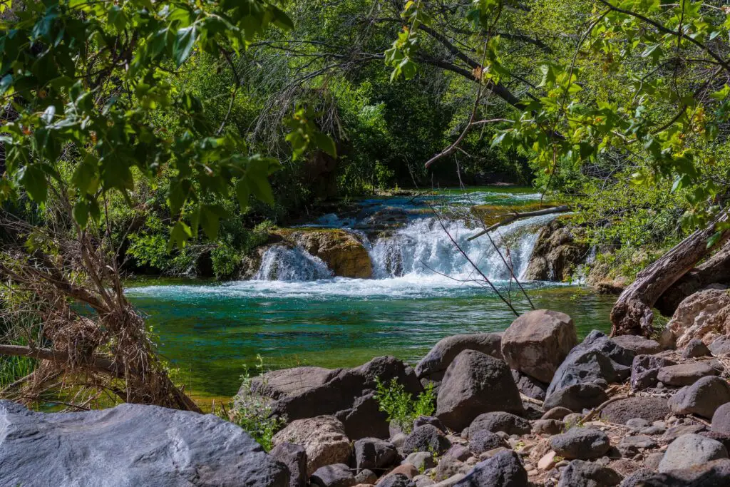
Fossil Creek Falls is one of the most famous waterfall hikes in Arizona, plunging from about 25 feet and also a lot wider than many waterfalls, forming a stunning turquoise pool below, one of the best swimming holes in Arizona.
Located along the northern part of the rugged Mazatzal Mountains, this remote area is one of the largest wilderness areas in the state.
It is an excellent half-day trip that you can easily add making it one of the most adventurous Payson hiking trails, as it is only 30 minutes away.
It is suitable for all levels, so if you are traveling with kids, this is one of the recommended swimming holes in Arizona worth adding to your itinerary. Bring snacks and water, and look out for rattlesnakes on your hike.
To get to the trailhead, drive for about 21 miles down Fossil Creek Road, and most of the route is unpaved. You must pay a $10 fee to enter Fossil Creek, allowing parking space at the trailhead.
If you love adventure, you will love your visit to Fossil Creek falls, as you can enjoy diving from the edge of the cliff 25 feet high to the pool below.
But check the water levels before plunging as sometimes the currents can be strong and deeper in some places.
The journey to the waterfall is a beautiful one-mile-long hike amidst the stunning Fossil Creek in the Fossil Creek Wilderness area, which boasts abundant lush forests, and rich wildlife, especially many birds.
There are several swimming spots and campsites on the way to the waterfalls. Stop by and swim in the pools or picnic on your hike.
After reaching the falls, you can swim at the beautiful pool, admire the beautiful landscapes and relax.
You can also walk, sit behind the waterfall, and even snorkel to see the fish in the water. You can enjoy floating, and kayaking.
GOING FURTHER
You can also access the waterfall following the path along the creek, which is more adventurous if you want to explore more, head to Fossil Springs, the source of Fossil Creek waterfalls.
The hike to Fossil Creek springs is a moderate trek with an elevation gain of about 4 miles one-way, and a permit is required.
HOW TO REACH?
Take the I-17 north out of Phoenix to the 260 East. After 10 miles, you’ll see forest road 708 leading to the trailhead.
BEST TIME TO VISIT
Fossil Creek Falls is worth visiting throughout the year. Spring and summer are the popular months, so if you plan to go during these seasons, it is best to secure your permits in advance.
GOOD TO KNOW
Fossil Creek Waterfall and the surrounding area are open to the public from April to October and are available solely for day use with a reserved permit.
The permits sell out very early, especially on the weekends, so be sure to get your permit soon. You can get your permits online here, issued one month before the arrival date.
The permit is for day use only, and no camping is allowed. No fees or permits are required if you are visiting during Fall and Winter.
BEAR CANYON LAKE TRAIL
- Location – Payson
- Distance – 1.7 miles one way
- Difficulty – Easy/Moderate
- Duration – 2 to 3 hours
- Elevation – 150 ft
- Type – Out-and-back
- Dog-Friendly – Yes
- Kid-Friendly – Yes
- Parking – Yes
Located northeast of the town is one of the pretty lakes near Payson, Bear Canyon Lake is one of the beautiful lakes at the end of a spectacular drive for about 45 miles through fantastic forested mountains.
There are many lookout points for you to enjoy some stunning views from the edge while driving in Mogollon Rim country to the lake.
Located in the Apache Sitegreaves National Forest, Bear Canyon Lake is not easy to access among the Payson lakes. You must drive on the gravel road FR 300 to arrive at the lake.
But its secluded location makes Bear Canyon Lake appealing as it has retained its wilderness, surrounded by towering forests of Ponderosa Pine and Douglas firs.
Spring is my favourite time as the forest floors are blanketed with vibrant violets, wild roses, lilies, and wild strawberries.
If you are looking for a scenic afternoon swim, Bear Canyon Lake is the perfect location.
Swimming is very popular during the summer months when the crowds swell.
Only electric boats are permitted, but you can enjoy fishing for trout, another favourite summer activity, as the 60-acre, 50 feet lake is stocked about once a month from April through September, with a bag limit of 6 trout and Arizona fishing license laws being applied.
Enjoy a picnic lunch, or swim in the stunning blue waters against the backdrop of aspen trees, tall green pines and blue spruce trees to beat Arizona heat.
Note that camping is basic, with no drinking water or tables or trash facilities. There is no entry or camping fee.
HOW TO REACH?
Bear Canyon Lake Shoreline Trail is an easy 3.5-mile loop around Bear Canyon Lake with forks leading inland at some places. You can start from the west shore and end at the dam at the crossroads.
For rugged wilderness and more beautiful views, I recommend taking the east shore trail, also a popular fishermen’s path.