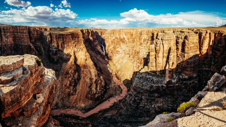
She created Wander In Arizona to share first-hand information about traveling to the many fantastic cities, trails, national parks, monuments and more as she continues to explore.
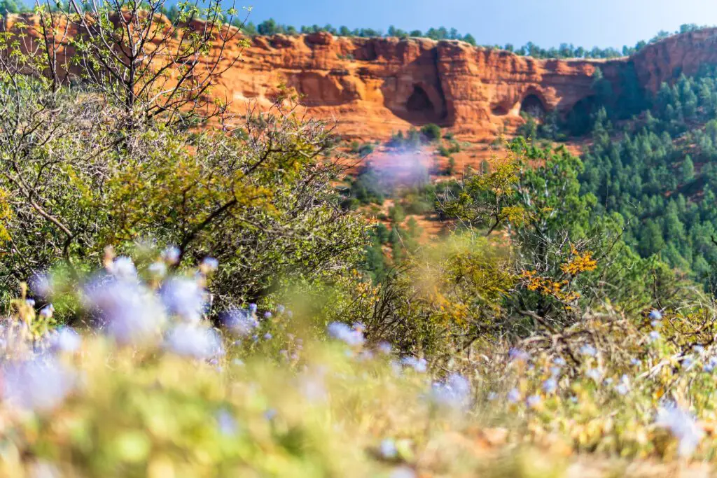
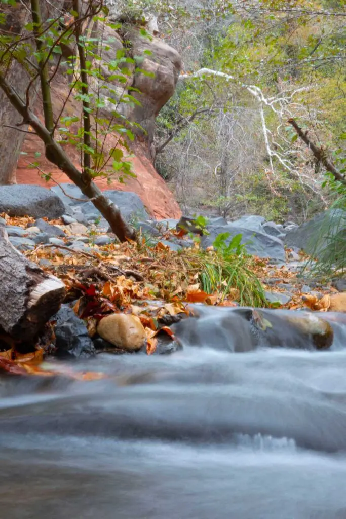
There are many fantastic waterfalls in Sedona Az worth exploring when you are in the city after you have had your fill of vortex, fascinating Sedona caves, buttes and Mesa.
Especially during the hotter months, the waterfalls and Sedona rivers offer the perfect respite.
While waterfalls and lakes may not be the first thing you can think of in Sedona, only a few know that spectacular waterfalls in Sedona AZ wait to be discovered, especially right after the snowmelt.
Scored of turquoise waterfalls and crystal-clear swimming holes, lie tucked away surrounded by the grandest red rock landscapes.
Whether you love chasing waterfalls just because, or want some respite from the hot Arizona sun to swim, cool off, admire splendid forested landscapes or enjoy picnic lunches, in this post, we cover the most beautiful waterfalls in Sedona AZ.
For more summer adventures, check out our guide to 30 Arizona’s best waterfall hikes and the list of 25 best beaches in Arizona.
If you wish to explore the many other swimming holes in the copper state, check out this guide to the best Arizona swimming holes.
OTHER RECOMMENDED HIKING TRAILS IN SEDONA FOR YOU
Hiking the Doe Mountain Trail – A Total Guide
A Complete Guide to Hiking the Birthing Cave Sedona
What You Need To Know To Hike The Fay Canyon Trail
A Total Guide To Hiking The Subway Cave(Boynton Cave)
Why the Cathedral Rock Hike Must Be On Your Bucket List!
How To Hike The Keyhole Cave In Sedona
A Fun Day Trip To Seven Sacred Pools In Sedona
The Best Routes To Hike The Soldier’s Pass Cave In Sedona
A Complete Guide To Hiking The Baldwin Trail, Sedona
How To Easily Hike The Red Rock Crossing – A Fun Outdoor Adventure
8 Top Sedona Hot Springs To Unwind Amidst Gorgeous Landscapes
THINGS TO KNOW WHILE VISITING WATERFALLS IN SEDONA AZ
CHECK WEATHER FORECAST
Before starting your trip, one of the most important things to do to visit is to check the weather forecast.
Some of these waterfalls in Sedona Az are located around the slot canyons, prone to flooding during monsoon season, between mid-June through September.
A few miles away rainstorm creates a dangerous flash flood sweeping through slot canyons without warning.
CHECK THE DEPTHS AND THE CURRENT
Before getting into these waterfalls in Sedona Az, test the depths and check for the current water levels before planning a trip.
STAY HYDRATED
Arizona’s hard and unrelenting weather is not for everyone, especially since being outdoors can feel daunting as you can get dehydrated quickly.
Keep drinking lots and lots of water and make arrangements to carry enough for everyone.
CARRY ESSENTIALS
Bring plenty of towels, spare clothes, and any other clothes you need.
Dress for the weather and carry enough food and water, a first aid kit, and other outdoor essentials.
WEAR WATER SHOES
Carry a pair of hiking shoes and sandals, but do not miss water shoes, as they can be lifesavers while navigating through slippery and sharp rocks.
STICK TO THE TRAILS
Although you can venture around the waterfalls in Sedona to some distances, it is not suggested to wander off too further as there are no trails, and the ecosystem is fragile and sensitive.
Keep to the trails and look for markers when you go around the creeks and waterfalls, especially if you are here during the night.
PRACTICE LEAVING NO TRACE
Natural hot springs are one of the fragile areas in the environment, and as with anywhere outdoors, practice Leave No Trace principles, including cleaning up after yourself, staying in the designated trails, and not touching or harming the surrounding natural things in and around Sedona waterfalls.
If you are going to camp or picnic, make sure you dispose of waste properly.
There is no trash collection at many waterfalls and creeks, so ensure you take all trash.
BEST WATERFALLS IN SEDONA AZ
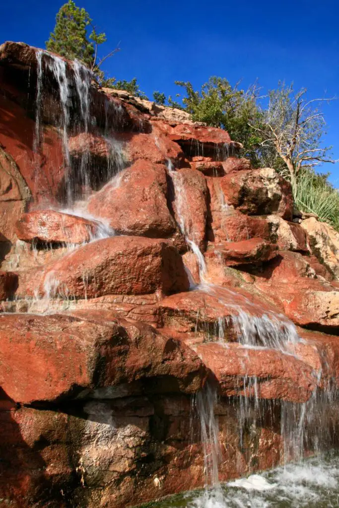
SEVEN SACRED POOLS
The Seven Sacred Pools Sedona is one of the popular stops for those hiking Soldiers Pass Trail or the nearby caves, and it is worth adding to your trip for many reasons.
The Seven Sacred Pools hike in Sedona is an easy hike appropriate for all skill levels, and undoubtedly one of the best waterfalls in Sedona Az
The trail is easy and flat, and it takes only 30 minutes if you plan to just visit the Seven Sacred Pools Sedona without exploring further on the trails.
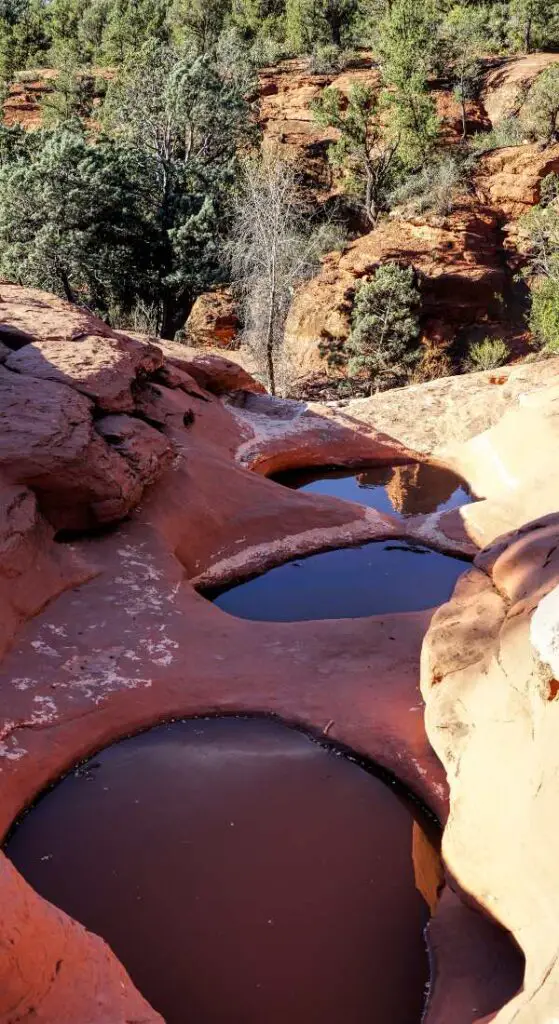
Located between the Oak Creek Mountains and Sedona’s arid desert in the Red Rock Secret Mountain Wilderness, these pools are essential both for human spirituality and for the needs of animals, who come to the pools to drink before venturing further into the dry surrounding landscape.
What makes the Seven Sacred Pools more special is its fantastic location amidst deep green juniper, agave and oak trees on one side and a series of towering red rock mountains and canyons.
It is one of the best family-friendly swimming holes near Sedona for a perfect day trip.
READ OUR COMPLETE GUIDE TO HIKING THE SEVEN SACRED POOLS HERE.
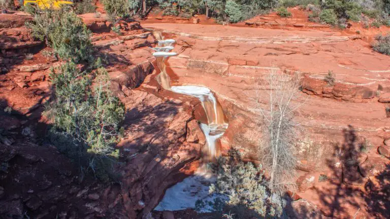
SLIDE ROCK
- Location – Slide Rock State Park
- Distance – 0.3 miles one way
- Difficulty – Easy
- Elevation – 100 ft
- Type – Out-and-back
- Dog-Friendly – Yes
- Kid-Friendly – Yes
- Permit – No
- Parking – Yes
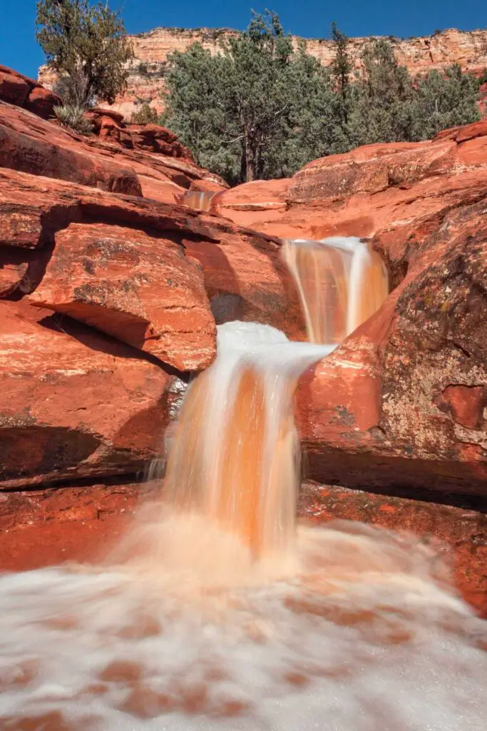
Although technically not a waterfall, Slide Rock is one the best waterfall hikes in Arizona for a quick relaxing getaway you can add as a side trip.
Slide Rock is a series of beautiful short cascades cut into the sandstone at Slide Rock State Park and is only about 15 minutes away from Sedona.
This stretches for about 80 feet and comprises many cascades of various sizes and shapes, ideal for sliding, as the name suggests.
Due to the deposition of algae on the rocks, Slide Rock forms a nature waterslide, allowing fun for adults and kids.
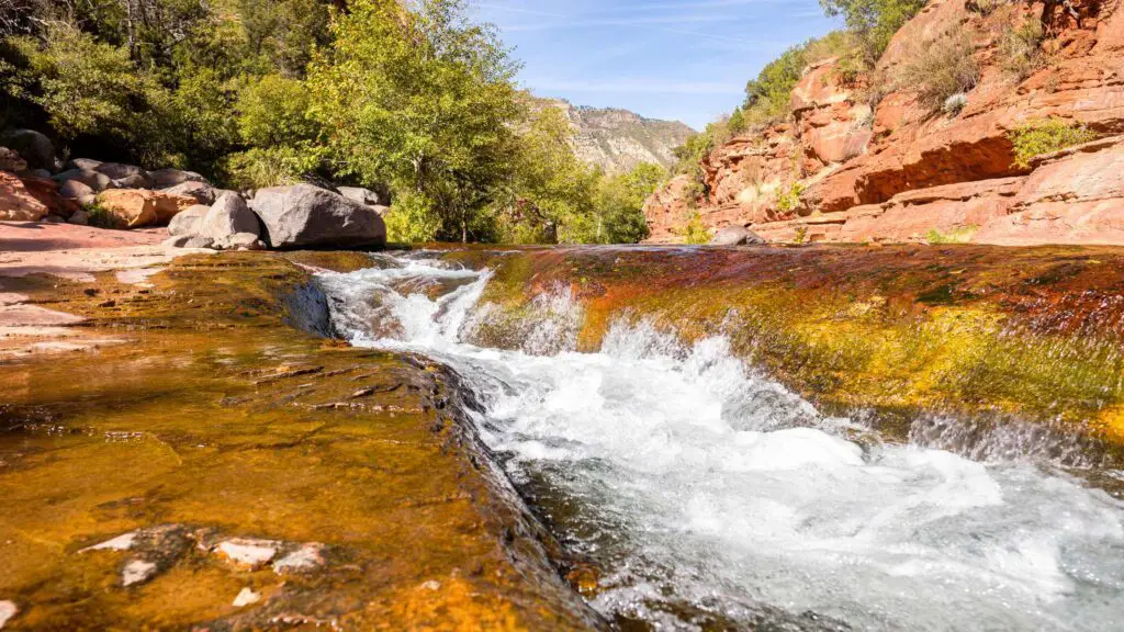
Plus, you can also enjoy swimming at the many holes along Oak Creek surrounding Slide Rock for about half a mile.
To reach Slide Rock, you have to only do the easy walk for about 0.3 miles from the trail.
You will start the hike at the historic apple-packing barn in Slide Rock State Park, home to hundreds of apples in the orchards along the creek, another attraction worth stopping by.
You will pass through old cabins and historical buildings before descending steps leading to the banks of Oak Creek, crossing a small bridge.
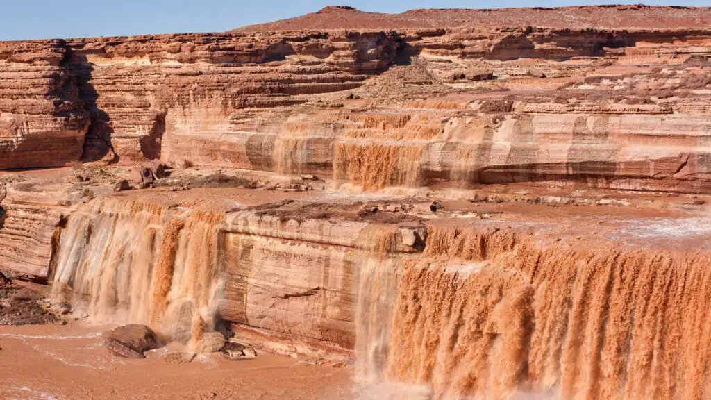
GRAND FALLS
- Location – Flagstaff
- Distance – 5 miles one way
- Difficulty – Moderate
- Elevation – 600 ft
- Type – Out-and-back
- Dog-Friendly – Yes
- Kid-Friendly – Yes
- Permit – Yes
- Parking – Yes
Also known as the chocolate waterfalls, Grand Falls located near Flagstaff is one of the best easy waterfall hikes in Arizona worth adding to your itinerary when you visit Flagstaff.
As the name indicates, Grand Falls, a part of the Navajo Nation, are grand indeed, plunging from 185 feet(higher than Niagara Falls) and forming many cascades as they widen to flow into the Colorado River.
Grand Falls is a volcanic waterfall formed by a vital flood area formed when lava from nearby Merriam Crater created a lava dam in the river’s original path, creating the waterfall.
You will need to get a permit from the Navajo Nation before you visit.
While the hike is short, the drive from Flagstaff will take about 1.5 hours one way since most of the drive will be on a dirt road, including a Little Colorado river crossing, with the best way to go being on a high-clearance vehicle.
BEST TIME TO VISIT
Unlike some Arizona waterfall hikes you can spontaneously plan, the flowing water is primarily dependent on snow melt or monsoon rain.
March and April are the best months to visit Grand Falls as they flow in full vigour due to snowmelt from earlier in the year.
GRASSHOPPER POINT
- Location – Coconino National Forest
- Distance – 0.2 miles one way
- Difficulty – Easy
- Elevation – 100 ft
- Type – Out-and-back
- Dog-Friendly – No
- Kid-Friendly – Yes
- Permit – No
- Parking – Yes, $9 per vehicle
If you want to avoid the crowds at Slide Rock State Park, head to Grasshopper Point, one of the best swimming holes in Arizona for families.
Located in Coconino National Forest, Grasshopper Point Swimming & Picnic Area downstream from Slide Rock at the base of a towering red-rock cliff features a vast clear pool amidst a landscape of gorgeous rock formations and greenery is a go-to, especially when in warmer weather.
Due to its size and calmness, this swimming hole is also perfect for tubing and floating.
You can often see people jumping off a large platform at 10 feet and one at 25 feet to the pool, but officials discourage cliff jumping at this spot because of varying depths and underwater hazards, so keep that in mind if you feel like diving.
Since there’s lots of shade around this pool, it’s easy to find a spot and spend several hours here enjoying your favourite book or picnic lunch in the shaded area.
Apart from swimming, you can also explore the many hiking trails and biking in Grasshopper point.
HOW TO REACH?
To get to Grasshopper Point, take highway 89A north out of Sedona, and after 2.5 miles, you’ll see the turnoff to the right to the entrance of Grasshopper Point on the right, after a large bridge.
There is a $9 parking fee to use the small parking lot, shaded picnic tables near the water, and there are bathrooms as well.
You can also reach this swimming hole on an early morning short hike down from Allen’s Bend Trail that follows Oak Creek and spend the rest of the day relaxing at Grasshopper point.
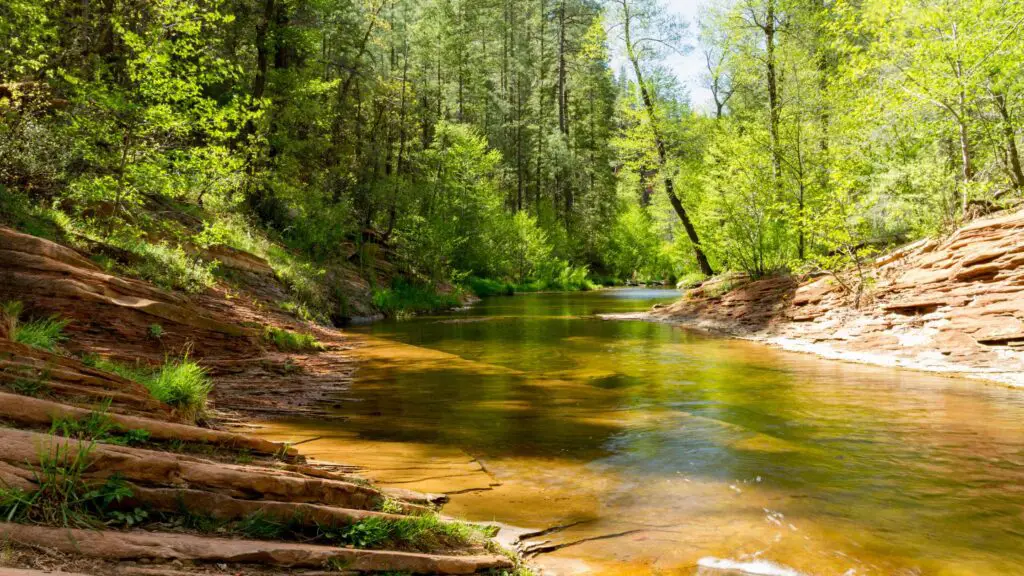
WEST FORK OAK CREEK TRAIL
If you are looking for a beautiful creek near Sedona, head on the West Fork Trail, one of the most popular hikes in Sedona, an easy trail ideal for beginners and people with kids.
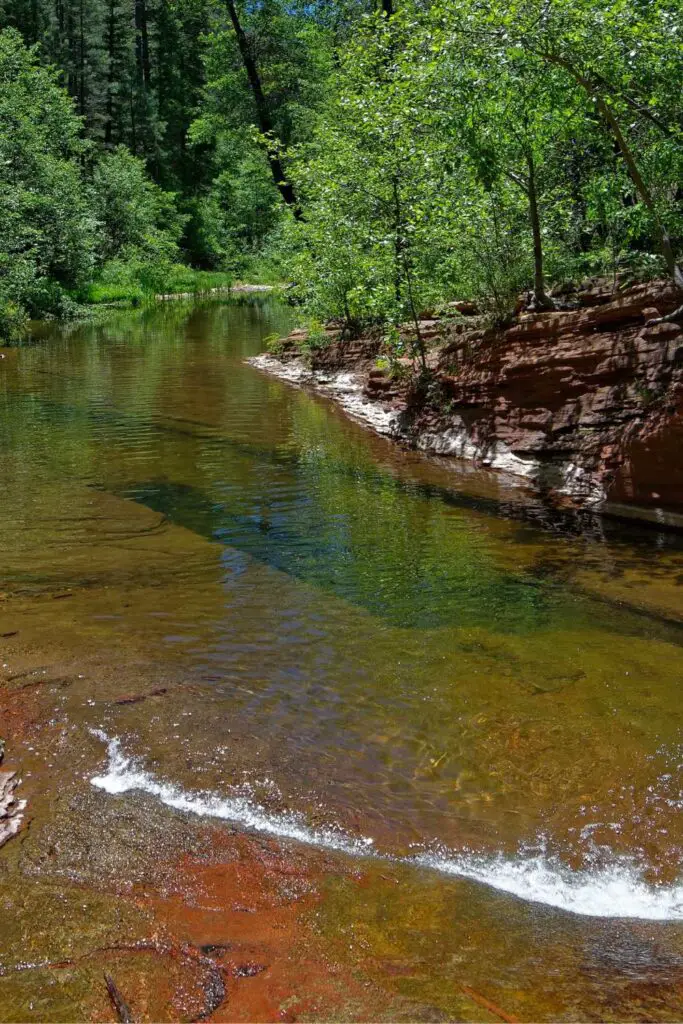
This trail, mainly on an easy, shaded path, leads you to the pretty Oak creek, Plus, you will cross its water every half mile or less, making it constantly refreshing and cool.
Depending on how far you want, you can continue along the river or camp for the day, enjoy a picnic, swim and float in the creek.
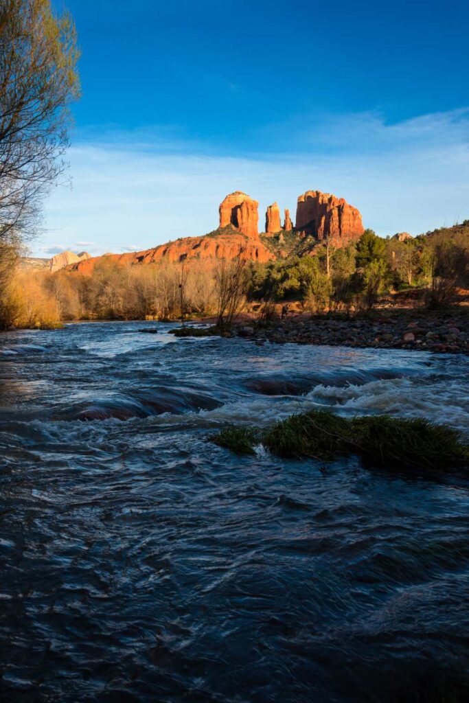
CATHEDRAL ROCK
- Distance – 2.5 miles round trip
- Type – Out and back
- Duration – 2 to 3 hours
- Trailhead – Cathedral Rock Trailhead
- Elevation Gain – 775 feet
- Hike Difficulty – Moderate
- Parking – Limited parking
- Best Time – Morning to afternoon
- Pass Required – Red Rock Pass or America the Beautiful Pass is needed
Cathedral Rock is located about four miles north of Sedona and takes 10 minutes to reach, and is one of the easily accessible waterfalls in Sedona AZ.
Although not a typical waterfall, you’ll have a large river flowing at many points, ideal for a swim or picnics.
After you leave Sedona, take Highway 179 past Oak Creek Village for about 3.5 miles, where you will reach the Back O’ Beyond Road.
Take a left here and keep heading for about a mile. You will reach the trailhead and it will be on your left.
There is overflow parking further down on Back O Beyond Road.
There are many intertwined trails, which lead to Cathedral Rock Sedona, so there is more than one way to access the trail that will lead to the summit.
All the trails listed above lead to a crossroads marking the beginning of the climb to the summit of Cathedral Rock.
You can access these trails from various parts of Sedona.
Also, the trailheads, which can be reached via different paths from Sedona, are located about 20 to 30 minutes from each other, and you need to take that journey time and work out the parking before you start the hike.
Depending on the season, your difficulty preference and the time of day, whether you plan to make it for the sunset or sunrise, below are the trails.
Read the complete guide to hiking Cathedral Rock, including alternate routes, here.
WET BEAVER CREEK, CAMP VERDE
- Distance – 6 miles round trip
- Type – Out and back
- Duration – 3 to 4 hours
- Hike Difficulty – Moderate
- Parking – Limited parking, $11 per vehicle
- Pass Required – No
One of the waterfalls in Sedona Az that recently became very popular due to Instagram is Wet Beaver Creek in Camp Verde.
It is located a few miles northeast of the Out of Africa Wildlife Park and Montezuma Castle National Park.
You can reach the crack on 3.5 miles one way on a hot and exposed Bell trail, and although the hike is rocky but pretty straightforward, it is best to start early and go on a weekday to avoid the crowds.
On warmer days, it is also best to leave early to avoid hiking during the peak of the daytime heat.
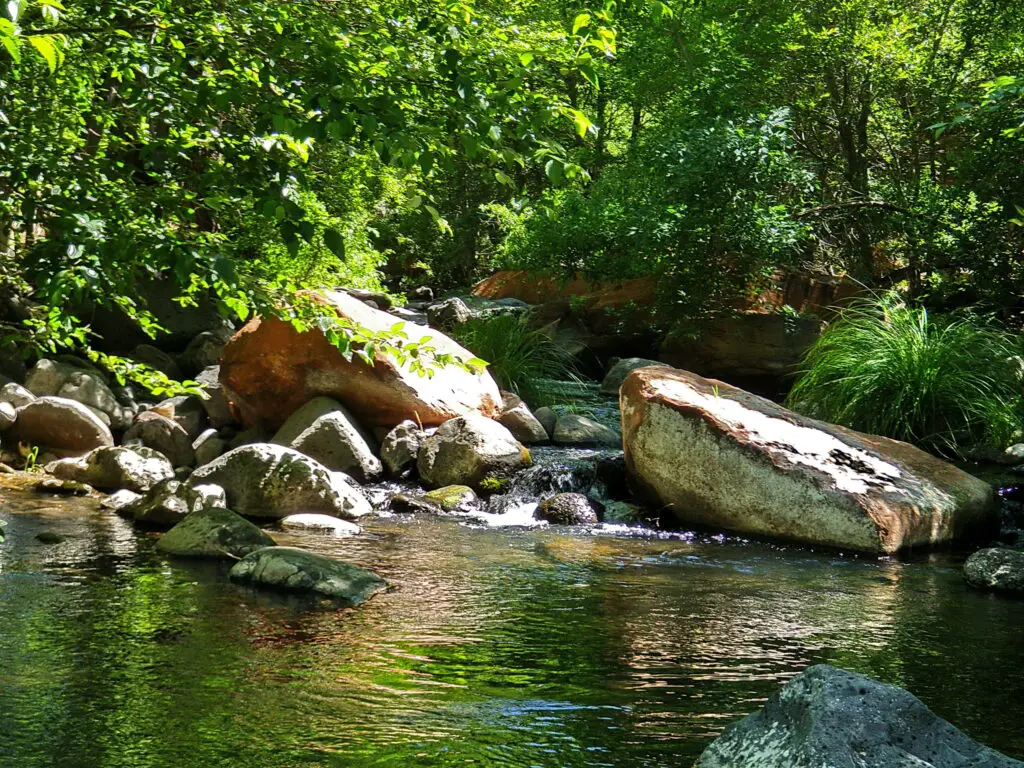
Depending on the season you are visiting, you will come across many smaller springs on the way to Wet Beaver Creek, beautifully surrounded by red rock formations.
There are many cliffs high enough to jump off into the deep pool.
No permit is needed to access this picnicking and day-use area near Wet Beaver Creek, accessible to locals and tourists.
The Crack divides the pools into the east and the west forming two pools with each having amenities.
Both picnic spots offer grills, picnic tables and restrooms for visitors to use. There are plenty of shaded spots to set up camps with your loved ones.
You can also enjoy camping at the nearby Beaver Creek Campground, picnicking, and sunbathing in Wet Beaver Creek.
HOW TO REACH?
From Flagstaff, get on I-17 to the AZ Highway 179 exit. Drive 2 miles east on Forest Road 618 to reach the Beaver Creek campground. There is a well-marked parking lot for Bell Trail.
RED ROCK CROSSING(CRESCENT MOON RANCH), SEDONA
- Distance – 1 to 2.5 miles round trip
- Type – Out and back
- Duration – 1 to 2 hours
- Elevation Gain – 125 feet
- Hike Difficulty – Easy
- Parking – Limited parking, $11 per vehicle
- Best Time – Afternoon and Sunset
- Pass Required – Red Rock Pass or America the Beautiful Pass is needed
- Dog Friendly – Yes
- Kid Friendly – Yes
Red Rock Crossing, also known as the Crescent Moon Ranch, is of the best waterfalls in Sedona AZ. It is known for its stunning views of Cathedral Rock and Red Rock Country Park.
Given its easy access and excellent location, it is no wonder one of the famous Sunset hikes in Sedona.
Red Rock Crossing is a warmer and flatter swimming hole compared to Grasshopper Point and Slide Rock to the north.
Crescent Moon Ranch was established in 1880 and serves as a day-use facility for the U.S. Forest Service.
There are several swimming holes to choose from, whether upstream or downstream in the spectacular Oak Creek with shaded banks and crystal clear, cool water.
You can also swim or enjoy fishing in Oak Creek.
Depending on when you visit, you will find the water levels at Oak Creek resembling a small stream, while the flow can be high after monsoons and snow melt.
There’s a parking lot and amenities such as picnic tables in shaded and open areas, toilets, drinking water, and a cement walkway.
The picnic area is open daily from 8 AM to 8 PM throughout the year.
March to May and October and November are the best months to hike the Red Rock Crossing.
The best time to hike Red Rock Crossing Sedona is around sunset or in the afternoon, as it is one of the favourite Sedona Sunset spots among hikers. For the gorgeous sunset spectacle of colours, hike during the fall.
If you’re spending the whole day there, grab a spot at the nearby Crescent Moon Picnic Site. As with nearly every Sedona swimming hole, it’s popular on summer weekends,
HOW TO REACH?
From the intersection of State Routes 89A and 179 in Sedona, head for about 6.3 miles. Here, turn to the right on Bell Rock Boulevard in the Villages of Oak Creek.
Keep driving on Bell Rock Boulevard for 1.1 miles.
Here, turn right onto Verde Valley School Road. Drive 4.1 miles on this road until the end to arrive at the Trailhead, located on the left side of the road.
Although the last mile of the road is unpaved, it’s suitable for all vehicles.
After parking at the area near Verde Valley Road, go across the street to the right, where you will find the Baldwin trailhead, which is well-marked.
The area opens into a big grassy field, widening further, leading to a sandy stretch to Oak Creek.
If you have time, hike on the Templeton trail for about 0.2 miles to arrive at Buddha Beach, one of the best Arizona beaches, and your last point before spending time at the Crescent moon picnic area.
This is the easiest way to hike the Red Rock Crossing Sedona without having to navigate on the water.
If you wish to skip the hike, you can cross Oak Creek at the end of Verde Valley Road. After crossing the creek, you’ll reach the Crescent Moon Day Use Site.
From here, if you go right, you will reach Buddha Beach. Watch out for slippery rocks in the creek. Wear good walking shoes. It is one of the best secluded waterfalls in Sedona Az.
BOYNTON CAVE TRAIL
- Distance – 6.3 miles round trip
- Difficulty – Moderate
- Duration – 3 to 4 hours
- Type – Out and Back
- Elevation Gain – 700 feet
- Dogs Allowed – Yes
- Trailhead – Boynton Canyon Trailhead
- Entry Fees – Red Rock Pass or America The Beautiful
- Permit – No permit is required
- Best Time – April to June, Sept-Oct
Although you can go all the way to reach Subway Cave, Boynton Cave Trail also takes you through the creek, one of the best Sedona waterfalls on the route.
You can head to the creek surrounded by many shaded areas, ideal for relaxing and swimming before returning or continuing your journey to the cave and beyond.
The Boynton Canyon Trail’s main trail has two spurs, one for the Boynton Vista trail and the other for the Subway Cave.
Since it is an out-and-back trail, you have the option of hiking the entire Boynton Canyon trail and doing both or just hiking the portion of the Boynton Canyon trail that leads to the Subway Cave or taking the Vista Spur trail.
Most people get on this trail only to hike the Subway Cave, but we highly recommend you do both, as you will come across two beautiful vortexes and stunning views on the other.
If you are making only the Boynton Canyon Trail, it is a 6.1-mile round trip and takes about 3-6 hours to complete.
If you are doing the Subway Cave Sedona, it will take 7.1 miles in total, taking about 4 to 6 hours.
Doing all three(including seeing the vortexes) will take about 5 to 7 hours to complete a 7.5 mile round trip.
Add this Boyton Canyon Trail to your GPS which will lead you to the correct location to begin the hike. Download this for offline use. You can also find the trail on Alltrails.
Check this guide to know the detailed trails including reaching the vortex.
MUNDS WAGON
- Distance from Sedona – 1 mile
- Hike Length – 7 miles out-and-back
- Difficulty – Moderate
One of the most popular hiking trails near Sedona, Munds Wagon trail, which gets its name due to an old cattle ranch around, is also home to one of the best waterfalls in Sedona AZ.
Since it is only a mile long, it is one of the best Sedona waterfalls to visit with your kids.
The only con is that this portion of the falling river is seasonal, and spring, after snowmelt, is the best time to be here.
You can continue following the trail after reaching the creek for about 3.5 miles to arrive at the base of Merry-Go-Round Rock, where you will find another cascading waterfall(during spring months).
To get there, drive from AZ-89A & AZ-179, head south on AZ-179. Make a left on Schnebly Hill Road.
Drive about 0.8 miles and then turn left. You will then be at Huckaby/Margs Draw Trailhead.
BALDWIN TRAIL
- Distance – 2.5 to 3.1 miles round trip
- Type – Out and back
- Duration – 2 to 3 hours
- Trailhead – Baldwin Trailhead near Verde Valley School Road
- Elevation Gain – 125 feet
- Hike Difficulty – Moderate
- Parking – Limited parking
- Best Time – Morning to afternoon
- Pass Required – Red Rock Pass or America the Beautiful Pass is needed
- Dog Friendly – Yes
- Kid Friendly – Yes
One of the waterfalls in Sedona AZ often overlooked but easily accessible is on the Baldwin Trail.
Overshadowed by the famous Cathedral Rock and Crescent Ranch among the other landmarks, the Baldwin trail offers you vast river spaces with trickling water amidst rocks to cool off.
After parking at the area near Verde Valley Road, go across the street to the south, where you will find the trailhead, which is well-marked.
You can hike the trail in both directions.
For the best views, we recommend going in the clockwise direction.
Also, if you use this trail to access Cathedral Rock, it is best to go clockwise(left side).
From the beginning of the hike along Baldwin Trail Sedona, you are treated to beautiful views, comprising red rock pinyon pine flat dissected by cool crevasses, gorgeous views of the red rocks and the iconic Cathedral Rock.
Continue on this Baldwin trail for about half a mile until you reach the end to arrive at Templeton Trail.
You can stop at Oak Creek for a quick swim or a picnic along the way by accessing one of the many short-side trails.
Check this guide to read the complete route details and tips to hike the Baldwin Trail.