She created Wander In Arizona to share first-hand information about traveling to the many fantastic cities, trails, national parks, monuments and more as she continues to explore.
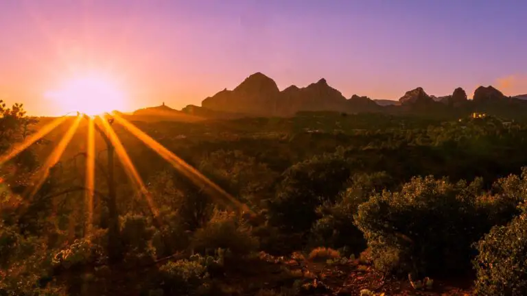
Are you looking for the perfect Sedona scenic drives?
Well, you are not alone, as driving around Sedona is one of the best ways to explore the fantastic outdoors of this region, home to powerful vortexes, stunning Arizona slot canyons, hot springs, rugged views of the fantastic red-rocks packed landscapes, beautiful creeks amidst juniper and oaks.
Whether you are looking for a weekend road trip near Sedona or a more extended trip with your kids along the routes of Sedona scenic drives, in this guide, we cover the best Sedona scenic routes, how to get there, points of interest and attractions along these drives and valuable tips.
OTHER RECOMMENDED oUTDOOR GUIDES NEAR SEDONA FOR YOU
Hiking the Doe Mountain Trail – A Total Guide
A Complete Guide to Hiking the Birthing Cave Sedona
What You Need To Know To Hike The Fay Canyon Trail
Why the Cathedral Rock Hike Must Be On Your Bucket List!
How To Hike The Keyhole Cave In Sedona
A Fun Day Trip To Seven Sacred Pools In Sedona
The Best Routes To Hike The Soldier’s Pass Cave In Sedona
A Complete Guide To Hiking The Baldwin Trail, Sedona
How To Easily Hike The Red Rock Crossing – A Fun Outdoor Adventure
8 Top Sedona Hot Springs To Unwind Amidst Gorgeous Landscapes
BEST SEDONA SCENIC DRIVES
Let us start with the most popular Sedona scenic drives.
THE RED ROCK SCENIC BYWAY
- Driving Distance – 7.5 miles
- Roads – AZ-179 S
- Duration – 1 to 2 hours, depending on diversions
- Total time – 5 to 6 hours for activities and attractions
- Permit – Red Rock Pass is needed
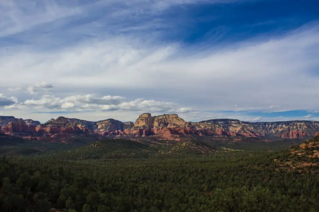
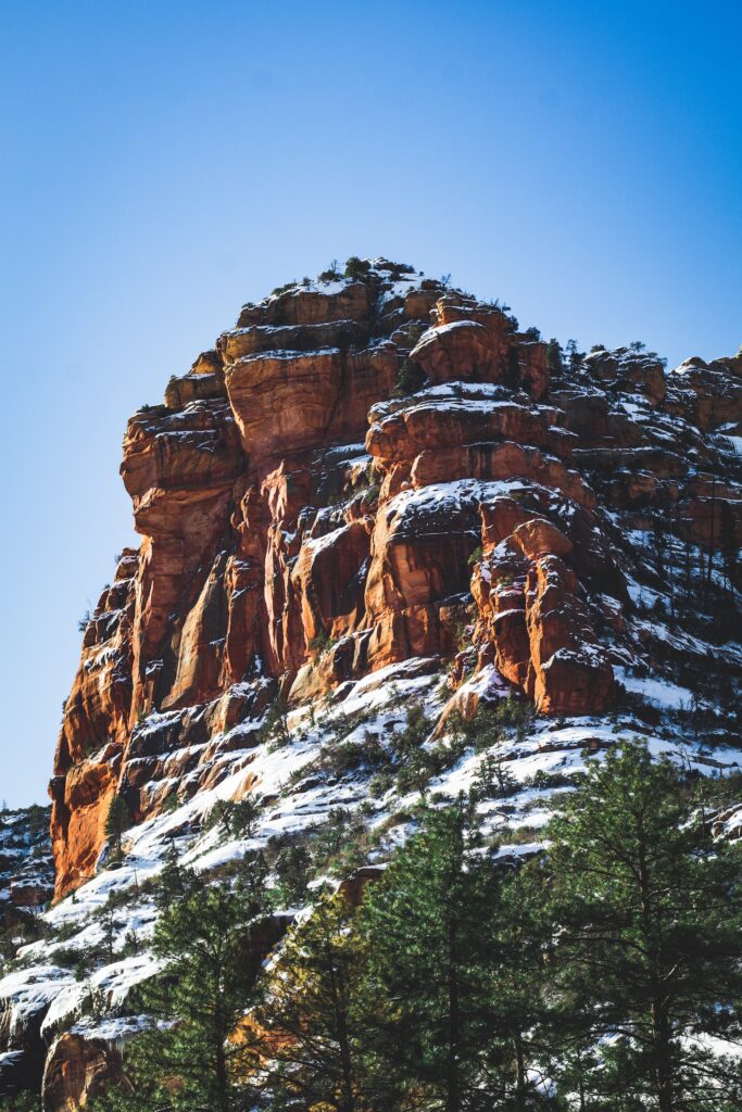
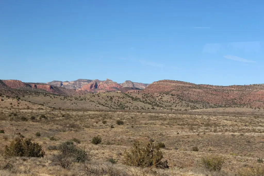
One of the best Sedona scenic drives loved by families and outdoor lovers is the Red Rock Scenic Byway in the beautiful Coconino National Forest, spanning 1.8 million acres, one of the largest among the six forest areas with diverse landscapes, ranging from semi-arid desert through ponderosa pine forests to alpine tundra.
Also known as State Route 179 in Sedona, this 7.5-mile road begins at Interstate 17 and ends at State Route 89A in Sedona.
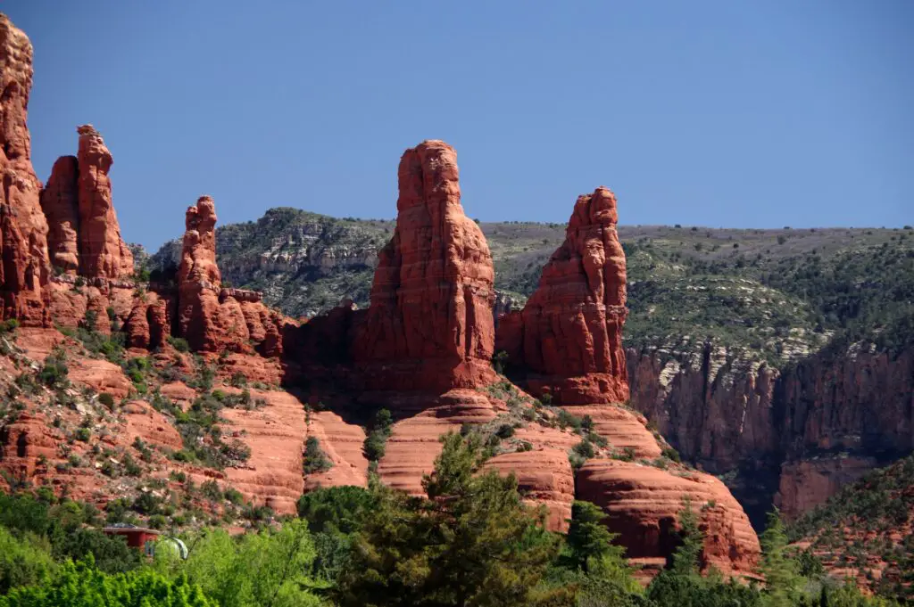
This scenic drive in Sedona takes you through stunning rugged rolling hills and washes covered with scrub oak, juniper, pinon pine, cacti, and yucca.
It takes you through many stunning views of the magnificent landmarks in Arizona, including Cathedral Rock and many mountains.
POINTS OF INTEREST AND STOPS
For covering the most attractions, this route starts near Flagstaff along Interstate 17, taking the exit on the left to get on 89 A to go south towards Sedona and further down to other landmarks.
PINE FLAT CAMPGROUND
Pine Flat Campground is one of the best campsites on this route along the Oak Creek Canyon panoramic road along pretty Oak Creek.
This developed campground is surrounded by excellent views of the forests comprising ponderosa pines. You can enjoy trout fishing, swimming, and hiking.
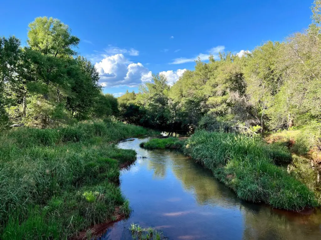
OAK CREEK CANYON NATURAL AREA
Oak Creek Vista midway point between Sedona and Flagstaff is another stop worth making for the stunning views.
For a quick hike and a dip in the creek, stop at Oak Creek Natural Area, located near the famous West Fork Oak Creek trailhead known for its cliffs, stream & canyons.
Recommended – 6 Best Sedona Hot Springs To Rejuvenate
The crystal clear waters of Oak Creek also provide an ideal spot for cliff-jumping.
As you travel further down the road, you may see deer, elk, coyotes, quail, hawks and eagles.
SLIDE ROCK STATE PARK
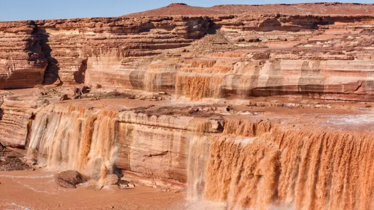
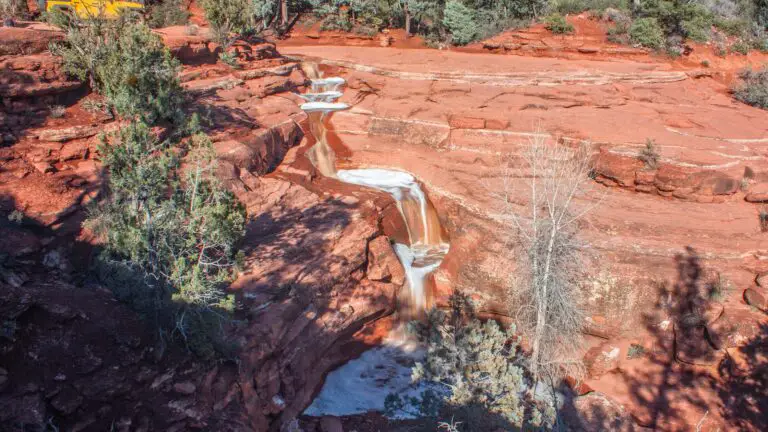
Your next stop is Slide Rock State Park, home to the famous Slide Rock.
It is one the best waterfall hikes in Arizona for a quick relaxing getaway you can add as a side trip.
Slide Rock is a series of beautiful short cascades cut into the sandstone at Slide Rock State Park and is only about 15 minutes away from Sedona.
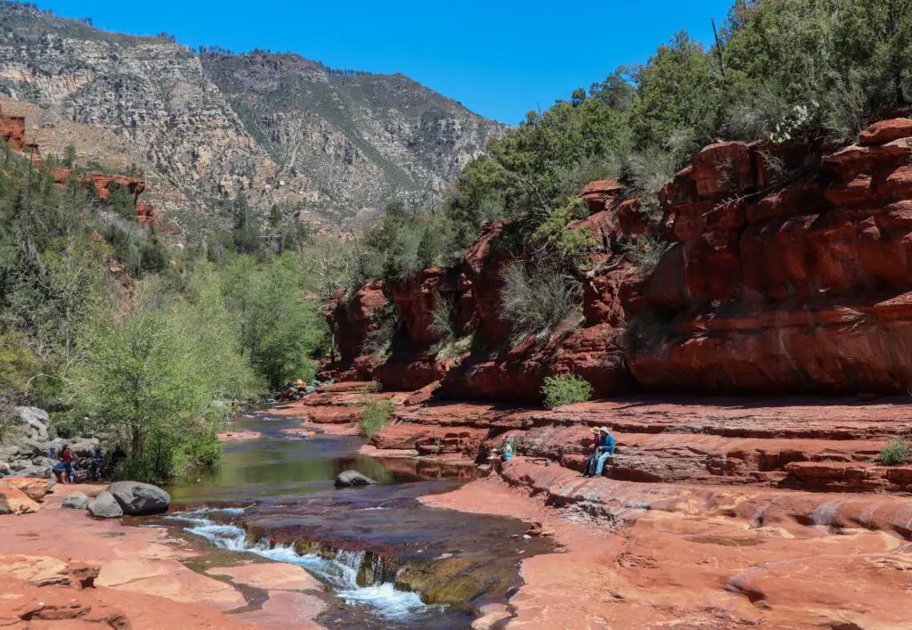
This stretches for about 80 feet and comprises many cascades of various sizes and shapes, ideal for sliding, as the name suggests.
Due to the deposition of algae on the rocks, Slide Rock forms a nature waterslide, allowing fun for adults and kids.
You can also enjoy swimming at the many holes along Oak Creek surrounding Slide Rock for about half a mile.
To reach Slide Rock, you have to only do the easy walk for about 0.3 miles from the trail.
You will start the hike at the historic apple-packing barn in Slide Rock State Park, home to hundreds of apples in the orchards along the creek, another attraction worth stopping by.
You will pass through old cabins and historical buildings before descending steps leading to the banks of Oak Creek, crossing a small bridge.
MIDGLEY BRIDGE
Midgley Bridge, surrounded by spectacular views of forested mountains, is one of the popular stops for day use, hiking and admiring panoramas.
It is home to many swimming holes near Sedona, perfect for summer getaways with your kids.
The steel arch bridge has a picnic area, restrooms, parking, and many trailheads.
CHAMBER OF COMMERCE VISITORS CENTRE
The first stop on this stunning Sedona scenic drive is the Sedona Chamber of Commerce Visitors Centre to learn about Red Rock Country information.
You can buy your Red Rock Passes for parking in the National Forest here.
This centre gives you all the exciting stories and history of this area, including the history of native settlements, formations of the rocks and mesas, hiking trails, top attractions, and more.
Collect your map, and check for the latest information before starting your drive here.
CHAPEL OF THE HOLY CROSS
As you drive south, you will find many boutique cafes, art galleries, and art shops.
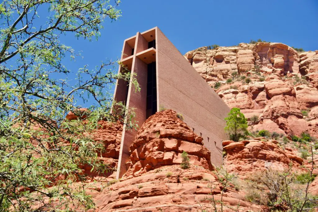
This Roman Catholic chapel was built from 1954 to 1956 in the red rock buttes of Sedona, Arizona, within the Coconino National Forest.
It is known for its brilliant architecture and engineering accomplishments in constructing the buttes, with windows framing buttes and rock outcroppings.
LITTLE HORSE TRAIL
Located atop a hill, Little Horse Trail offers stunning views of Cathedral Rock, one of the most photographed landmarks in Arizona.
You can see the stunning views of the Three Nuns, a series of red spires just above the Chapel of the Holy Cross.
You can choose to hike any of the hiking trails branching off from here that will take you through hidden washes and pools.
BELL ROCK AND COURT HOUSE BUTTE
Bell Rock, one of the famous attractions near Sedona, will be your next stop on this Red Rock Scenic Byway.
One of the top landmarks in these Sedona scenic drives, you will see the first views of the mystical Bell Rock, a longtime spot known for earth energy or vortex, a sacred spot among the earliest native Indians, sitting magnificently surrounded by red rock mountains.
This region is at least 300 million years old and has been the home of thousands of Native Americans for whom the land was sacred.
Going further, you’ll see the gigantic Courthouse Butte, a popular spot for off-road mountain biking.
You can stop at many points to enjoy the views, including Bell Rock Vista. This trailhead has extensive Red Rock Country information.
THE VILLAGE OF OAK CREEK
Your next stop will be the Village of Oak Creek, but the segment of the byway between the Village of Oak Creek and Sedona is a divided highway, so if you have time, we recommend driving both as they offer spectacular views and additional stops.
The Village of Oak Creek is one of the little hamlets that lies cradled by the red rock formations.
This quiet and small residential community was established by ranch settlers and farmers in the late 1800s.
It is one of the best places for dining, biking, golf, and spending overnight or more if you wish to access any of the dozens of trails.
Continuing south through the Village of Oak Creek, Castle Rock dominates the landscape on your right and Bell Rock on your left.
You can also see Wild Horse Mesa, Court House Butte and House Mountain in the distant background. This route is one of the famous filming locations.
MAP OF THE RED ROCK SCENIC BYWAY
Find Sedona scenic drives map below.
OAK CREEK CANYON
- Driving Distance – 16 miles
- Roads – State Route 89A
- Duration – 1 to 2 hours, depending on diversions
- Total time – 5 to 6 hours for activities and attractions
- Permit – No fees
If you are looking for one of the Sedona scenic drives that will keep you close to Oak Creek canyon, plan a road trip on the Oak Creek Highway south of Flagstaff.
Take State Route 89A from Uptown Sedona towards Flagstaff through Oak Creek Canyon running parallel to Oak Creek, which passes through many stunning views of the landmarks, hiking trails, campgrounds, picnic sites, cafes, restaurants and hotels.
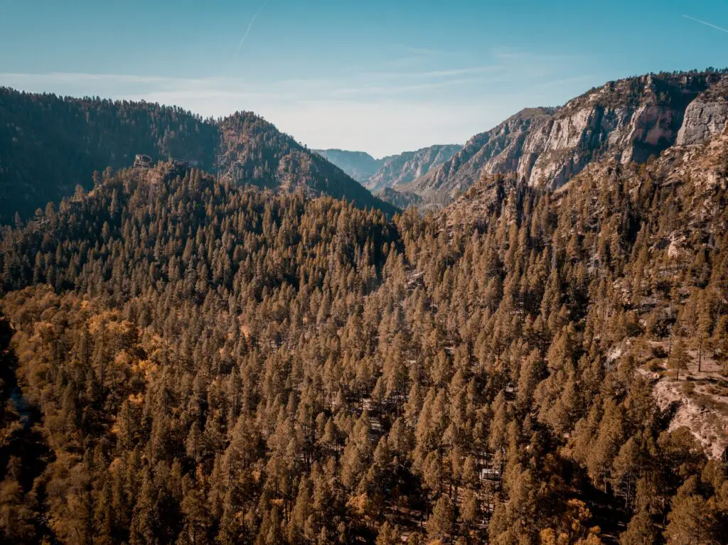
This route runs north through Oak Creek Canyon to the top of the Mogollon Rim, through a lush Ponderosa Pine forest through a series of switchbacks into the canyon that hugs the edges of cliffs as you pass through mountain cliffs turning crimson red.
Stop at Oak Creek Vista for stunning views of the contrasting landscapes and towering rock formations.
Enjoy a picnic lunch at Grasshopper Point Day Use Area or Banjo Bill Picnic Area. Visit Rainbow Trout Farm for views and learn about trout fishing.
If you have more time, you can plan a hike to Slide Rock, one of the best Sedona swimming holes in Slide Rock State Park, the West Fork Hiking Area.
Visit Midgely Bridge known for many hiking and biking trails, swimming holes and viewpoints.
You can base in one of the pretty cottages, cabins, lodging and vacation homes along the creekside or into the canyon forest and plan one or more hikes.
The West Fork of Oak Creek trail is a popular one, located in the Secret Mountain Wilderness known for its colourful landscapes, wildflowers and stunning views.
It is a moderate hike which takes you through powerful vortexes as the Secret Mountain wilderness area is home to sacred vortexes long considered a spiritual place by Native Americans known to have healing powers.
Fall is the best month for this Sedona scenic drive as the landscapes transform into magical panoramas thanks to the brilliant foliage with the contrast of evergreen pines and the golden leaves of oak trees against red rock monoliths forming a visual feast.
RED ROCK LOOP ROAD
- Driving Distance – 6 miles
- Roads – SR 89 A
- Duration – 1 to 2 hours, depending on diversions
- Total time – 3 to 4 for activities and attractions
- Permit – Red Rock Pass is needed
If you turn toward Cottonwood along State Highway 89 A, you will find one of the short Sedona Scenic drives that you can plan as a day trip for a few hours or spend a day trip exploring some stops.
You can begin from Cultural Park Road, head south to Upper Red Rock Loop, and continue along SR 89 A to find Lower Red Rock Loop Road.
It is one of the best scenic drives near Sedona that can be done in a few hours and takes you through some fantastic views of the Red Rock mountains and the typical desert landscapes of Arizona, including many types of Cacti.
Some of the most notable landmarks and attractions on this route include Red Rock State Park, Red Rock Crossing, trails like the Scenic overlook, & Crescent Moon Picnic site.
MAP OF THE RED ROCK LOOP ROAD
DESERT CANYON LOOP
- Driving Distance – 25 miles loop
- Roads – Forest Service Road 618 and FSR 9
- Duration – 3 to 4 hours, depending on diversions
- Total time – 5 to 6 hours for activities and attractions
- Permit – Red Rock Pass is needed
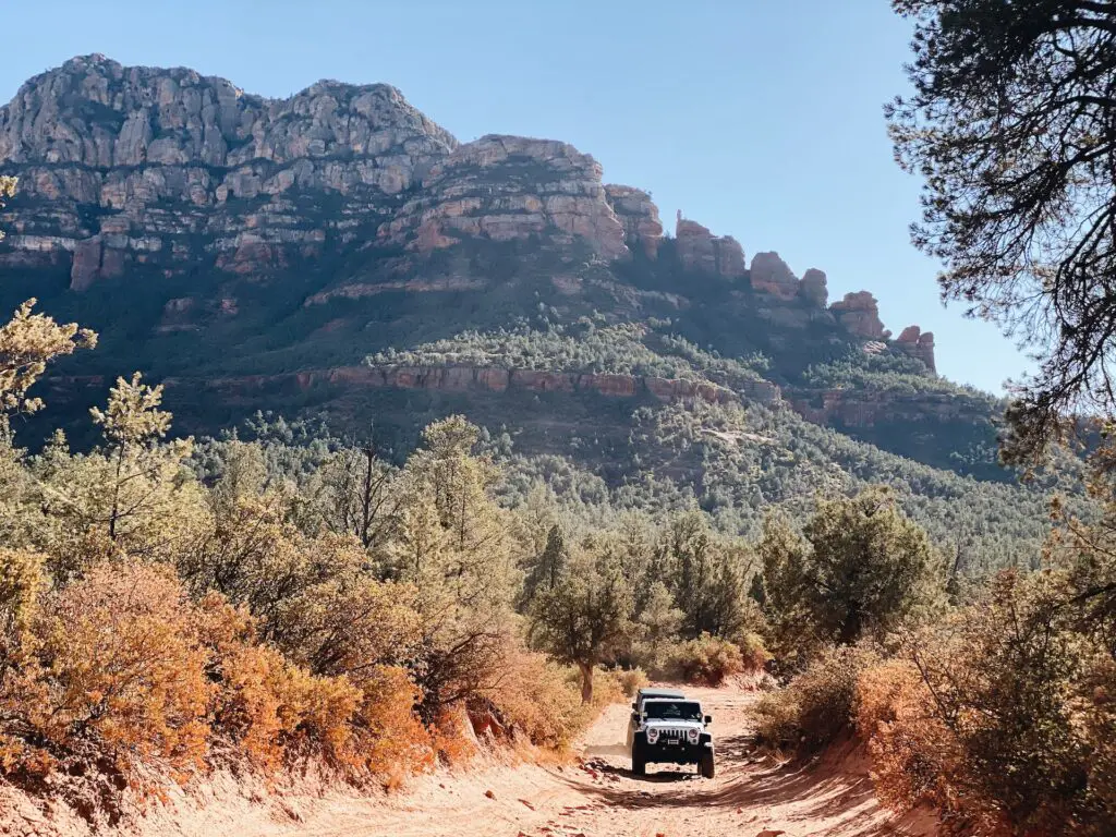
As the name suggests, one of the best Sedona scenic drives you should plan if you want to experience the desert landscapes in the region, Desert Canyon Loop runs through Camp Verde and the Village of Oak Creek, taking you through colourful canyons, oases, ranches, and some off-the-beaten-path Indian ruins.
Although the road is well-suited for passenger cars, some parts, including spur roads, can be tricky to navigate.
Many hiking trails branch off along the route leading to the secluded back country.
You can begin by taking I-17 to the exit for Highway 179. Get onto Forest Service Road 618 until along the base of the Mogollon Rim, 13 miles to FSR 9, and turn back on the 17 whenever you want.
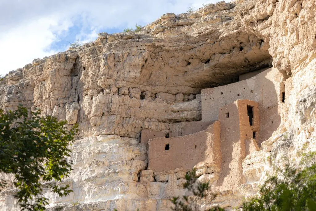
The major attractions and landmarks include the Montezuma Castle and Well, one of the best Arizona national monuments and campsites found in Wet Beaver Creek Crossing and West Clear Creek at the end of the route.
DRY CREEK ROAD
- Driving Distance – 6.5 miles
- Roads – Arizona 89A S
- Duration – 1 to 2 hours, depending on diversions
- Total time – 5 to 6 hours for activities and attractions
- Permit – No fees
The Dry Creek Scenic Road offers splendid views of Red Rock Country, comprising lush evergreen trees of the Great Basin Conifer Woodlands contrasting with the red rocks.
It is one of the easy Sedona scenic drives perfect for a quick getaway as the entire route can be done in a few hours where you can sometimes enjoy the gorgeous views of the Colorado Plateau and even the snowcapped San Francisco peaks in the background on clear days.
You will find dozens of hiking trails, washes, canyons, and more with the popular ones including Devil’s Bridge Trail, Vultee Arch, Mescal Trailhead, Bear Mountain, Fay Canyon and the Secret Wilderness Area.
SYCAMORE CANYON SCENIC LOOP
- Driving Distance – 27 miles loop
- Roads – FR 152C
- Duration – 1 to 2 hours, depending on diversions
- Total time – 5 to 6 hours for activities and attractions
- Permit – Red Rock Pass is needed
If you are looking for more wilderness in the region, look no further than the Red Rocks and Sycamore Canyon Scenic Loop, one of the best Sedona scenic drives that take you into the heart of the magnificent Sedona Red Rocks Country amidst the colourful cliffs, slot canyons, washes, and plenty of stunning trailheads.
The major attraction on this route is Sycamore Canyon, one of the best Canyons in Arizona after the Grand Canyon known for its magnificent landscapes.
Stop at Sycamore Canyon Vista to admire the views of the Sycamore Canyon up close.
If you are willing to deviate, check out Robber’s Roost and Sycamore Pass, the gateway to the Sycamore Canyon Wilderness and Kaibab National Forest.
BOYNTON PASS LOOP
- Driving Distance – 16 miles
- Roads – Boynton Pass Road
- Duration – 1 to 2 hours, depending on diversions
- Total time – 5 to 6 hours for activities and attractions
- Permit – No fees
One of the most accessible Sedona scenic driving routes is the Boynton Pass road, taking you through many Sedona attractions and landmarks, including tons of hiking trails.
Head to Boynton Pass road from Sedona by taking a left on Dry Creek Road after passing a sig, located northwest of the city proper.
Some road portions are not paved and can be muddy during the summer.
Boynton Canyon, also known as Birthing Cave, is one of the most potent vortexes, and you can access this on the Boynton Canyon trail.
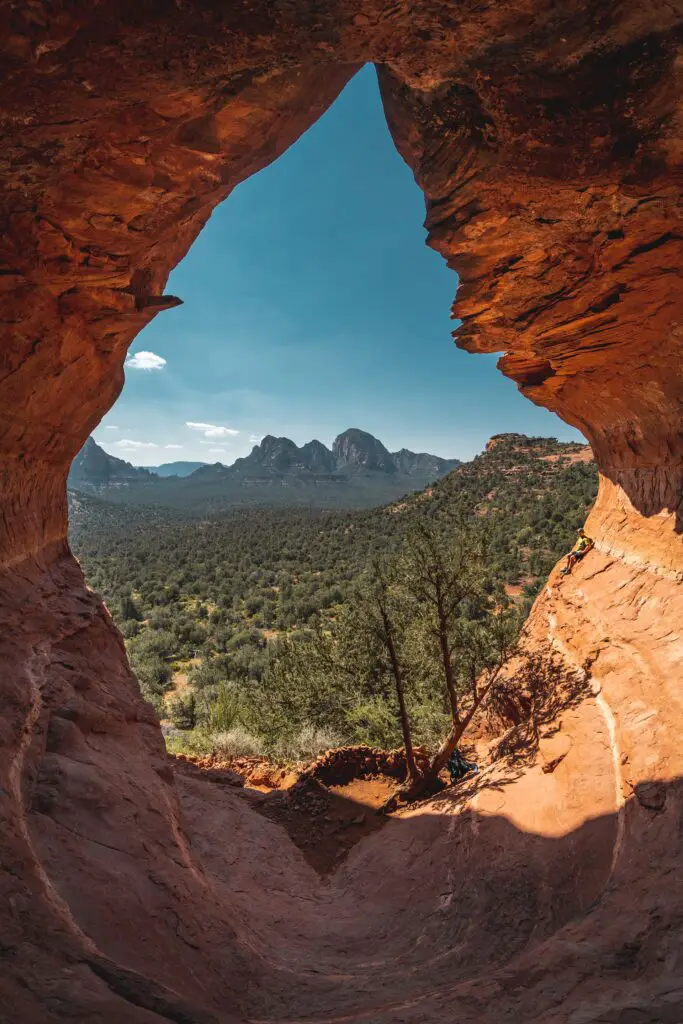
Stop at the magnificent attraction Devil’s Bridge on the route for sweeping views of the valley.
Other points of interest are the Fay Canyon trailhead and Chimney Rock. You can take the spur leading to Soldier’s Pass trail, one of the best hikes near Sedona.
Note that if you plan to do one or some of these hikes, you may have to stay overnight at one of the campsites, and it is best to avoid this drive during or after the rains as some sections can get slippery.
GRAND CANYON LOOP
- Driving Distance – 8 to 10 miles
- Duration – 1 to 2 hours, depending on diversions
- Total time – 5 to 6 hours for activities and attractions
- Permit – Red Rock Pass is needed
Although most people make this loop from Flagstaff, you can go on one of these best Sedona scenic drives that take you through the magnificent Grand Canyon National Park.
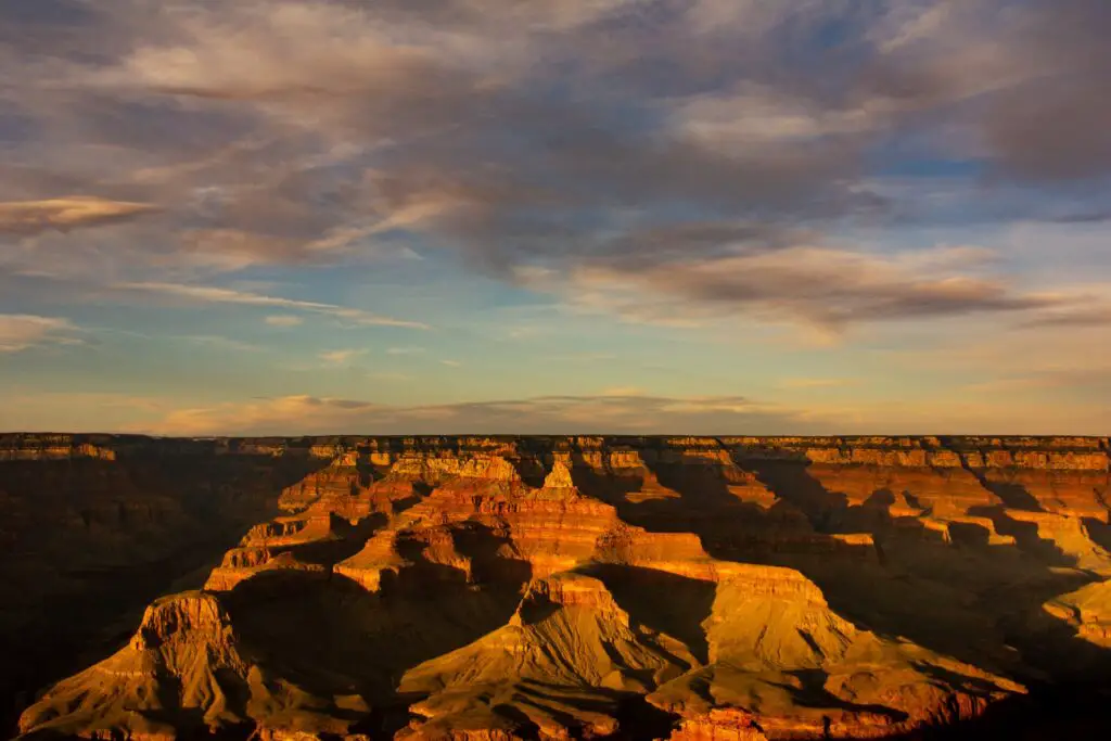
You will pass through tons of attractions, so if you wish to see at least some of them, you will need at least 3 or 4 days, and more if you wish to do longer hikes.
You can enjoy the splendid views of San Francisco Peaks, Yavapai Point, Wupatki National Monument, and more, apart from many landmarks in the Grand Canyon National Park.
OTHER RECOMMENDED HIKING TRAILS IN SEDONA FOR YOU
Hiking the Doe Mountain Trail – A Total Guide
A Complete Guide to Hiking the Birthing Cave Sedona
What You Need To Know To Hike The Fay Canyon Trail
Why the Cathedral Rock Hike Must Be On Your Bucket List!
How To Hike The Keyhole Cave In Sedona
A Fun Day Trip To Seven Sacred Pools In Sedona
The Best Routes To Hike The Soldier’s Pass Cave In Sedona
A Complete Guide To Hiking The Baldwin Trail, Sedona
How To Easily Hike The Red Rock Crossing – A Fun Outdoor Adventure
8 Top Sedona Hot Springs To Unwind Amidst Gorgeous Landscapes