She created Wander In Arizona to share first-hand information about traveling to the many fantastic cities, trails, national parks, monuments and more as she continues to explore.
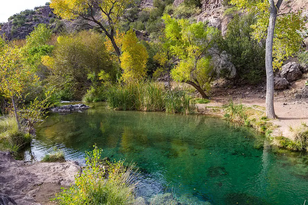
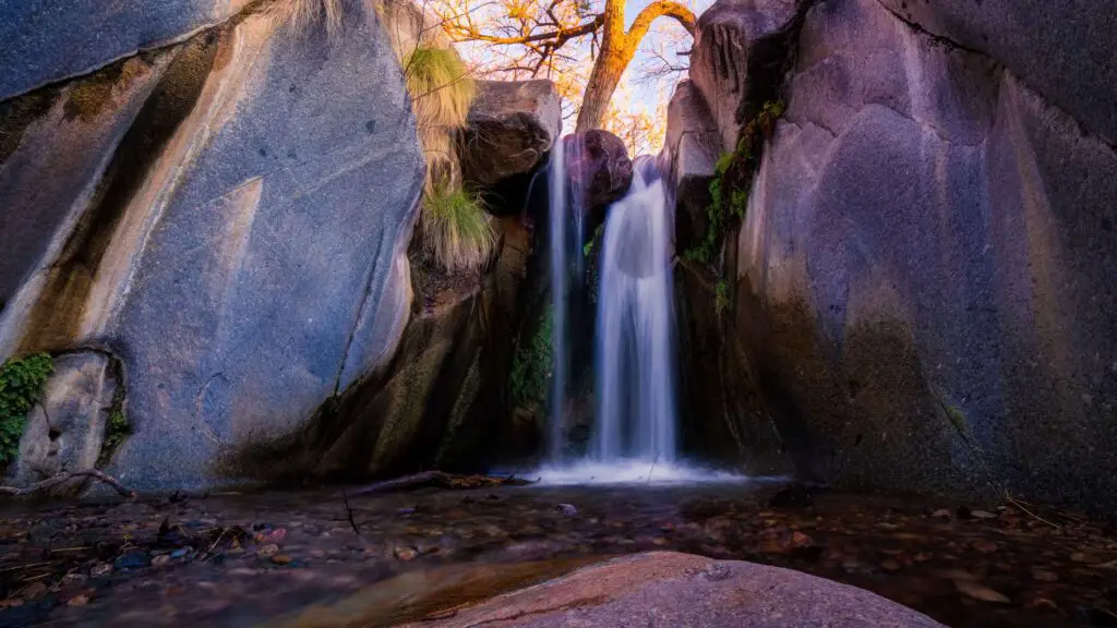
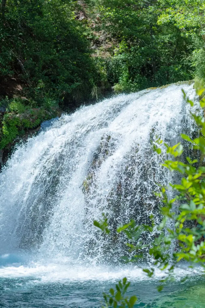
Swimming holes in Arizona are the perfect escape from the brutally hot summers in the Grand Canyon State. Thanks to these beautiful Arizona swimming holes scattered across, bearing the scorching sun becomes easier.
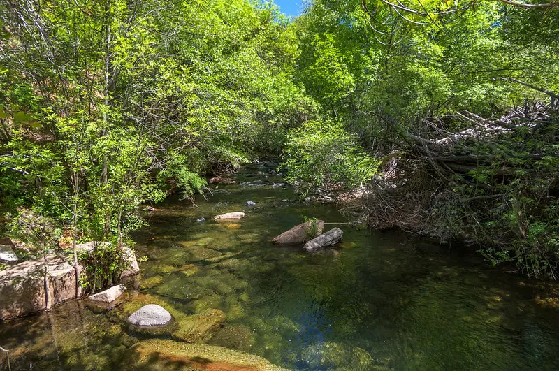
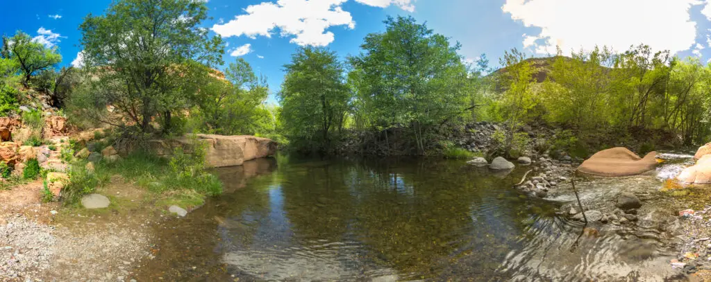
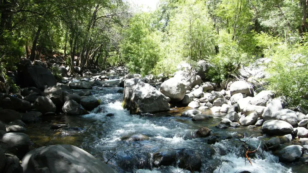
More than 90,000 miles of rivers, creeks, and streams course through Arizona, so you’re never more than a dirt road and hike away from water, especially after snowmelt in spring, when the water levels rise everywhere.
You can continue exploring Arizona’s best swimming holes well until summer, as they become mandatory trips when the Valley’s temperatures start hitting the triple digits.
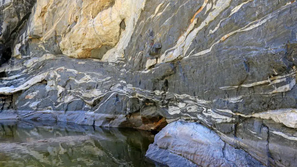
Since many of these swimming holes in Arizona are fed by natural springs, meaning the water is crystal clear and ice-cold year round.
Whether you want to only swim or want some adventure of cliff jumping from various heights, or love having picnic lunches amidst lush forests surrounding these Arizona swimming holes, in this guide, we will cover the best swimming holes in Arizona, how to reach them, valuable tips and more.
For more summer adventures, check out our guide to 30 Arizona’s best waterfall hikes and the list of 25 best beaches in Arizona.
If you are specifically looking for something in central Arizona, check out this guide to the best swimming holes in Sedona.
THINGS TO KNOW WHILE PLANNING A TRIP TO SWIMMING HOLES IN ARIZONA
CHECK WEATHER FORECAST
Before starting your trip, one of the most important things to do to visit any of the slot canyons in Arizona is to check the weather forecast.
Some of these swimming holes in Arizona are located around the slot canyons, which are prone to flooding during monsoon season, between mid-June through September.
A few miles away rainstorm creates a dangerous flash flood sweeping through slot canyons without warning.
CHECK THE DEPTHS AND THE CURRENT
Before getting into these Arizona swimming holes, test the depths and check for the current water levels before planning a trip.
STAY HYDRATED
Arizona’s hard and unrelenting weather is not for everyone, especially since being outdoors can feel daunting as you can get dehydrated quickly. Keep drinking lots and lots of water and make arrangements to carry enough for everyone.
CARRY ESSENTIALS
Bring plenty of towels, spare clothes, and any other clothes you need.
Dress for the weather and carry enough food and water, a first aid kit, and other outdoor essentials.
WEAR WATER SHOES
Carry a pair of hiking shoes and sandals, but do not miss water shoes, as they can be lifesavers while navigating through slippery and sharp rocks.
STICK TO THE TRAILS
Although you can venture around the swimming holes in Arizona to some distances, it is not suggested to wander off too further as there are no trails, and the ecosystem is fragile and sensitive.
Keep to the trails and look for markers when you go around the creeks and waterfalls, especially if you are here during the night.
PRACTICE LEAVING NO TRACE
Natural hot springs are one of the fragile areas in the environment, and as with anywhere outdoors, practice Leave No Trace principles, including cleaning up after yourself, staying in the designated trails, and not touching or harming the surrounding natural things in and around Arizona swimming holes.
If you are going to camp or picnic, make sure you dispose of waste properly.
There is no trash collection at many public hot springs, so ensure you take all trash with you.
TOP SWIMMING HOLES IN ARIZONA
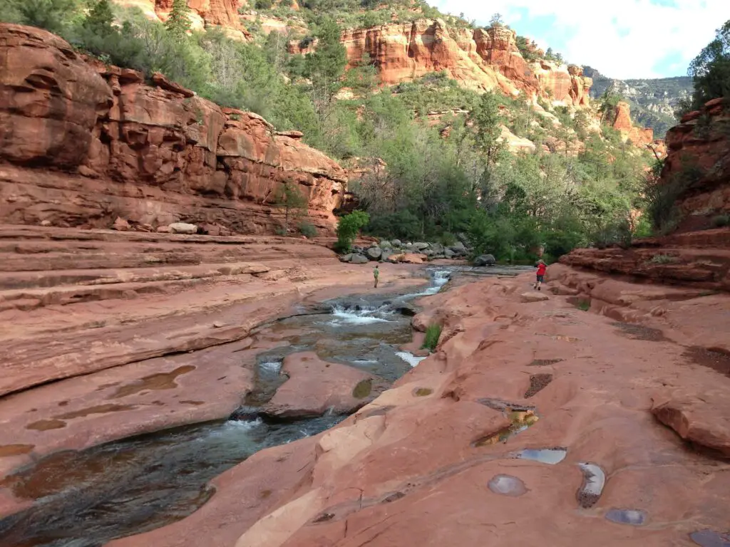
SLIDE ROCK, SEDONA
- Location – Slide Rock State Park
- Distance – 0.3 miles one way
- Difficulty – Easy
- Elevation – 100 ft
- Type – Out-and-back
- Dog-Friendly – Yes
- Kid-Friendly – Yes
- Permit – No
- Parking – Yes
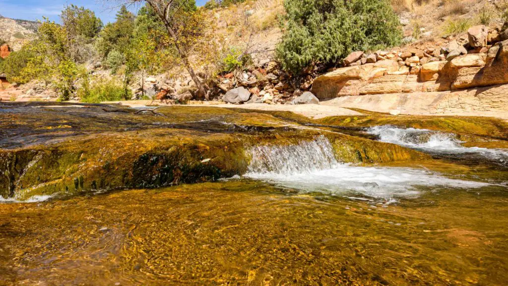
Slide Rock is one the best swimming holes in Arizona for a quick relaxing getaway you can add as a side trip.
Slide Rock is a series of beautiful short cascades cut into the sandstone at Slide Rock State Park and is only about 15 minutes away from Sedona, just six miles north of Oak Creek Canyon and is named for its waterslide-like rock formations that surround Oak Creek’s calm waters.
This stretches for about 80 feet and comprises many cascades of various sizes and shapes, ideal for sliding, as the name suggests.
Due to the deposition of algae on the rocks, Slide Rock forms a nature waterslide, allowing fun for adults and kids.
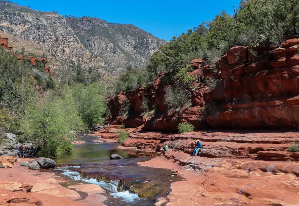
Since there are many swimming pools with different depths it is the best option if you travel with kids or prefer to wade in shallow waters.
You can also enjoy swimming at the many holes along Oak Creek surrounding Slide Rock for about half a mile.
To reach Slide Rock, you have to only do the easy walk for about 0.3 miles from the trail.
You will start the hike at the historic apple-packing barn in Slide Rock State Park, home to hundreds of apples in the orchards along the creek, another attraction worth stopping by.
You will pass through old cabins and historical buildings before descending steps leading to the banks of Oak Creek, crossing a small bridge.
There are a few shady spots along this stretch of the creek, perfect for picnics or camping during the day, but these get filled quickly during spring and summer.
However there’s still room to spread out and relax on red rock benches, and many places to enjoy the water other than the creek.
HOW TO REACH?
Slide Rock State Park can be easily reached in 15 minutes by taking highway 89A out of Sedona for about 7 miles, and you’ll see the sign for Slide Rock.
There is a large parking lot worth accommodating about 100 vehicles, but it is occupied fully usually during busy days.
GRASSHOPPER POINT, SEDONA
- Location – Coconino National Forest
- Distance – 0.2 miles one way
- Difficulty – Easy
- Elevation – 100 ft
- Type – Out-and-back
- Dog-Friendly – No
- Kid-Friendly – Yes
- Permit – No
- Parking – Yes, $9 per vehicle
If you want to avoid the crowds at Slide Rock State Park, head to Grasshopper Point, a day-use area and one of the best swimming holes in Arizona for families.
Located in Coconino National Forest, Grasshopper Point Swimming & Picnic Area downstream from Slide Rock at the base of a towering red-rock cliff features a vast clear pool amidst a landscape of gorgeous rock formations and greenery is a go-to, especially when in warmer weather.
Due to its size and calmness, this swimming hole is also perfect for tubing and floating.
You can often see people jumping off a large platform at 10 feet and one at 25 feet to the pool, but officials discourage cliff jumping at this spot because of varying depths and underwater hazards, so keep that in mind if you feel like diving.
Since there’s lots of shade around this pool, it’s easy to find a spot and spend several hours here enjoying your favourite book or picnic lunch in the shaded area.
Apart from swimming, you can also explore the many hiking trails and biking in Grasshopper point.
HOW TO REACH?
To get to Grasshopper Point, take highway 89A north out of Sedona, and after 2.5 miles you’ll see the turnoff to the right to the entrance of Grasshopper Point on right, after a large bridge.
There is a $9 parking fee to use the small parking lot, shaded picnic tables near the water and there are bathrooms as well.
You can also reach this swimming hole on an early morning short hike down from Allen’s Bend Trail that follows Oak Creek and spend the rest of the day relaxing at Grasshopper point.
RED ROCK CROSSING(CRESCENT MOON RANCH), SEDONA
- Distance – 1 to 2.5 miles round trip
- Type – Out and back
- Duration – 1 to 2 hours
- Elevation Gain – 125 feet
- Hike Difficulty – Easy
- Parking – Limited parking, $11 per vehicle
- Best Time – Afternoon and Sunset
- Pass Required – Red Rock Pass or America the Beautiful Pass is needed
- Dog Friendly – Yes
- Kid Friendly – Yes
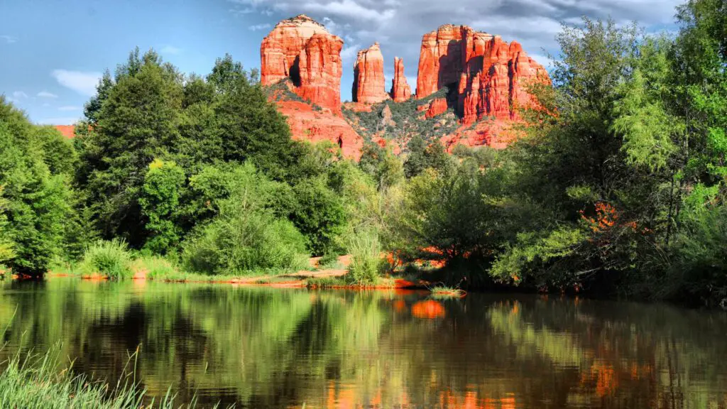
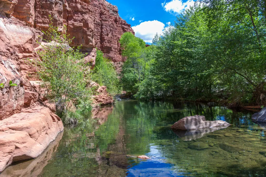
Red Rock Crossing, also known as the Crescent Moon Ranch, is of the best Arizona swimming holes. It is known for its stunning views of Cathedral Rock and Red Rock Country Park.
Given its easy access and excellent location, it is no wonder one of the famous Sunset hikes in Sedona.
Red Rock Crossing is a warmer and flatter swimming hole compared to Grasshopper Point and Slide Rock to the north.
Crescent Moon Ranch was established in 1880 and serves as a day-use facility for the U.S. Forest Service.
There are several swimming holes to choose from, whether upstream or downstream in the spectacular Oak Creek with shaded banks and crystal clear, cool water.
You can also swim or enjoy fishing in Oak Creek.
Depending on when you visit, you will find the water levels at Oak Creek resembling a small stream, while the flow can be high after monsoons and snow melt.
There’s a parking lot and amenities such as picnic tables in shaded and open areas, toilets, drinking water, and a cement walkway.
The picnic area is open daily from 8 AM to 8 PM throughout the year.
March to May and October and November are the best months to hike the Red Rock Crossing.
The best time to hike Red Rock Crossing Sedona is around sunset or in the afternoon, as it is one of the favourite Sedona Sunset spots among hikers. For the gorgeous sunset spectacle of colours, hike during the fall.
If you’re spending the whole day there, grab a spot at the nearby Crescent Moon Picnic Site. As with nearly every Sedona swimming hole, it’s popular on summer weekends,
HOW TO REACH?
From the intersection of State Routes 89A and 179 in Sedona, head for about 6.3 miles. Here, turn to the right on Bell Rock Boulevard in the Villages of Oak Creek.
Keep driving on Bell Rock Boulevard for 1.1 miles.
Here, turn right onto Verde Valley School Road. Drive 4.1 miles on this road until the end to arrive at the Trailhead, located on the left side of the road.
Although the last mile of the road is unpaved, it’s suitable for all vehicles.
After parking at the area near Verde Valley Road, go across the street to the right, where you will find the Baldwin trailhead, which is well-marked.
The area opens into a big grassy field, widening further, leading to a sandy stretch to Oak Creek.
If you have time, hike on the Templeton trail for about 0.2 miles to arrive at Buddha Beach, one of the best Arizona beaches, and your last point before spending time at the Crescent moon picnic area.
This is the easiest way to hike the Red Rock Crossing Sedona without having to navigate on the water.
If you wish to skip the hike, you can cross Oak Creek at the end of Verde Valley Road. After crossing the creek, you’ll reach the Crescent Moon Day Use Site.
From here, if you go right, you will reach Buddha Beach. Watch out for slippery rocks in the creek. Wear good walking shoes.
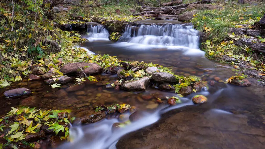
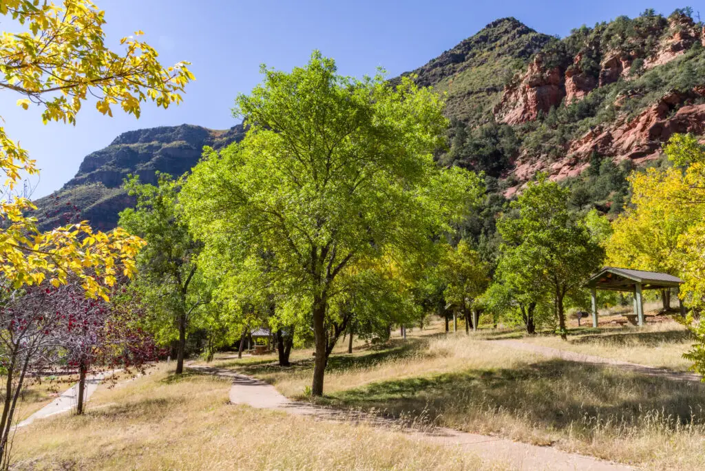
WEST CLEAR CREEK, SEDONA
Another trail in the Coconino National Forest leading to one of the secluded swimming holes in Arizona is the West Clear Creek trail, leading to the West Clear Reservoir, constructed across Clear Creek in the 1930s. Today it forms a quiet picnic spot loved by families.
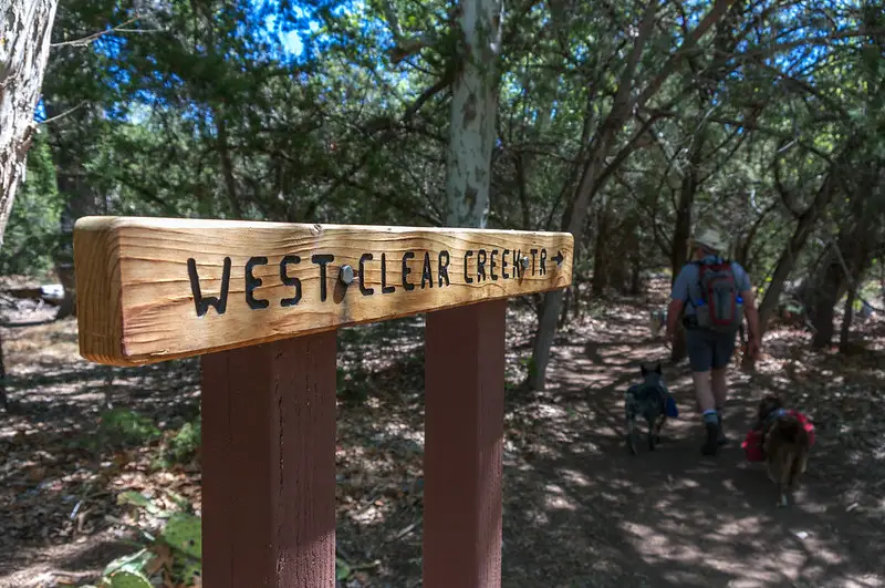
Located in McHood Park in Winslow, it is one of the most beautiful swimming holes in Arizona, known for its excellent location and deep blue waters.
The West Clear Creek trail 17 provides only marked and maintained access to the lower reaches of West Clear Creek Wilderness.
There are plenty of amazing things to do in Clear Creek Reservoir with something for everyone, including kayaking, paddling, boating, jet skiing, rock climbing, cliff diving, and fishing, apart from swimming and cooling off in the creek.
You can also visit the Bull Pen Day Visit area, home to Bull Pen creek, to make it a full-day water adventure.
Find more information about this trail here.
BULL PEN, CAMP VERDE
If you are visiting Camp Verde, add a stop at Bull Pen, one of the best swimming holes in Arizona worth, for a relaxing picnic day surrounded by pretty landscapes.
Since some parts of the pool are shallow, it is one of the perfect things to do in Camp Verde with kids.
There are other points higher offering the best platforms for cliff diving if you are daring from 25 feet high. Bull Pen is about 10 feet at its deepest and is mainly composed of sand, pebbles, and larger rocks.
It takes a quick one-mile hike to get to the beautiful swimming hole. The first swimming hole at Bull Pen is at the Bull Pen Day Use Area, which will be your first stop.
Here you can take one of the many trailheads. The trail cuts across the old Bull Pen Ranch for under a mile before reaching the water.
You can continue on the trail a bit further to follow the creek, leading to some smaller pools.
You can start from the bottom which is shallow or jump here.
You can enjoy swimming, sunbathing, and jumping from a rope swing if you are not up for cliff diving.
HOW TO GET THERE?
The trailhead lies about 15 miles east of Camp Verde. Located on West Clear Creek, getting to Bull Pen requires a drive down a 5-mile dirt road of these 15 miles, best tackled in a high-clearance vehicle. If you are arriving from Phoenix, it takes about two hours.
FOSSIL CREEK, CAMP VERDE
- Location – Camp Verde
- Distance – 1 mile one way
- Difficulty – Difficult
- Duration – 2 to 3 hours
- Elevation – 250 ft
- Type – Out-and-back
- Dog-Friendly – Yes
- Kid-Friendly – Yes
- Permit – Yes, $10 per person
- Parking – Available at the trailhead
Fossil Creek Falls, located near Camp Verde, is one of the most famous waterfall hikes in Arizona, plunging from about 25 feet and also a lot wider than many waterfalls, forming a stunning turquoise pool below, one of the best swimming holes in Arizona.
Located along the northern part of the rugged Mazatzal Mountains, this remote area is one of the largest wilderness areas in the state.
It is an excellent half-day trip that you can easily add when visiting Payson, as it is only 30 minutes away, or Strawberry, only 15 minutes away from the waterfalls. Fossil Creek Waterfalls is located 2 hours North of Phoenix, or 1.5 hours South of Sedona.
It is suitable for all levels, so if you are traveling with kids, this is one of the recommended swimming holes in Arizona worth adding to your itinerary. Bring snacks and water, and look out for rattlesnakes on your hike.
To get to the trailhead, drive for about 21 miles down Fossil Creek Road, and most of the route is unpaved. You must pay a $10 fee to enter Fossil Creek, allowing parking space at the trailhead.
If you love adventure, you will love your visit to Fossil Creek falls, as you can enjoy diving from the edge of the cliff 25 feet high to the pool below.
But check the water levels before plunging as sometimes the currents can be strong and deeper in some places.
The journey to the waterfall is a beautiful one-mile-long hike amidst the stunning Fossil Creek in the Fossil Creek Wilderness area, which boasts abundant lush forests, and rich wildlife, especially many birds.
There are several swimming spots and campsites on the way to the waterfalls. Stop by and swim in the pools or picnic on your hike.
After reaching the falls, you can swim at the beautiful pool, admire the beautiful landscapes and relax.
You can also walk, sit behind the waterfall, and even snorkel to see the fish in the water. You can enjoy floating, and kayaking.
GOING FURTHER
You can also access the waterfall following the path along the creek, which is more adventurous if you want to explore more, head to Fossil Springs, the source of Fossil Creek waterfalls.
The hike to Fossil Creek springs is a moderate trek with an elevation gain of about 4 miles one-way, and a permit is required.
HOW TO REACH?
Take the I-17 north out of Phoenix to the 260 East. After 10 miles, you’ll see forest road 708 leading to the trailhead.
BEST TIME TO VISIT
Fossil Creek Falls is worth visiting throughout the year. Spring and summer are the popular months, so if you plan to go during these seasons, it is best to secure your permits in advance.
GOOD TO KNOW
Fossil Creek Waterfall and the surrounding area are open to the public from April to October and are available solely for day use with a reserved permit.
The permits sell out very early, especially on the weekends, so be sure to get your permit soon. You can get your permits online here, issued one month before the arrival date.
The permit is for day use only, and no camping is allowed. No fees or permits are required if you are visiting during Fall and Winter, from October 2 to March 31.
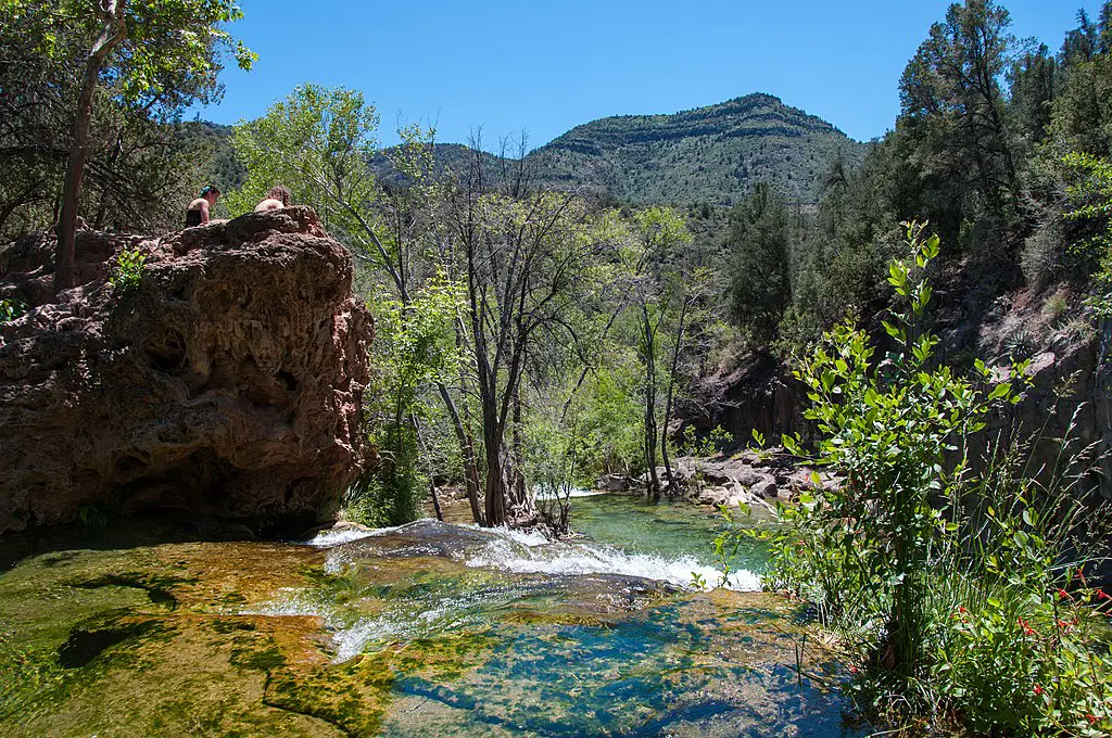
WET BEAVER CREEK, CAMP VERDE
- Distance – 6 miles round trip
- Type – Out and back
- Duration – 3 to 4 hours
- Hike Difficulty – Moderate
- Parking – Limited parking, $11 per vehicle
- Pass Required – No
One of the swimming holes in Arizona that recently became very popular due to Instagram is Wet Beaver Creek in Camp Verde, for swimming hole at The Crack on Wet Beaver Creek, located a few miles northeast of the Out of Africa Wildlife Park and Montezuma Castle National Park.
You can reach the crack on 3.5 miles one way on a hot and exposed Bell trail, and although the hike is rocky but pretty straightforward, it is best to start early and go on a weekday to avoid the crowds.
On warmer days, it is also best to leave early to avoid hiking during the peak of the daytime heat.
Depending on the season you are visiting, you will come across many smaller springs on the way to Wet Beaver Creek, beautifully surrounded by red rock formations.
There are many cliffs high enough to jump off into the deep pool.
No permit is needed to access this picnicking and day-use area near Wet Beaver Creek, accessible to locals and tourists.
The Crack divides the pools into the east and the west forming two pools with each having amenities.
Both picnic spots offer grills, picnic tables and restrooms for visitors to use. There are plenty of shaded spots to set up camps with your loved ones.
You can also enjoy camping at the nearby Beaver Creek Campground, picnicking, and sunbathing in Wet Beaver Creek.
HOW TO REACH?
From Flagstaff, get on I-17 to the AZ Highway 179 exit. Drive 2 miles east on Forest Road 618 to reach the Beaver Creek campground. There is a well-marked parking lot for Bell Trail.
ROMERO POOLS, TUCSON
- Location – Catalina State Park, near Tucson
- Distance – 2.8 miles one way
- Difficulty – Difficult
- Duration – 2 to 3 hours
- Elevation – 900 ft
- Type – Out-and-back
- Dog-Friendly – No
- Kid-Friendly – No
- Parking – $7
The Romero Pools in the Catalina State Park, located near Tucson is one of the moderate waterfall hikes in Arizona that you can add to your itinerary for a quick hike.
If you are up for a moderately difficult hike, you will love this Arizona swimming hole known for its stunning location and cool, crystal-clear waters ideal for swimming and sunbathing in the summers.
Only the last mile of the hike is a bit difficult since it involves a climb on a rocky path with an elevation gain of about 900 feet, but still doable by beginner hikers.
The hike to the waterfalls begins on the Romero Canyon Trail in Catalina State Park. You will pass through stunning views with towering Saguaro and views of the vast deserted mountains on your way to the waterfalls.
After going along a relatively flat trail for a mile, you will feel the eventual incline as you climb higher into the Santa Catalina Mountain Range.
After a mile more, you will arrive at a series of beautiful waterfalls forming pools, forming splendid oases, surrounded by smooth granite boulders overlooking the skyline of Tucson on the horizon and the views of Mount Lemmon.
The best way to reward yourself is plunging into the pools for a cool dip, a refreshment from the hot temperature. Enjoy picnic lunches or sunbathing soaking in some stunning views.
BEST TIME TO VISIT
Except for the summer months, you can visit Romero Pools during the entire year.
The best time to come is after the rains, so the falls are flowing well. There are plenty of visitor facilities for your convenience, so bring a picnic and stay a while and enjoy the calm fresh waters.
ROPER LAKE STATE PARK, SAFFORD
A small park on the southern outskirts of Safford, Roper Lake State Park is home to one of the best swimming holes in Arizona.
Roper Lake is a 400-acre state park on the Gila River, surrounding a lovely 32-acre lake at the foot of gorgeous Mount Graham, a part of the Pinaleño Mountains.
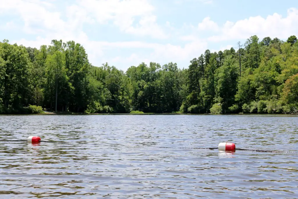
It is a famous relaxation spot offering many activities ideal for families. Enjoy sunbathing, take a relaxing stroll along the white sandy shores and have a picnic lunch.
For a more active holiday experience, you can lease a boat, rent a paddleboard or canoe, go hiking, fish for bass and trout, or rent a cabin or camp overnight.
You can also explore the waters and sail aboard a small electric motorboat or a canoe. Once done, you can take a relaxing swim or go bird watching or wildlife viewing before joining your friends and family.
FOSSIL SPRINGS(BOB BEAR TRAIL)
Bob Bear, also known as Fossil Springs, which should not be confused with Fossil Creek, is a popular trek among locals in Arizona and offers the best water sports for a full day of fun.
It is one of the best swimming pools in Arizona
You can enjoy cliff jumping, waterfalls, grottos, and caves along with swimming in the pool.
The hike to reach the swimming hole is nine miles long, with much of it in the sunlight out in the open.
So be serious about staying hydrated, and wearing sunscreen, sunglasses and hats as there have been many fatal sunstroke incidents on this trail.
HORTON CREEK, PAYSON
- Location – Payson
- Distance – 4.3 miles one way
- Difficulty – Difficult
- Duration – 5 to 6 hours
- Elevation – 750 ft
- Type – Out-and-back
- Dog-Friendly – Yes
- Kid-Friendly – No
- Parking – Tonto Creek campground
If you are traveling to Payson or looking for day trips from Flagstaff or Phoenix involving waterfalls, one of the swimming holes in Arizona recommended for you is Horton Cree, located in the Mogollon Rim area, about 20 miles away from Payson.
This is a very popular area for backpacking, camping, and hiking, and on this trail, you will be rewarded with pretty Horton Springs and a few mini waterfalls.
It is one of the best picnic spots ideal for swimming thanks to its close location to the springs and the many smaller pools.
This waterfall hike starts from parking at Upper Tonto Creek, home to a campground with a trailhead on the left.
Once you begin the hike from the parking lot, the trail heads gradually up along Horton Creek, with many waterfalls, surrounded by magnificent pine stands.
You have many spots to jump into the pools or sunbathe and picnic on the trail.
Once you are at the trail’s end, you will reach the views of the stunning crystal-clear waters of Horton Springs, perfect for swimming to escape from the Arizona heat.
The last mile of the stretch involves a slight climb past Horton Springs into rim country
BEST TIME TO VISIT
The best times to visit Horton Creek trail are May through October when the water levels in the creek and springs rise after rains.
The eight-mile Horton Creek Trail winds under the Mogollon Rim and towering Ponderosa pines and seasonal wildflowers. There’s plenty of shade, and the temperatures at this high-elevation spot make it a cooler-than-average hike.
MORE BEAUTIFUL SWIMMING HOLES IN ARIZONA
MOONEY FALLS
- Location – Havasupai Reservation
- Distance – 1.5 miles
- Difficulty – Difficult
- Elevation – 200 ft
- Type – Out-and-back
- Dog-Friendly – No
- Kid-Friendly – No
- Permit – Yes
- Parking – Yes
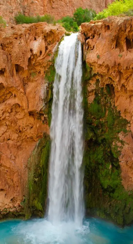
One of the top swimming holes in Arizona is Mooney Falls, the tallest waterfall located near Havasupai Campground in Supai, Arizona.
The fantastic Mooney Falls cascades plunging down from 200 feet forming a turquoise pool below.
The waters in the pool are just cool enough to refresh on a hot summer day and cold enough in the chillier months.
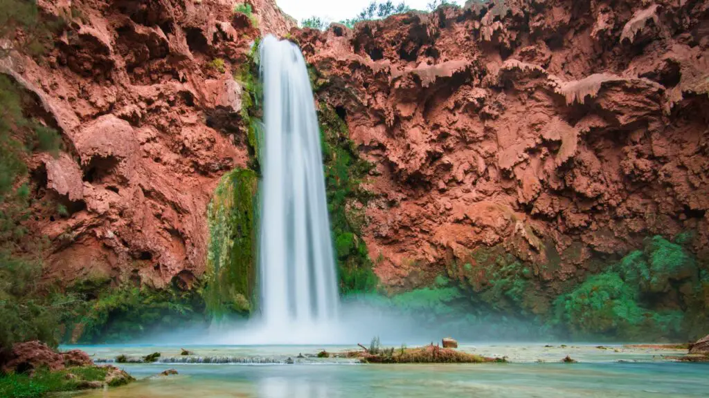
The base of the Mooney waterfall may be a little bit harder to access but is definitely worth visiting for the gorgeous views that you will be rewarded with.
It may not be for everyone, especially beginners or if you are traveling with young children, as it requires some climbing down through old mining tunnels.
In that case, it is best to admire the views from the top, easily accessible by all and only a mile long from the northwest end of Havasupai Campground.
If you are up for an adventure and not scared of heights, start the difficult hike of about 0.5 miles to reach the base of Mooney Falls.
Since there will be many moving up and down and you may have to wait, it is best to begin your hike early if you plan to go to the base of Mooney Waterfalls.
Follow the trail where you will start descending down the series of tunnels. It is best to hold tightly onto chains and walk down ladders to descend the cliff face.
You will also have to climb some rocks and ladders with the help of chains before passing down to these old tunnels that open up the fantastic waterfalls offering spectacular views of the rocky hills and giant trees around.
GOOD TO KNOW
It is best to wear gloves, and sturdy hiking shoes and hike slowly and carefully.
Since the currents in the pool in the cascades below can be high and dangerous, swimming in the pools is not recommended. Avoid hiking in winter and monsoons as the trail can get slippery.
BEST TIME TO VISIT
Early Spring or late Fall, i.e, from March to May and September to November are the best months to visit Mooney Falls.
Note that Mooney Falls is currently closed to visitors. Check for opening details and other updates on access on the official website here.
CIBECUE FALLS
- Location – Havasupai Reservation
- Distance – 3.2 miles one way
- Difficulty – Difficult
- Duration – 3 to 4 hours
- Elevation – 200 ft
- Type – Out-and-back
- Dog-Friendly – Yes
- Kid-Friendly – Yes
- Permit – Yes, Cibecue Falls Access Permit, $30 per person
- Parking – Yes
One of the most beautiful swimming holes in Arizona is Cibecue Waterfalls, located near Globe in Salt River Canyon, about a 3-hour drive away from Phoenix on White Mountain Apache Tribe land.
The waterfall, over 40 feet tall, is a beautiful majestic fall gushing from a narrow canyon or an alcove into a pool of emerald water, surrounded by the red rocks blanketed landscapes of Arizona.
It is one of the moderately challenging hikes involving a long trail with an elevation gain of about 220 feet, but it is one of the most beautiful waterfalls known for its stunning location.
It is one of the best Arizona waterfall hikes to introduce you to the spectacular rugged wilderness the state is renowned for as you walk among the towering canyons of the White Mountain Apache Tribal Land.
This 3-mile-long trail(one way) begins at Cibecue Creek Falls Trailhead in Gila. You can drive to the trailhead along the Salt River Canyon area, which is bumpy as some stretches are still unpaved.
This lovely road trip offers stunning views of Salt River and Salt River Canyon.
At the end of your drive, you’ll have to drive over the running Cibecue Creek to reach the parking lot.
This adventurous rock hopping, river crossing hike begins at the trailhead on the Fort Apache Reservation. You will soon be wading through the Salt River, passing through rocky boulders.
As the trail begins to narrow, you can hear the roars of Cibecue Falls echoing off the canyon walls, which means you are near the end of your hike.
The view of the Canyon gets better and more spectacular as you arrive at the magnificent waterfall, which pours into the turquoise pools below.
After an adventurous Arizona waterfall hike, enjoy the best views of the Canyon from the waterfall’s base. Note that swimming is not allowed to preserve the delicate ecosystem.
BEST TIME TO VISIT
The best time to do this waterfall hike in Arizona is during the spring or summer, around May or June, before the monsoon, as the rains cause flash floods, and the trail remains closed.
GOOD TO KNOW
Wear appropriate shoes as you will be crisscrossing your way and hopping boulders on the hike. Camping, swimming, and fishing are not permitted at these falls.
SEVEN FALLS
- Location – Sabino Canyon
- Distance – 8.3 miles from the visitor’s centre or 4.3 miles via shuttle
- Difficulty – Easy to Moderate
- Duration – 5 to 6 hours
- Elevation – 900 ft
- Type – Out-and-back
- Dog-Friendly – Yes
- Kid-Friendly – Yes
- Parking – $5
Seven Falls, located in Sabino Canyon, in the Catalina Foothills, close to Tucson, is one of the relatively more accessible and most popular swimming holes in Arizona in the middle of the desert.
As the name suggests, you will be treated to not one but a series of seven beautiful cascading waterfalls surrounded by stunning desert landscapes. It is one of the best Arizona waterfall hikes you can plan with your family.
The trail leading to the falls is usually crowded as it is one of the most famous falls and attractions for people exploring Tucson.
The hike is 2.5 miles one-way if you use the Bear Canyon Tram. And if you do not use this shuttle, it will be 4.5 miles one way.
The best part is that you can access this all year round, but like other Arizona waterfalls hikes, know that the water levels are seasonal.
So if you want a fully-flowing fall, it is best to hike in the right season.
The hike goes through the Catalina Foothills amidst lush landscapes, passing through forests encompassing many cacti, saguaros, sycamore, and cottonwood trees.
You will cross a river at several points during this hike, which is a great relief, especially while hiking through the arid landscapes of the Sonoran Desert in the heat.
The trail begins in a small parking lot marked Bear Canyon Trail. Although it is a little longer hike at 8.2 miles, it is primarily flat. Throughout the trail, you can find pockets of swimming holes on your way up to the Seven Falls.
The first 3 miles involve many creek crossings and are generally flat. The last part of the hike leading to the Seven Falls involves a moderately challenging climb.
You will be rewarded with stunning views of the Seven Waterfalls right after this climb, with each fall forming a vast pool. Scramble to the top levels to reach the best swimming holes.
Sunbathe, enjoy picnics, cliff-jump, swim, scramble, and slide until your heart’s content before making your way back on the same trail that you used.
GOOD TO KNOW
Arrive at the trailhead early, as the parking lot fills up quickly. Also, starting the hike around sunrise means avoiding the sweltering Arizona desert heat.
Note that since it is one of the town’s most popular swimming holes, expect crowds or plan a trip on a weekday afternoon.
Bring plenty of water and snacks to keep you hydrated, as the weather can wear you down more.
If you want to cut down your hiking distance and time, take the shuttle, which costs about $6 per person and the parking fees.
It will take you from the visitor centre to the trailhead, cutting about 3.5 miles off the 8-mile hike roundtrip. You can buy the ticket to the shuttle at the visitor centre using cash or credit cards.
These shuttles run from 9 AM to 4 PM, with one every half hour.
BEST TIME TO VISIT
Fall and Spring are the best times to visit the Seven Falls, as the temperature is manageable during these months.
TANQUE VERDE FALLS, TUCSON
- Location – Tucson
- Distance – 2.5 miles one way
- Difficulty – Moderate
- Duration – 3 to 4 hours
- Elevation – 400 ft
- Type – Out-and-back
- Dog-Friendly – Yes
- Kid-Friendly – Yes
- Parking – Yes
One of the best day trips from Tucson is heading to Tanque Verde Canyon, which offers five swimming holes in Arizona formed by the stunning 80 feet tall Tanque Verde Falls, surrounded by beautiful red-rock landscapes.
There are many more smaller swimming holes around the falls for you to cool off soaking in the views, the perfect way to unwind after a hike.
Since the road leading to the trailhead is a dirt road, it is best to drive a high-clearance vehicle to reach the Tanque Verde trail.
Although it is a relatively short hike to Tanque Verde Falls, it is a moderately challenging trail on the edge of the Sonoran Desert partly due to the unmarked trail and needing to cross a creek if the water flow is good.
About a mile in, you will find the first fall, Lower Tanque, which has a 30 feet cascade.
Stop here for a quick swim, or get going for a short while until you see the main waterfall roaring down to form many cascades.
Depending on the water levels and the season you are visiting, you will have to move along the creek bed to get to the falls.
Although swimming and cliff jumping is allowed, be cautious about the slippery granite rocks and strong water currents.
There is also a rope swing, and you can add more miles and hike further along the creek into the canyon if you are up for it.
BEST TIME TO VISIT
Since the waterfall is seasonal, it is best to go after the snow melt, during spring and early summer or right after the monsoons from October. Check for flash floods and trail details before planning your trip.
WATER WHEEL FALLS, PAYSON
- Location – Payson
- Distance – 1.8 miles one way
- Difficulty – Easy
- Duration – 3 to 4 hours
- Elevation – 150 ft
- Type – Out-and-back
- Dog-Friendly – Yes
- Kid-Friendly – Yes
- Permit – $6 per person
- Parking – Yes
If you are looking for exploring Arizona swimming holes with kids, head to Water Wheel Falls, one of the most famous waterfall hikes in Arizona with kids and pets is Water Wheel and Ellison Creek Waterfalls, located near Payson.
It is a great option for beginner hikers, thanks to the short distance and easily accessible trail.
You can enjoy a nice swim at the waterfalls and the swimming holes on this hike or picnic with your kids, soaking in the fantastic views around you as crystal-clear mountain water pours from the East Verde River, creating deep gorges and dramatic waterfalls.
Since the entire trail runs the length of the river, you can sunbathe, picnic, swim and relax at many places before making it to the waterfalls.
The waterfall hike starts from the Houston Mesa Road parking lot. In a short while, you will pass through the East Verde River on your right amidst boulders.
About 0.25 miles into the trail, you’ll get your first chance to dip into the chilly water of Ellison Creek.
You can stop by and picnic or continue your hike to encounter huge granite boulders, soon after which the small creek turns into a beautiful turquoise river.
You only have to go on this trail for about half a mile past these boulders to arrive at the roaring waters of Water Wheel Falls.
If you are looking for a longer walk, continue on the trail to the Bridal Veil Falls, another among the list of the best waterfalls in Arizona.
If you want to avoid crowds, weekdays are the best days to enjoy picnics here.
BEST TIME TO VISIT
Spring, summer and Falls are the best months to visit Water Wheel Falls, but it is best to avoid monsoons since the area is frequently prone to flash floods.
Check the forecast before heading out on the trail to avoid dangerous conditions.
BRIDAL WREATH FALLS, TUCSON
- Location – Saguaro National Park, Tucson
- Distance – 3 miles one way
- Difficulty – Moderate
- Elevation – 600 ft
- Type – Out-and-back
- Kid-Friendly – Yes
- Parking – Yes
Another Arizona Swimming hole you can add is the Bridal Wreath Falls, which you can combine while exploring Tanque Verde Falls or Tucson.
Located in the famous Saguaro National Park in the Rincon Mountain District, Bridal Wreath Falls is 25 feet tall with a small pool, great for swimming.
The Bridal Wreath Falls can be accessed via the Douglas Spring Trailhead in the Saguaro National Park.
This 3-miles long one-way hike starts easy, where you’ll hike amidst the Rincon Mountains views and the giant cacti.
The path gets steep and becomes challenging as you go through rocky stretches and boulders.
It is one of the best hikes to experience the vast expanse of distinct desert wilderness in the Saguaro National Park, including wildlife such as deer, javelina, and coyotes and colourful desert blooms in the spring.
Although the entire trail is out in the open with little shade, you can cool off after reaching the waterfall area, well-shaded by tall canyon walls and a cottonwood-willow canopy.
BEST TIME TO VISIT
Since the water flow in the fall is seasonal, it is best to visit the Bridal Wreath Falls during spring, post-monsoon and fall seasons, between
March and October when the weather is fantastic and high water levels in the fall and the pool.
GOOD TO KNOW
Since it is a fragile wilderness area, do not touch or go off the trail and leave no trace. Watch out for rattlesnakes and poisonous Gila monster lizards on the trail.
OTHER SWIMMING HOLES IN ARIZONA FOR AN OFFBEAT GETAWAY
TONTO NATURAL BRIDGE STATE PARK, PAYSON
One of the top attractions in Payson among outdoor lovers, Tonto Natural Bridge State Park is home to a few stunning swimming holes in Arizona.
Located right off the highway, Tonto Natural Bridge is a fantastic stop for a quick hike that will lead you to a cave, a pretty waterfall and a swimming pool, ideal for a picnic day. There are viewing platforms, picnic tables and a few shaded spots for you to enjoy a day trip.
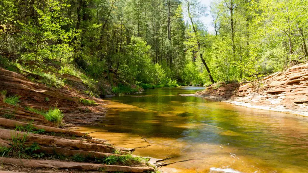
WEST FORK OAK CREEK TRAIL, SEDONA
If you are looking for a beautiful creek near Sedona, head on the West Fork Trail, one of the most popular hikes in Sedona, an easy trail ideal for beginners and people with kids.
This trail, mostly on an easy, shaded path, leads you to the pretty Oak creek, Plus, you will cross its water every half mile or less, making it constantly refreshing and cool.
Depending on how far you like to go, you can continue along the river, or camp for the day, enjoy a picnic, swim and float in the creek.
LYMAN LAKE STATE PARK
If you are looking for an offbeat Arizona swimming hole to beat the heat, look no further than Lyman Lake State Park, the 1,500-acre lake across the high plains between Springerville and St. Johns.
You have the options for boat trips, camping at the site, fishing, and picnics apart from swimming in the lake. There is a visitor centre with basic amenities. There is an admission fee of $7 per vehicle.
EINCINOSO PICNIC SITE, OAK CREEK
If you are looking for an offbeat getaway to beat the summer heat, plan a day trip to Encinoso Picnic site, home to one of the hidden Swimming holes in Arizona, in Oak Creek Canyon.
Located in the Coconino National Forest, Encinoso is an easily accessible picnic area surrounded by beautiful trails.
You can enjoy a picnic, go on hikes, and fishing, sunbathe and lounge apart from swimming in the clear water pools of Oak Creek.
Encinoso is also one of the best spots for birdwatching.
To access Encinoso, take the two-mile trail at the Coconino National Forest day-use picnic site about two miles from Grasshopper Point.
Although you must scramble a bit to reach the swimming hole, it’s nothing too challenging to tackle.